geocat.ch
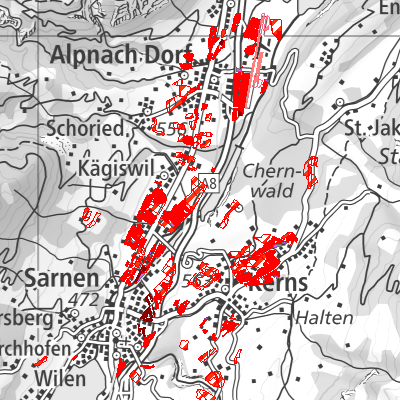
Fruchtfolgeflächen (OW)
Die Geobasisdatensatz umfasst die Fruchtfolgeflächen gemäss Sachplan FFF.
Simple
- Date (Creation)
- 2010-01-01
- Date (Revision)
- 2024-07-19
- Identifier
- ow_fff
- Status
- On going
Owner
Das Amt für Landwirtschaft und Umwelt ist Anlaufstelle für die Bereiche Landwirtschaft, Umweltschutz und Gewässerschutz sowie Fischerei. Es berät und informiert Bäuerinnen und Landwirte bei Vollzugsfragen im Zusammenhang mit der Neuausrichtung der Agrarpolitik und ist zuständig für den Vollzug der Direktzahlungen. Weiter ist es zuständig für den Vollzug des Boden- und Pachtrechts sowie der landwirtschaftlichen Grundstückschätzungen, die Ausrichtung von Investitionshilfen (Beiträge und Investitionskredite), der Betriebshilfedarlehen und der Umschulungsbeihilfen. Es wirkt mit bei der Beurteilung von Baugesuchen sowie von Gesuchen der Landwirtschaft für nicht versicherbare Elementarschäden und Finanzhilfen für Hilfswerke.
- Spatial representation type
- Vector
- Topic category
-
- E Planning cadastre
Extent
Extent
- Description
-
Canton of Obwalden (OW)
))

- Maintenance and update frequency
- As needed
- GEMET
-
-
arable farming
-
field
-
crop rotation
-
basic food requirement
-
agriculture
-
cultivation of agricultural land
-
safety
-
- geocat.ch
-
-
surface of crop rotation SCR
-
cultivated area
-
agricultural exploitation
-
usable agricultural area UAA
-
Resource constraints
- Access constraints
- Other restrictions
- Use constraints
- Other restrictions
- Other constraints
- Die Geodaten sind öffentlich zugänglich (Zugangsberechtigungsstufe A gemäss GeoIV Art. 21).
- Language
- Deutsch
- Character encoding
- UTF8
- Environment description
-
QGIS
- Subtopic Category
- E1 Spatial Planning, Spatial Development
- Basic Geodata
- true
- Basic Geodata ID
-
68.1
- Basic Geodata Legal Level
- Bund
- Distribution format
-
-
INTERLIS
-
andere Formate auf Anfrage
-
Distributor
Digital transfer options
- OnLine resource
-
Geoshop OW
Datenbezug
Digital transfer options
- OnLine resource
-
fruchtfolgeflaeche
WMS-Dienst geodienste.ch
Digital transfer options
- OnLine resource
-
Geobasisdatenkatalog
Digital transfer options
- OnLine resource
-
Webkarte Fruchtfolgeflächen
Digital transfer options
- OnLine resource
-
Geodienste.ch
Datenbezug
Digital transfer options
- OnLine resource
-
ch.ow.fruchtfolgeflaechen
WMS-Dienst Kanton Obwalden
Identifier
- Code
- 2056
Metadata
- Metadata identifier
- A5D9C316-58A3-4660-903E-E1DFFA8BFA36
- Language
- Deutsch
- Character encoding
- UTF8
- Language
- Français
- Character encoding
- UTF8
- Language
- English
- Character encoding
- UTF8
- Language
- Italiano
- Character encoding
- UTF8
Custodian
Type of resource
- Resource scope
- Dataset
- Date info (Revision)
- 2026-05-12T13:10:54.000Z
Metadata standard
- Title
-
GM03_2