 geocat.ch
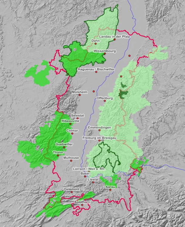
Interactive map of protected areas in the Upper Rhine
Interactive map integrating the different data about the protected nature sites in the Upper Rhine area.
Simple
- Date (Publication)
- 2021-05-11T14:38:13
- Presentation form
- Digital map
- Status
- Completed
- Topic category
-
- L Environment
Extent
Extent
N
S
E
W
))
- Maintenance and update frequency
- Unknown
- Theme
-
-
parcs;naturels;biosphère;Naturparks ;parks;Biosphärenreservate ;2021;carte;Interaktive;Karte;interactive
-
- GEMET - Concepts, version 2.4
-
-
national park
-
natural park
-
regional natural park
-
biosphere
-
biosphere reserve
-
- Language
- Français
- Distribution format
-
-
OGC:OWS-C
-
Digital transfer options
- OnLine resource
-
Ouvrir la carte interactive
- Reference system identifier
- EPSG:3857
Metadata
- Metadata identifier
- 9f70d363-25fe-45a2-8528-89fe2e06eaa4
- Language
- Français
- Character encoding
- UTF8
- Language
- Deutsch
- Character encoding
- UTF8
- Language
- English
- Character encoding
- UTF8
Type of resource
- Resource scope
- interactiveMap
- Date info (Revision)
- 2022-09-26T14:43:52.130747Z
Metadata standard
- Title
-
ISO 19115-3:2018
- Edition
-
1.0
)))