geocat.ch
Gebäude- und Wohnungsregister Liechtenstein
Liechtenstein Building and Housing Register
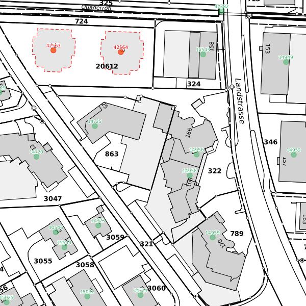
Das liechtensteinische Gebäude- und Wohnungsregister (GWR) enthält die wichtigsten Grunddaten zu den Gebäuden (öffentlich) und Wohnungen (nicht öffentlich). Die Nachführung erfolgt in Koordination mit dem Baubewilligungsverfahren. Jedes Gebäude > 6 qm verfügt über eine eindeutige und einmalige Identifikationsnummer (GEID) sowie über eine geokodierte Adresse. Hausnummern mit Strassennamen und Grundstücksnummern sowie metrische Koordinaten erlauben eine exakte geografische Lokalisierung der Gebäude. Die öffentlichen Daten werden als csv-Datei im Download-Bereich des Geodatenportals bereitgestellt und umfassen die Gebäudemerkmale gemäss Art. 12a der Statistikverordnung.
The Liechtenstein Register of Buildings and Dwellings (GWR) contains the most important basic data on buildings (public) and dwellings (non-public). Updating takes place in coordination with the building permit procedure. Each building > 6 square metres has a unique and unambiguous identification number (GEID) and a geocoded address. House numbers with street names and plot numbers as well as metric coordinates allow the exact geographical localisation of buildings. The public data is provided as a csv file in the download area of the geodata portal and includes the building characteristics in accordance with Art. 12a of the Statistics Ordinance.
Simple
-
Autre titreAltri nomi o acronimiAlternate titleAlternativtitel
-
Gebäude- und Wohnungsregister Liechtenstein - öffentliche Merkmale - GWR
Liechtenstein Building and Housing Register - public features - GWR
-
Date (Création)Data (Creazione)Date (Creation)Datum (Erstellung)
- 2018-12-01
-
IdentifiantIdentificatoreIdentifierKennung
- https://metadata.geo.llv.li/9e245276-531f-437c-b92f-01081f64836e
-
ButScopoPurposeZweck
-
Nutzung für Statistiken, Forschung und Planung sowie für den Vollzug von gesetzlichen Aufgaben. Datenbasis für räumliche Analysen (Geokodierung).
Utilisation for statistics, research and planning as well as for the implementation of legal tasks. Data basis for spatial analyses (geocoding).
-
ÉtatStatoStatusBearbeitungsstatus
-
TerminéCompletatoCompletedAbgeschlossen
responsable de la publication
Editore
Publisher
Herausgeber
-
Heures de serviceOrario di servizioHours of serviceBetriebszeiten
-
8:00-11:30 und 13:30-17:00
Propriétaire
Proprietario
Owner
Eigentümer
-
Heures de serviceOrario di servizioHours of serviceBetriebszeiten
-
8:00-11:30 und 13:30-17:00
-
Type de représentation spatialeTipo di rappresentazione spazialeSpatial representation typeRäumliche Darstellungsart
-
vecteurVettorialeVectorVektor
Résolution spatiale
Risoluzione spaziale
Spatial resolution
Räumliche Auflösung
Fraction représentative
Frazione rappresentativa
Equivalent scale
Vergleichsmassstab
-
DénominateurDenominatoreDenominatorMassstabszahl
- 500
-
Catégorie de thèmeCategoria ISOTopic categoryThematik
-
-
O StructureO StrutturaO StructureO Bauwerke
-
Étendue
Estensione
Extent
Ausdehnung
Étendue
Estensione
Extent
Ausdehnung
-
DescriptionDescrizioneDescriptionBeschreibung
-
Liechtenstein
Liechtenstein
Liechtenstein
Liechtenstein
))

-
Fréquence de mise à jourFrequenza di aggiornamentoMaintenance and update frequencyWartungsintervall
-
HebdomadaireSettimanaleWeeklyWöchentlich
Format de la ressource
Formato della risorsa
Resource format
Format der Ressource
-
TitreTitoloTitleTitel
-
TEXT, semicolon separated (CSV)
-
DateDataDateDatum
- GEMET
-
-
statistiques
statistica
statistics
-
vecteur
vettore
vector
-
bâtiment
edilizia
building
-
- geocat.ch
-
-
INSPIRE
INSPIRE
INSPIRE
-
adresse de bâtiment
indirizzo di edificio
building address
-
registre
registro
register
-
OpenData
OpenData
OpenData
-
- GEMET - INSPIRE themes, version 1.0
-
-
Adresses
Indirizzi
Addresses
-
- Räumlicher Anwendungsbereich
-
-
Nationales
Nazionali
National
-
Contraintes sur la ressource
Vincoli sulle risorse
Resource constraints
Ressourcenbeschränkungen
-
Limitation d'utilisationLimitazione d'usoUse limitationNutzungsbeschränkung
-
keine
-
Contraintes d'accèsVincoli di accessoAccess constraintsZugriffsbeschränkungen
-
Autres restrictionsAltre restrizioniOther restrictionsAndere Beschränkungen
-
Contraintes d'utilisationVincoli d'usoUse constraintsNutzungseinschränkungen
-
Autres restrictionsAltre restrizioniOther restrictionsAndere Beschränkungen
-
Autres contraintesAltri vincoliOther constraintsAndere Einschränkungen
- No limitations to public accessNo limitations to public accessNo limitations to public accessNo limitations to public access
Contraintes sur la ressource
Vincoli sulle risorse
Resource constraints
Ressourcenbeschränkungen
-
Contraintes d'accèsVincoli di accessoAccess constraintsZugriffsbeschränkungen
-
Autres restrictionsAltre restrizioniOther restrictionsAndere Beschränkungen
-
Contraintes d'utilisationVincoli d'usoUse constraintsNutzungseinschränkungen
-
Autres restrictionsAltre restrizioniOther restrictionsAndere Beschränkungen
-
Autres contraintesAltri vincoliOther constraintsAndere Einschränkungen
- No conditions to access and useNo conditions to access and useNo conditions to access and useNo conditions to access and use
-
Autres contraintesAltri vincoliOther constraintsAndere Einschränkungen
- Opendata BY: Freie Nutzung. Quellenangabe ist Pflicht.Opendata BY: Utilisation libre. Obligation d’indiquer la source.Opendata BY: Libero utilizzo. Indicazione della fonte obbligatoria.Opendata BY: Open use. Must provide the source.
-
LangueLinguaLanguageSprache
- Deutsch
-
Encodage de caractèresCodifica dei caratteriCharacter encodingZeichenkodierung
-
Utf8UTF8UTF8Utf8
-
Format de distributionFormato (codifica)Distribution formatAbgabeformat
-
-
TEXT, semicolon separated (CSV)
-
INTERLIS 1 (ITF)
-
AutoCAD DXF (DXF)
-
ESRI Shapefile (SHP)
-
Point de contact
Punto di contatto
Point of contact
Ansprechpartner
-
Heures de serviceOrario di servizioHours of serviceBetriebszeiten
-
8:00-11:30 und 13:30-17:00
Options de transfert numérique
Opzioni di trasferimento digitale
Digital transfer options
Optionen für die digitale Übertragung
-
Ressource en ligneRisorsa onlineOnLine resourceOnline
-
Geodatenportal der Liechtensteinische Landesverwaltung
Öffentliche Online-Karten der Liechtensteinischen LandesverwaltungGeodata Portal of the National Administration
Options de transfert numérique
Opzioni di trasferimento digitale
Digital transfer options
Optionen für die digitale Übertragung
-
Ressource en ligneRisorsa onlineOnLine resourceOnline
-
Zip Download über das Geodatenportal
Zip Download über das GeodatenportalZip download via the geodata portal
Options de transfert numérique
Opzioni di trasferimento digitale
Digital transfer options
Optionen für die digitale Übertragung
-
Ressource en ligneRisorsa onlineOnLine resourceOnline
-
Homepage ATG, Datenausgabestelle
Datenausgabestelle der Liechteinsteinischen LandesverwaltungData Distribution Office of the National Administration
Options de transfert numérique
Opzioni di trasferimento digitale
Digital transfer options
Optionen für die digitale Übertragung
-
Ressource en ligneRisorsa onlineOnLine resourceOnline
-
li.as.geb_wohnungsregister
OGC WMS Service der Liechtensteinen LandesverwaltungOGC-WMS Service of the National Administration
-
NiveauLivelloHierarchy levelBezugsebene
-
Jeu de donnéesSet di datiDatasetDatenbestand
Rapport sur la qualité
Rapporto sulla qualità
Report
Qualitätsbericht
Result
Risultato
Result
Ergebnis
-
TitreTitoloTitleTitel
-
VERORDNUNG (EG) Nr. 1089/2010 DER KOMMISSION vom 23. November 2010 zur Durchführung der Richtlinie 2007/2/EG des Europäischen Parlaments und des Rates hinsichtlich der Interoperabilität von Geodatensätzen und -diensten
-
Date (Publication)Data (Pubblicazione)Date (Publication)Datum (Publikation)
- 2010-12-08
-
ExplicationSpiegazioneExplanationErläuterung
-
nicht getestet
-
Degré de conformitéGrado di conformitàPassKonformitätsgrad
- false
-
Généralités sur la provenanceInformazioni generali sulla provenienzaStatementErklärung
-
Koordination mit Baubewilligungsverfahren
-
NiveauLivelloHierarchy levelBezugsebene
-
Jeu de donnéesSet di datiDatasetDatenbestand
-
Niveau de topologieLivello di topologiaTopology levelTopologieebene
-
Géométrie seulementSolo geometriaGeometry onlyNur Geometrie
-
Type d’objet géométriqueTipo di oggetto geometricoGeometric object typeTyp des geometrischen Objekts
-
PointPuntoPointpoint
-
Nombre d’objets géométriquesNumero di oggetti geometriciGeometric object countAnzahl geometrischer Objekte
- 100000
-
Nom du système de référenceNome del sistema di riferimentoReference system identifierName des Referenzsystems
- http://www.opengis.net/def/crs/EPSG/0/2056
-
Nom du système de référenceNome del sistema di riferimentoReference system identifierName des Referenzsystems
- http://www.opengis.net/def/crs/EPSG/0/4936
-
Fréquence de mise à jourFrequenza di aggiornamentoMaintenance and update frequencyWartungsintervall
-
Comme nécessaireSecondo necessitàAs neededBei Bedarf
Metadata
-
Identifiant des métadonnéesIdentificativo della schedaMetadata identifierIdentifikator des Metadatensatzes
- 9e245276-531f-437c-b92f-01081f64836e
-
LangueLinguaLanguageSprache
- Deutsch
-
Encodage de caractèresCodifica dei caratteriCharacter encodingZeichenkodierung
-
Utf8UTF8UTF8Utf8
-
LangueLinguaLanguageSprache
- Français
-
Encodage de caractèresCodifica dei caratteriCharacter encodingZeichenkodierung
-
Utf8UTF8UTF8Utf8
-
LangueLinguaLanguageSprache
- Italiano
-
Encodage de caractèresCodifica dei caratteriCharacter encodingZeichenkodierung
-
Utf8UTF8UTF8Utf8
-
LangueLinguaLanguageSprache
- English
-
Encodage de caractèresCodifica dei caratteriCharacter encodingZeichenkodierung
-
Utf8UTF8UTF8Utf8
Point de contact
Punto di contatto
Point of contact
Ansprechpartner
-
Heures de serviceOrario di servizioHours of serviceBetriebszeiten
-
8:00-11:30 und 13:30-17:00
Type de ressource
Tipo di risorsa
Type of resource
Anwendungsbereich der Metadaten
-
Domaine d'application de la ressourceAmbito di applicazione della risorsaResource scopeDomäne der Ressourcenanwendung
-
Jeu de donnéesSet di datiDatasetDatenbestand
-
Informations de date (Création)Informazioni sulla data (Creazione)Date info (Creation)Datumsangaben (Erstellung)
- 2019-03-04T06:47:31Z
-
Informations de date (Révision)Informazioni sulla data (Revisione)Date info (Revision)Datumsangaben (Aktualisierung)
- 2026-04-13T09:17:02.810125Z
Norme des métadonnées
Standard dei metadati
Metadata standard
Metadatenstandard
-
TitreTitoloTitleTitel
-
eCH-0271