geocat.ch
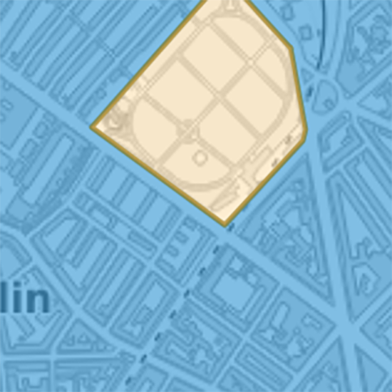
Archäologischer Zonenplan
Der Archäologische Zonenplan besteht aus zwei Ebenen. Die Archäologischen Zonen weisen die Zonen aus, in welchen mit hoher Wahrscheinlichkeit archäologische und naturgeschichtliche Funde und Fundkomplexe zu erwarten sind (Denkmalschutzgesetz § 24b). Übrige Bereiche bezeichnen Gebiete, bei denen archäologische bzw. naturgeschichtliche Funde möglich sind.
Simple
- Date (Creation)
- 2011-08-22
- Date (Revision)
- 2025-01-13
- Purpose
-
Das Bauinspektorat überweist alle Baugesuche in den im Archäologischen Zonenplan ausgewiesenen Gebieten der Archäologischen Bodenforschung. Diese orientiert und berät die Eigentümerschaft sowie die Bauleitung und führt erforderlichenfalls archäologische Untersuchungen durch.
- Status
- Completed
Owner
- Spatial representation type
- Vector
- Topic category
-
- E Planning cadastre
Extent
Extent
- Description
-
Canton of Basel-Stadt (BS)
))

- Maintenance and update frequency
- As needed
- GEMET
-
-
archaeology
-
Resource constraints
- Other constraints
-
Die Geodaten sind öffentlich zugänglich. (Zugangsberechtigungsstufe [A] = öffentlich)
- Other constraints
-
Es gelten die Nutzungsbedingungen für Geodaten des Kantons Basel-Stadt. ( http://www.geo.bs.ch/agb)
Associated resource
- Title
-
Archäologischer Zonenplan
- Association Type
- Reference to a master resource of which this one is a part
- Language
- Deutsch
- Character encoding
- UTF8
- Supplemental Information
-
Die im Archäologischen Zonenplan ausgewiesenen Bereiche sind nicht abschliessend. Es ist damit zu rechnen, dass auch ausserhalb dieser Gebiete wichtige archäologische Funde und Strukturen auftreten können.
- Subtopic Category
- E1 Spatial Planning, Spatial Development
- Basic Geodata
- true
- Basic Geodata ID
-
19-BS
- Basic Geodata Legal Level
- Cantonal
- Distribution format
-
-
ESRI Shapefile (SHP)
-
ESRI File Geodatabase FileGDB (GDB)
-
OGC Geopackage (GPKG)
-
TEXT, semicolon separated (CSV)
-
GeoJSON (GEOJSON)
-
GeoParquet
-
FlatGeobuf
-
Distributor
- Hours of service
-
Mo - Do: 8:00 bis 12:00, 13:30 bis 16:30, Fr: 8:00 bis 12:00, 13:30 bis 16:00
Digital transfer options
- OnLine resource
-
MapBS
Öffentliches Auskunftssystem des Kantons Basel-Stadt
Digital transfer options
- OnLine resource
-
Geodaten-Shop
Öffentlich zugänglicher Geodaten-Downloaddienst des Kantons Basel-Stadt
Digital transfer options
- OnLine resource
-
WMS BS
Die derzeit im WMS BS verfügbaren Datenebenen entsprechen, bis auf wenige Ausnahmen, den Geodaten, welche auch in MapBS dargestellt sind. Der WMS BS ist kostenlos nutzbar und bietet Zugriff auf öffentliche sowie beschränkt öffentliche Geodaten, wobei gegebenenfalls Benutzername und Passwort benötigt werden (Zugangsdaten von MapBS).
Digital transfer options
- OnLine resource
-
WFS BS
Die derzeit im WFS BS verfügbaren Datenebenen entsprechen, bis auf wenige Ausnahmen, den Geodaten, welche auch in MapBS dargestellt sind. Der WFS BS ist kostenlos nutzbar und bietet Zugriff auf öffentliche sowie beschränkt öffentliche Geodaten, wobei gegebenenfalls Benutzername und Passwort benötigt werden (Zugangsdaten von MapBS).
- Reference system identifier
- CH1903+ / LV95/EPSG: 2056
Metadata
- Metadata identifier
- 9c8952da-4258-4774-9660-265aa6152050
- Language
- Deutsch
- Character encoding
- UTF8
- Language
- Français
- Character encoding
- UTF8
- Language
- Italiano
- Character encoding
- UTF8
- Language
- English
- Character encoding
- UTF8
Custodian
Type of resource
- Resource scope
- Dataset
- Metadata linkage
-
https://www.geocat.ch/geonetwork/srv/api/records/9c8952da-4258-4774-9660-265aa6152050
- Date info (Creation)
- 2011-10-17T13:00:42Z
- Date info (Revision)
- 2026-04-13T09:38:33.022181Z
Metadata standard
- Title
-
eCH-0271