 geocat.ch
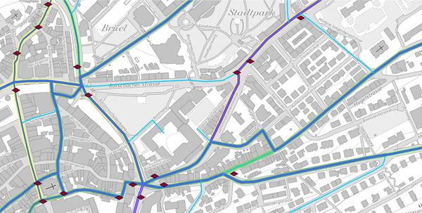
Rad-, MTB- und Skatingwege
Der Geodatensatz beinhaltet sowohl das Radweg-Netz als auch definierten Routen auf diesem Netz. Ausserdem sind die Wegweiser der Radwege enthalten. Unter die Radwege fallen sowohl Wege für Velos als auch für Mountainbikes (MTB) und Inline-Skates.
Simple
- Date (Creation)
- 2013-08-27
- Date (Revision)
- 2026-06-21
- Other citation details
-
Verkehr
- Status
- On going
partner
- Hours of service
-
Mo. - Fr. von 8:00 - 17:00 Uhr
- Spatial representation type
- Vector
Spatial resolution
Equivalent scale
- Denominator
- 25000
- Topic category
-
- P Transportation
Extent
Extent
- Description
-
Kanton St.Gallen
))
- Maintenance and update frequency
- Annually
- geocat.ch
-
-
Radwege
-
Velowege
-
opendata.swiss
-
Resource constraints
- Access constraints
- Other restrictions
- Other constraints
-
A = öffentlich
Resource constraints
- Classification
- Unclassified
- Language
- Deutsch
- Distribution format
-
-
ESRI Shapefile
-
DXF
-
Distributor
- Hours of service
-
Mo. - Fr. von 8:00 - 17:00 Uhr
Digital transfer options
- Statement
-
Ursprünglich wurden die Geodaten durch das damalige Vermessungsamt des Kantons St.Gallen erfasst und nachgeführt. In den Jahren 2003 und 2004 erfolgte die Übernahme und Integration der einzelnen Datensätze in das GIS-System GoBike.
- Hierarchy level
- Dataset
- Reference system identifier
- CH1903+_LV95 / EPSG 2056
Metadata
- Metadata identifier
- 9b58995e-ca2e-4548-8e60-3159643b015a
- Language
- Deutsch
- Character encoding
- UTF8
Resource provider
- Hours of service
-
Mo. - Fr. von 8:00 - 17:00 Uhr
Type of resource
- Resource scope
- Dataset
- Date info (Revision)
- 2026-06-21T01:15:48+02:00
Metadata standard
- Title
-
GM03 Core
)))
