geocat.ch
Gemeindegrenzen - Zeitreise
Limites de commune - voyage dans le temps
Limiti comunali - viaggio nel tempo
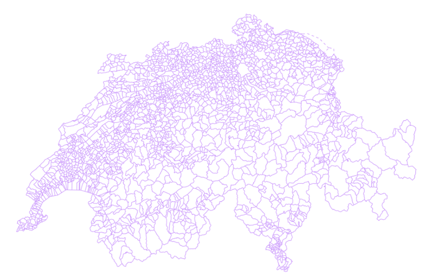
Municipal boundaries - journey through time
Der Layer Gemeindegrenzen besteht aus den administrativen Grenzen der Gemeinden der Schweiz und des Fürstentums Liechtenstein. Die Gemeinde ist die kleinste administrative Einheit. Standardmässig wird jeweils der aktuellste Stand der Gemeindegrenzen angezeigt. Mit dem Werkzeug für die Darstellung von historischen Daten – der sogenannten «Zeitreise» - kann die Entwicklung der Gemeindegrenzen von 1850 bis heute interaktiv verfolgt werden. Wenn ein älterer Zeitstand ausgewählt wird, erscheint immer der Stand der Gemeindegrenzen vom 1. Januar des entsprechenden Jahres. Bei der aktuellsten Darstellung werden Gemeindefusionen, die im Laufe des Jahres erfolgten, ebenfalls berücksichtigt. Der Layer wurde aus zwei Datenquellen aufgebaut: "Gemeindegrenzen: Zeitreihe seit 1850" des Bundesamtes für Statistik für den Zeitraum 1850 - 2015 und swissBOUNDARIES3D des Bundesamtes für Landestopographie für den Zeitraum 2016 bis heute.
La couche limites de commune comprend les limites administratives des communes de la Suisse et de la Principauté de Liechtenstein. La commune est la plus petite unité administrative. Par défaut, l'état actuel des limites de commune est affiché. Avec l'outil de représentation historique des données – nommé « voyage dans le temps » - l’évolution des limites de communes 1850 à nos jours est interactive. Lorsqu’une année antérieure à l’état actuel est sélectionnée, l’état des limites de commune au premier janvier est affiché. Pour l’état actuel, les fusions de commune en cours d’année sont intégrées. Deux sources de données ont été utilisées pour générer cette couche : "Limites communales : série temporelle depuis 1850" de l’Office fédéral de la statistique pour la période 1850 – 2015 et swissBOUNDARIES3D de l’Office fédéral de topographie pour la période 2016 à aujourd’hui.
Il livello dei limiti comunali include i confini amministrativi dei comuni in Svizzera e nel Principato del Liechtenstein. Il comune è l'unità amministrativa più piccola. Per default viene visualizzato lo stato attuale dei limiti comunali. Con lo strumento di rappresentazione storica dei dati, chiamato "viaggio nel tempo", l'evoluzione dei limiti comunali dal 1850 a oggi è interattiva. Quando viene selezionato un anno precedente allo stato attuale, viene visualizzato lo stato dei limiti comunali al primo gennaio di quell'anno. Per lo stato attuale, le fusioni comunali in corso d'anno sono integrate. Due fonti di dati sono state utilizzate per generare questo strato: "Confini comunali: serie temporale dal 1850" dell'Ufficio federale di statistica per il periodo 1850-2015 e swissBOUNDARIES3D dell'Ufficio federale di topografia per il periodo dal 2016 ad oggi.
The layer municipal boundaries constitute the administrative borders of the municipalities of Switzerland and the principality of Liechtenstein. The municipality is the smallest administrative unit. By default, the current status of municipal boundaries is displayed. With the historical data representation tool - called " journey through time - the evolution of municipal boundaries from 1850 to the present day is interactive. When a year prior to the current status is selected, the status of municipal boundaries on the first of January is displayed. For the current status, mergers of municipalities during the year are included. Two data sources have been used to generate this layer: "Municipal boundaries: time series since 1850s" from the Swiss Federal Statistical Office for the period 1850 - 2015 and swissBOUNDARIES3D from the Swiss Federal Office of Topography for the period 2016 to the present.
Simple
-
Autre titreAltri nomi o acronimiAlternate titleAlternate titleAlternativtitel
-
Gemeindegrenzen
Limites de commune
Limiti comunali
Municipal boundaries
Cunfins communals
-
Date (Révision)Data (Revisione)Date (Revision)Date (Revision)Datum (Aktualisierung)
- 2025-12-18
-
Date (Publication)Data (Pubblicazione)Date (Publication)Date (Publication)Datum (Publikation)
- 2026-01-01
-
IdentifiantIdentificatoreIdentifierIdentifierKennung
- ch.swisstopo.swissboundaries3d-gemeinde-flaeche.fill
Point de contact
Punto di contatto
Point of contact
Point of contact
Ansprechpartner
Fournisseur
Fornitore di risorse
Resource provider
Resource provider
Anbieter
Résolution spatiale
Risoluzione spaziale
Spatial resolution
Spatial resolution
Räumliche Auflösung
Fraction représentative
Frazione rappresentativa
Equivalent scale
Equivalent scale
Vergleichsmassstab
-
DénominateurDenominatoreDenominatorDenominatorMassstabszahl
- 10000
-
Catégorie de thèmeCategoria ISOTopic categoryTopic categoryThematik
-
-
D LimitesD ConfiniD BoundariesD BoundariesD Grenzen
-
Étendue
Estensione
Extent
Extent
Ausdehnung
Étendue
Estensione
Extent
Extent
Ausdehnung
-
DescriptionDescrizioneDescriptionDescriptionBeschreibung
-
Switzerland
Schweiz
Suisse
Svizzera
Svizra
))

Étendue
Estensione
Extent
Extent
Ausdehnung
Étendue
Estensione
Extent
Extent
Ausdehnung
-
DescriptionDescrizioneDescriptionDescriptionBeschreibung
-
Liechtenstein
Liechtenstein
Liechtenstein
Liechtenstein
Liechtenstein
))

-
Fréquence de mise à jourFrequenza di aggiornamentoMaintenance and update frequencyMaintenance and update frequencyWartungsintervall
-
AnnuelleAnnualmenteAnnuallyAnnuallyJährlich
-
Remarque sur la mise à jourNota sull'aggiornamentoMaintenance noteMaintenance noteAnmerkung
-
Die Nachführung erfolgt auf den Grundlagen der Amtlichen Vermessung (AV) und des Bundesamtes für Statistik (BFS). swissBOUNDARIES3D wird immer zu Jahresbeginn umfassend aktualisiert. Bei Gemeindefusionen, die während des Jahres in Kraft treten, publiziert swisstopo zeitnah eine Spezialnachführung. In diesem Fall enthält die Sonderausgabe von swissBOUNDARIES3D nur punktuelle Anpassungen, die im Zusammenhang mit der Fusion stehen.
L’actualisation se base sur les informations de la mensuration officielle (MO) et de l'office fédéral de la statistique (OFS). swissBOUNDARIES3D est toujours actualisé complètement en début d'année. En cas de fusion de communes entrant en vigueur pendant l'année, swisstopo publie rapidement une mise à jour spéciale. Dans ce cas, l'édition spéciale de swissBOUNDARIES3D ne comprend que des adaptations ponctuelles liées à la fusion.
L’aggiornamento è effettuato sulla base della Misurazione ufficiale (MU) e dei dati dell’Ufficio federale di statistica (UST). swissBOUNDARIES3D è sempre completamente aggiornato all'inizio dell'anno. In caso di fusioni di comuni che entrano in vigore nel corso dell'anno, swisstopo pubblicherà prontamente un aggiornamento speciale. In questo caso, l'edizione speciale di swissBOUNDARIES3D comprende solo gli adeguamenti puntuali legati alla fusione.
Updating is based on information provided by the Cadastral Survey (CS) and the Federal Statistical Office. swissBOUNDARIES3D is always fully updated at the beginning of the year. When municipality fusions take place during the year, swisstopo will publish a special update as soon as possible. In this case, the special edition of swissBOUNDARIES3D includes only selective adjustments related to the fusion.
- GEMET - INSPIRE themes, version 1.0
-
-
Unités administratives
Unità amministrative
Administrative units
-
- geocat.ch
-
-
INSPIRE
INSPIRE
INSPIRE
-
opendata.swiss
opendata.swiss
opendata.swiss
opendata.swiss
-
- GEMET
-
-
commune
comune
municipality
-
- geocat.ch
-
-
BGDI Bundesgeodaten-Infrastruktur
IFDG l’Infrastructure Fédérale de données géographiques
IFDG Infrastruttura federale dei dati geografici
FSDI Federal Spatial Data Infrastructure
-
- GEMET
-
-
Verwaltungsgrenze
limite administrative
confine amministrativo
administrative boundary
-
Contraintes sur la ressource
Vincoli sulle risorse
Resource constraints
Resource constraints
Ressourcenbeschränkungen
-
Autres contraintesAltri vincoliOther constraintsOther constraintsAndere Einschränkungen
-
Freie Nutzung. Quellenangabe ist Pflicht.
Utilisation libre. Obligation d’indiquer la source.
NonCommercialAllowed-CommercialAllowed-ReferenceRequired
Ressource associée
Risorsa associata
Associated resource
Associated resource
Verlinkte Ressource
-
Type d'associationTipo di associazioneAssociation TypeAssociation TypeAssoziationstyp
-
Citation de travail plus largeCitazione di un'opera più ampiaReference to a master resource of which this one is a partReference to a master resource of which this one is a partÜbergeordneter Datenbestand
-
Metadata ReferenceRiferimento metadatiMetadata ReferenceMetadata ReferenceMetadatenreferenz
Ressource associée
Risorsa associata
Associated resource
Associated resource
Verlinkte Ressource
-
TitreTitoloTitleTitleTitel
-
Hoheitsgrenzen (Landesvermessung)
Limites territoriales (mensuration nationale)
Administrative boundaries (national survey)
-
Type d'associationTipo di associazioneAssociation TypeAssociation TypeAssoziationstyp
-
Citation de travail plus largeCitazione di un'opera più ampiaReference to a master resource of which this one is a partReference to a master resource of which this one is a partÜbergeordneter Datenbestand
-
LangueLinguaLanguageLanguageSprache
- Deutsch
-
Encodage de caractèresCodifica dei caratteriCharacter encodingCharacter encodingZeichenkodierung
-
Utf8UTF8UTF8UTF8Utf8
-
LangueLinguaLanguageLanguageSprache
- Français
-
Encodage de caractèresCodifica dei caratteriCharacter encodingCharacter encodingZeichenkodierung
-
Utf8UTF8UTF8UTF8Utf8
-
LangueLinguaLanguageLanguageSprache
- English
-
Encodage de caractèresCodifica dei caratteriCharacter encodingCharacter encodingZeichenkodierung
-
Utf8UTF8UTF8UTF8Utf8
-
Géodonnées de baseGeodati di baseBasic GeodataBasic GeodataGeobasisdaten
- true
-
Identifiant Géodonnées de baseIdentificativo dei geodati di baseBasic Geodata IDBasic Geodata IDIdentifikator des Geobasisdatensatzes
-
39.3
-
Niveau des géodonnées de baseLivello legale dei geodati di baseBasic Geodata Legal LevelBasic Geodata Legal LevelGeobasisdatenebene
-
FédéralFederaleFederalFederalNational
-
Livré avec jeu de donnéesFornito con set di datiIncluded with datasetIncluded with datasetMit Datensatz geliefert
- 0
-
TitreTitoloTitleTitleTitel
-
swissBOUNDARIES3D Grenzen Schweizweit in 3D
swissBOUNDARIES3D Les limites administrative de la Suisse en 3D
-
Date (Publication)Data (Pubblicazione)Date (Publication)Date (Publication)Datum (Publikation)
- 2026-01-01
-
Format de distributionFormato (codifica)Distribution formatDistribution formatAbgabeformat
-
-
OGC Geopackage (GPKG)
-
ESRI File Geodatabase FileGDB (GDB)
-
ESRI Shapefile (SHP)
-
INTERLIS 2 (XTF)
-
Options de transfert numérique
Opzioni di trasferimento digitale
Digital transfer options
Digital transfer options
Optionen für die digitale Übertragung
-
Ressource en ligneRisorsa onlineOnLine resourceOnLine resourceOnline
-
Vorschau map.geo.admin.ch
Vorschau map.geo.admin.chAperçu map.geo.admin.chPrevisione map.geo.admin.chPreview map.geo.admin.ch
Options de transfert numérique
Opzioni di trasferimento digitale
Digital transfer options
Digital transfer options
Optionen für die digitale Übertragung
-
Ressource en ligneRisorsa onlineOnLine resourceOnLine resourceOnline
-
ch.swisstopo.swissboundaries3d-gemeinde-flaeche.fill
WMS-BGDI Dienst, Layer "Gemeindegrenzen"Service WMS-IFDG, couche "Limites de commune"Servizio WMS-IFDG, strato "Limiti comunali"WMS-FSDI service, layer "Municipal boundaries"WMS-BGDI Dienst, Layer "Gemeindegrenzen"
Options de transfert numérique
Opzioni di trasferimento digitale
Digital transfer options
Digital transfer options
Optionen für die digitale Übertragung
-
Ressource en ligneRisorsa onlineOnLine resourceOnLine resourceOnline
-
ch.swisstopo.swissboundaries3d-gemeinde-flaeche.fill
WMTS-BGDI Dienst, Layer "Gemeindegrenzen"Service WMTS-IFDG, couche , Layer "Limites de commune"Servizio WMTS-IFDG, strato "Limiti comunali"WMTS-FSDI service, layer "Municipal boundaries"WMTS-BGDI Dienst, Layer "Gemeindegrenzen"
Options de transfert numérique
Opzioni di trasferimento digitale
Digital transfer options
Digital transfer options
Optionen für die digitale Übertragung
-
Ressource en ligneRisorsa onlineOnLine resourceOnLine resourceOnline
-
swissBOUNDARIES3D
Options de transfert numérique
Opzioni di trasferimento digitale
Digital transfer options
Digital transfer options
Optionen für die digitale Übertragung
-
Ressource en ligneRisorsa onlineOnLine resourceOnLine resourceOnline
-
Downloadseite
Options de transfert numérique
Opzioni di trasferimento digitale
Digital transfer options
Digital transfer options
Optionen für die digitale Übertragung
-
Ressource en ligneRisorsa onlineOnLine resourceOnLine resourceOnline
-
Gemeindegrenzen: Zeitreihe seit 1850
Options de transfert numérique
Opzioni di trasferimento digitale
Digital transfer options
Digital transfer options
Optionen für die digitale Übertragung
-
Ressource en ligneRisorsa onlineOnLine resourceOnLine resourceOnline
-
Linked Data
Options de transfert numérique
Opzioni di trasferimento digitale
Digital transfer options
Digital transfer options
Optionen für die digitale Übertragung
-
Ressource en ligneRisorsa onlineOnLine resourceOnLine resourceOnline
-
RESTful API von geo.admin.ch
RESTful API von geo.admin.chRESTful API de geo.admin.chRESTful API da geo.admin.chRESTful API from geo.admin.chRESTful API dad geo.admin.ch
Options de transfert numérique
Opzioni di trasferimento digitale
Digital transfer options
Digital transfer options
Optionen für die digitale Übertragung
-
Ressource en ligneRisorsa onlineOnLine resourceOnLine resourceOnline
-
Linked Data Dienst (via SPARQL)
-
Type d’objet géométriqueTipo di oggetto geometricoGeometric object typeGeometric object typeTyp des geometrischen Objekts
-
LigneCurvaCurveCurvecurve
-
Type d’objet géométriqueTipo di oggetto geometricoGeometric object typeGeometric object typeTyp des geometrischen Objekts
-
PolygoneSuperficieSurfaceSurfacesurface
-
Nom du système de référenceNome del sistema di riferimentoReference system identifierReference system identifierName des Referenzsystems
- EPSG:2056
Metadata
-
Identifiant des métadonnéesIdentificativo della schedaMetadata identifierMetadata identifierIdentifikator des Metadatensatzes
- 9961dc6c-20a9-4b16-8a24-b20c3d8ddb83
-
LangueLinguaLanguageLanguageSprache
- Deutsch
-
Encodage de caractèresCodifica dei caratteriCharacter encodingCharacter encodingZeichenkodierung
-
Utf8UTF8UTF8UTF8Utf8
-
LangueLinguaLanguageLanguageSprache
- Français
-
Encodage de caractèresCodifica dei caratteriCharacter encodingCharacter encodingZeichenkodierung
-
Utf8UTF8UTF8UTF8Utf8
-
LangueLinguaLanguageLanguageSprache
- Italiano
-
Encodage de caractèresCodifica dei caratteriCharacter encodingCharacter encodingZeichenkodierung
-
Utf8UTF8UTF8UTF8Utf8
-
LangueLinguaLanguageLanguageSprache
- English
-
Encodage de caractèresCodifica dei caratteriCharacter encodingCharacter encodingZeichenkodierung
-
Utf8UTF8UTF8UTF8Utf8
-
LangueLinguaLanguageLanguageSprache
- Rumantsch
-
Encodage de caractèresCodifica dei caratteriCharacter encodingCharacter encodingZeichenkodierung
-
Utf8UTF8UTF8UTF8Utf8
Point de contact
Punto di contatto
Point of contact
Point of contact
Ansprechpartner
-
Heures de serviceOrario di servizioHours of serviceHours of serviceBetriebszeiten
-
08h30 - 11h00 / 14h00 - 16h00 GMT+1
Type de ressource
Tipo di risorsa
Type of resource
Type of resource
Anwendungsbereich der Metadaten
-
Domaine d'application de la ressourceAmbito di applicazione della risorsaResource scopeResource scopeDomäne der Ressourcenanwendung
-
Jeu de donnéesSet di datiDatasetDatasetDatenbestand
-
Lien vers la métadonnéeCollegamento ai metadatiMetadata linkageMetadata linkageLink zu den Metadaten
-
Informations de date (Création)Informazioni sulla data (Creazione)Date info (Creation)Date info (Creation)Datumsangaben (Erstellung)
- 2011-10-24T08:56:32Z
-
Informations de date (Révision)Informazioni sulla data (Revisione)Date info (Revision)Date info (Revision)Datumsangaben (Aktualisierung)
- 2026-04-13T09:16:21.832211Z
Norme des métadonnées
Standard dei metadati
Metadata standard
Metadata standard
Metadatenstandard
-
TitreTitoloTitleTitleTitel
-
eCH-0271