geocat.ch
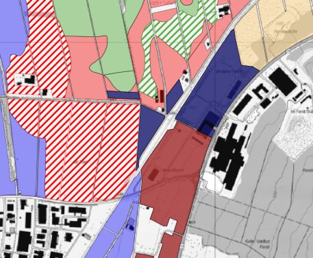
Agricultural soil mapping 2006
Soil mapping 2006
Simple
- Alternate title
-
Soil mapping 2006
- Date (Creation)
- 2006-12-31
- Identifier
- https://metadata.geo.llv.li/9849221f-6e4c-4069-a89d-002f32f8728a
- Purpose
-
Soil mapping 2006
- Status
- Completed
Publisher
Civil Engineering and Geoinformation Office - Abteilung Vermessung und Geoinformation
Giessenstrasse 3
Vaduz
9490
LI
https://www.llv.li/en/national-administration/civil-engineering-and-geoinformation-office
- Hours of service
-
8:00-11:30 und 13:30-17:00
Owner
https://www.llv.li/inhalt/12140/amtsstellen/amt-fur-bevolkerungsschutz
- Hours of service
-
8:00-11:30 und 13:30-17:00
- Spatial representation type
- Vector
Spatial resolution
Equivalent scale
- Denominator
- 500
- Topic category
-
- F Geoscientific information
Extent
Extent
- Description
-
Liechtenstein
N
S
E
W
))

- Maintenance and update frequency
- Not planned
Point of contact
Civil Engineering and Geoinformation Office - Abteilung Vermessung und Geoinformation
Giessenstrasse 3
Vaduz
9490
LI
https://www.llv.li/en/national-administration/civil-engineering-and-geoinformation-office
- Hours of service
-
8:00-11:30 und 13:30-17:00
Resource format
- Title
-
INTERLIS 2 (XTF)
- Date
- GEMET
-
-
agriculture
-
soil use
-
soil use
-
- geocat.ch
-
-
OpenData
-
Resource constraints
- Use limitation
-
keine
- Access constraints
- Other restrictions
- Use constraints
- Other restrictions
- Other constraints
- No limitations to public access
Resource constraints
- Access constraints
- Other restrictions
- Use constraints
- Other restrictions
- Other constraints
- No conditions to access and use
- Other constraints
- Opendata BY: Open use. Must provide the source.
- Language
- Deutsch
- Character encoding
- UTF8
- Subtopic Category
- F2 Soils
- Distribution format
-
-
INTERLIS 1 (ITF)
-
Distributor
Civil Engineering and Geoinformation Office - Abteilung Vermessung und Geoinformation
Giessenstrasse 3
Vaduz
9490
LI
https://www.llv.li/en/national-administration/civil-engineering-and-geoinformation-office
- Hours of service
-
8:00-11:30 und 13:30-17:00
Digital transfer options
- OnLine resource
-
Datenausgabestelle der Landesverwaltung
Data Distribution Office of the National Administration
Digital transfer options
- OnLine resource
-
OGC WMS Service der Liechtensteinen Landesverwaltung
OGC-WMS Service of the National Administration
- Topology level
- Full planar graph
- Geometric object type
- Surface
- Geometric object count
- 100
- Reference system identifier
- EPSG:2056
Metadata
- Metadata identifier
- 9849221f-6e4c-4069-a89d-002f32f8728a
- Language
- Deutsch
- Character encoding
- UTF8
- Language
- Français
- Character encoding
- UTF8
- Language
- Italiano
- Character encoding
- UTF8
- Language
- English
- Character encoding
- UTF8
Owner
Civil Engineering and Geoinformation Office - Abteilung Vermessung und Geoinformation
Giessenstrasse 3
Vaduz
9490
LI
https://www.llv.li/en/national-administration/civil-engineering-and-geoinformation-office
- Hours of service
-
8:00-11:30 und 13:30-17:00
Type of resource
- Resource scope
- Dataset
- Metadata linkage
-
https://www.geocat.ch/geonetwork/srv/api/records/9849221f-6e4c-4069-a89d-002f32f8728a
- Date info (Creation)
- 2023-04-17T11:40:14.747Z
- Date info (Revision)
- 2026-04-13T08:27:59.422143Z
Metadata standard
- Title
-
eCH-0271