geocat.ch
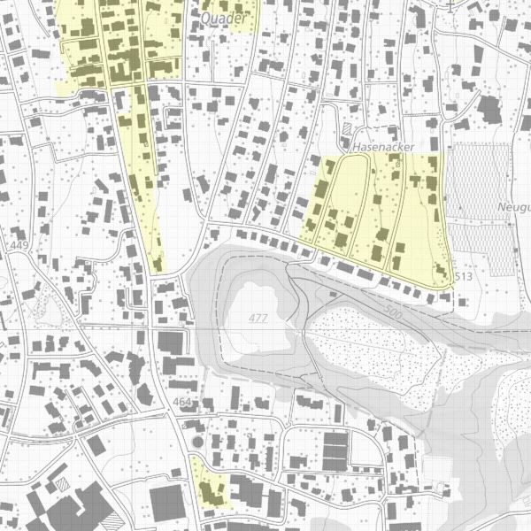
Archaeological perimeter
This planning instrument records those properties where cultural artefacts have been discovered in the past or where there is a high probability of coming across such artefacts. To date, only some of the actual archaeological sites in Liechtenstein are known. New sites are regularly discovered during construction work or during inspections, even outside the area already recorded in the archaeological perimeter.
Keeping and maintaining an inventory of archaeological sites is a legal mandate. The areas can be accessed in the geodata portal of the Liechtenstein National Administration (KGS 2016).
All types of earth movements within the archaeological perimeter must be reported to the Office of Culture at least 14 days before they are carried out.
Simple
- Alternate title
-
Archaeological perimeter Liechtenstein
- Date (Creation)
- 2000-01-01
- Identifier
- https://metadata.geo.llv.li/941ab829-1128-4798-a545-2cd29e7ce611
- Purpose
-
Overview and information source for authorities and private individuals
- Status
- On going
Publisher
- Hours of service
-
8:00-11:30 und 13:30-17:00
Owner
- Hours of service
-
8:00-12:00 und 13:30-17:00
- Spatial representation type
- Vector
- Topic category
-
- M Society
Extent
Extent
- Description
-
Liechtenstein
))

- Maintenance and update frequency
- Continual
Resource format
- Title
-
INTERLIS 1 (ITF)
- Date
- GEMET
-
-
archaeology
-
- GEMET - INSPIRE themes, version 1.0
-
-
Protected sites
-
- geocat.ch
-
-
INSPIRE
-
- Spatial scope
-
-
National
-
- Language
- Deutsch
- Character encoding
- UTF8
- Included with dataset
- 0
- Title
-
Datenmodell Denkmalschutz und Archäologie
- Date (Creation)
- 2001-12-10
- Distribution format
-
-
INTERLIS 1 (ITF)
-
AutoCAD DXF (DXF)
-
ESRI Shapefile (SHP)
-
Point of contact
- Hours of service
-
8:00-11:30 und 13:30-17:00
Digital transfer options
- OnLine resource
-
Webseite der Landesverwaltung
Website of the national administration
Digital transfer options
- OnLine resource
-
li.aku.arch_perimter
OGC-WMS Service of the National Administration
- Hierarchy level
- Dataset
Report
Result
- Title
-
VERORDNUNG (EG) Nr. 1089/2010 DER KOMMISSION vom 23. November 2010 zur Durchführung der Richtlinie 2007/2/EG des Europäischen Parlaments und des Rates hinsichtlich der Interoperabilität von Geodatensätzen und -diensten
- Date (Publication)
- 2010-12-08
- Explanation
-
nicht geprüft
- Pass
- false
- Statement
-
Konstruktion auf der Grundlage der Grundstücksgrenzen, parzellenschaft
- Hierarchy level
- Dataset
- Topology level
- Full planar graph
- Geometric object type
- Surface
- Geometric object count
- 200
- Maintenance and update frequency
- As needed
Metadata
- Metadata identifier
- 941ab829-1128-4798-a545-2cd29e7ce611
- Language
- Deutsch
- Character encoding
- UTF8
- Language
- Français
- Character encoding
- UTF8
- Language
- Italiano
- Character encoding
- UTF8
- Language
- English
- Character encoding
- UTF8
Point of contact
- Hours of service
-
8:00-11:30 und 13:30-17:00
Type of resource
- Resource scope
- Dataset
- Metadata linkage
-
https://www.geocat.ch/geonetwork/srv/api/records/941ab829-1128-4798-a545-2cd29e7ce611
- Date info (Creation)
- 2006-05-09T12:00:00Z
- Date info (Revision)
- 2026-05-05T12:37:53.290295Z
Metadata standard
- Title
-
eCH-0271