geocat.ch
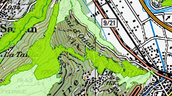
Réserves forestières
Les réserves forestières sont des surfaces protégées durablement et vouées à la diversité écologique et biologique en forêt. Les périmètres des réserves peuvent délimiter des zones non boisées. L'aménagement des réserves forestières est de la compétence du canton. Les réserves forestières sont classées selon l'annexe 2 à la résolution de Vienne n°4 de la conférence ministérielle sur la protection des forêts en Europe. Celle-ci prévoit trois catégories (1.1 pas d'intervention active, 1.2 intervention minimum, 1.3 conservation par une gestion active). Les réserves particulières suisses sont assignées à la catégorie 1.3 alors que les réserves forestières naturelles appartiennent aux catégories 1.1 ou 1.2 en fonction des conventions appliquées.
Simple
- Alternate title
-
Réserves forestières
- Date (Creation)
- 2011-08-17
- Date (Revision)
- 2025-11-04
- Identifier
- 327
- Purpose
-
Géodonnées de base communales
- Status
- Completed
Custodian
- Spatial representation type
- Vector
Spatial resolution
Equivalent scale
- Denominator
- 10000
- Topic category
-
- L Environment
- G Biota
Extent
Extent
- Description
-
Canton of Valais (VS)
))

- Maintenance and update frequency
- Biannually
Resource format
- Title
-
ESRI Enterprise Geodatabase
- Date
- GEMET themes
-
-
natural areas, landscape, ecosystems
-
- GEMET
-
-
forestry
-
forest biological reserve
-
forest
-
- geocat.ch
-
-
official geodata
-
opendata.swiss
-
Resource constraints
- Use limitation
-
aucune
Resource constraints
- Access constraints
- Other restrictions
- Other constraints
-
Géodonnées accessibles au public (niveau A selon l'OGéo)
- Other constraints
-
Les conditions générales d'utilisation des géodonnées du Canton du Valais font foi ( https://www.vs.ch/fr/web/guest/information-legale).
Associated resource
- Association Type
- Reference from one resource to another
- Metadata Reference
- Language
- Français
- Character encoding
- UTF8
- Language
- Deutsch
- Character encoding
- UTF8
- Environment description
-
S:\Géodonnées VS\L2 Protection de la nature\Réserves forestières.lyr
- Supplemental Information
- Subtopic Category
- L2 Nature and Landscape Protection
- Basic Geodata
- true
- Basic Geodata ID
-
160>A.1
- Basic Geodata Legal Level
- Communal
- Basic Geodata Type
- basicGeodata oerebRegister
- Included with dataset
- 0
- Title
-
Catalogue d'objets des réserves forestières
- Date (Creation)
- 2018-11-02
- Included with dataset
- 0
- Title
-
MGDM
- Date (Creation)
- 2017-05-09
- Distribution format
-
-
ESRI Shapefile (SHP)
-
autres formats sur demande / andere Formate auf Anfrage
-
ArcGIS REST Feature Service
-
Distributor
Digital transfer options
- OnLine resource
-
Landing Page
Landing Page pour opendata
Digital transfer options
- OnLine resource
-
geodienste.ch le portail intercantonal
Téléchargement de géodonnées conformes au modèle minimal (divers formats)
Digital transfer options
- OnLine resource
-
Permalink opendata.swiss
Permalink opendata.swiss
Digital transfer options
- OnLine resource
-
Géoportail du Canton du Valais
Géoportail du Canton du Valais
Digital transfer options
- OnLine resource
-
OpenData Valais
Site de téléchargement de géodonnées à l'Etat du Valais: multiformat et WebMercator
Digital transfer options
- OnLine resource
-
biodiversité
Réserves forestières
- Statement
-
Selon surface du contrat publique-privé
- Hierarchy level
- Dataset
- Description
-
selon parcellaire
- Geometric object type
- Surface
- Geometric object count
- 205
- Reference system identifier
- EPSG:2056/CH1903+_MN95
Metadata
- Metadata identifier
- 9398701e-ec47-4336-afe1-53ef04b782cd
- Language
- Français
- Character encoding
- UTF8
- Language
- Deutsch
- Character encoding
- UTF8
- Language
- Italiano
- Character encoding
- UTF8
- Language
- English
- Character encoding
- UTF8
- Language
- Rumantsch
- Character encoding
- UTF8
Distributor
Type of resource
- Resource scope
- Dataset
- Metadata linkage
-
https://www.geocat.ch/geonetwork/srv/api/records/9398701e-ec47-4336-afe1-53ef04b782cd
- Date info (Creation)
- 2018-11-20T13:24:28Z
- Date info (Revision)
- 2026-04-13T09:33:53.810188Z
Metadata standard
- Title
-
eCH-0271