geocat.ch
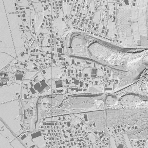
Digitales Oberflächenmodell (DOM) 2015
Digitales Oberflächenmodell über ganz Liechtenstein als Grid 0.5m. Erstellt am 8. April 2015 (Talgebiet) und am 26. August 2015 (Berggebiet nach Schneefreiheit) von der Firma TopScan GmbH mit Laserscannermessung aus einer Cessna 402 B und einer mittl. Flughöhe von 800 m. Die Höhengenauigkeit (einfache Standardabweichung) beträgt ±0.2 m (± 0.6 m im Vegetationsbereich), die Punktdichte 4 Punkte pro Quadratmeter. Die Gemeinden des Landes haben sich an den Herstellungskosten beteiligt (keine Nutzungsgebühr bei Bezug).
Simple
- Date (Creation)
- 2016-02-17
- Identifier
- https://metadata.geo.llv.li/935bf47a-cd72-4ae5-bba6-90ffb8c9b9e6
- Purpose
-
Grundlagedaten, Höheninformationen
- Status
- Completed
Point of contact
- Hours of service
-
8:00-11:30 und 13:30-17:00
- Spatial representation type
- Vector
- Topic category
-
- C Elevation
Extent
Extent
- Description
-
Liechtenstein
))

- Maintenance and update frequency
- Unknown
Resource format
- Title
-
GRID ASCII (XYZ)
- Date
- geocat.ch
-
-
INSPIRE
-
DSM (digital surface model)
-
- GEMET - INSPIRE themes, version 1.0
-
-
Elevation
-
- Räumlicher Anwendungsbereich
-
-
National
-
Resource constraints
- Use limitation
-
gebührenpflichtig
- Access constraints
- Other restrictions
- Use constraints
- License
- Other constraints
-
keine Eschränkung
- Country
- LI
- Title
-
Verordnung über die Gebühren für die Nutzung der Geodateninfrastruktur Liechtenstein
- Alternate title
-
GDI-Gebührenverordnung (GDI-GebV)
- Date (Creation)
- 2011-08-30
- Language
- Deutsch
- Character encoding
- UTF8
- Included with dataset
- 0
- Title
-
Digitales Höhenmodell (DHM)
- Date (Revision)
- 2016-02-17
- Distribution format
-
-
GRID ASCII (XYZ)
-
GeoTIFF (GEOTIFF)
-
ESRI Shapefile (SHP)
-
ESRI Arcinfo ASCII GRID (ASC)
-
AutoCAD DXF (DXF)
-
Point of contact
- Hours of service
-
8:00-11:30 und 13:30-17:00
Digital transfer options
- OnLine resource
-
Geodatenportal
Geodatenportal der Liechtenischen Landesverwaltung
- Hierarchy level
- Dataset
Report
Result
- Title
-
VERORDNUNG (EG) Nr. 1089/2010 DER KOMMISSION vom 23. November 2010 zur Durchführung der Richtlinie 2007/2/EG des Europäischen Parlaments und des Rates hinsichtlich der Interoperabilität von Geodatensätzen und -diensten
- Date (Publication)
- 2010-12-08
- Explanation
-
nicht geprüft
- Pass
- false
- Statement
-
Flugzeuggestütztes Laserscanning
- Hierarchy level
- Dataset
- Topology level
- Geometry only
- Geometric object type
- Point
- Reference system identifier
- http://www.opengis.net/def/crs/EPSG/0/2056
- Reference system identifier
- http://www.opengis.net/def/crs/EPSG/0/4936
Metadata
- Metadata identifier
- 935bf47a-cd72-4ae5-bba6-90ffb8c9b9e6
- Language
- Deutsch
- Character encoding
- UTF8
- Language
- Français
- Character encoding
- UTF8
- Language
- Italiano
- Character encoding
- UTF8
- Language
- English
- Character encoding
- UTF8
Point of contact
- Hours of service
-
8:00-11:30 und 13:30-17:00
Type of resource
- Resource scope
- Dataset
- Metadata linkage
-
https://www.geocat.ch/geonetwork/srv/api/records/935bf47a-cd72-4ae5-bba6-90ffb8c9b9e6
- Date info (Creation)
- 2016-08-03T16:13:05Z
- Date info (Revision)
- 2026-05-05T12:37:35.148082Z
Metadata standard
- Title
-
eCH-0271