geocat.ch
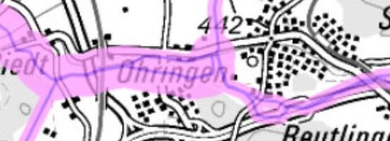
Location and adjoining areas of pipeline systems according to the Ordnance on Protection against Major Accidents
The Ordinance on Protection against Major Accidents (MAO, SR 814.012) is designed to protect the public and the environment from serious damage resulting from major accidents. It regulates the safety measures that must be implemented by the owners of transport routes, businesses and pipeline systems and the authorities' control and assessment procedures. The enforcement authority (Swiss Federal Office of Energy SFOE) publishes details of the geographical location of pipeline systems governed by the MAO and of the adjoining area (consultation area) (Art. 20 para. 1 MAO) defined by the enforcement authority; this area must be taken into account in decisions on land use. Data is kept on all pipeline systems defined in the Pipelines Ordinance of 2 February 2000 which meet the criteria specified in Annex 1.3 (PipeO, SR 746.11). Data is also kept on the areas adjoining the pipeline installations (consultation areas). The consultation area measures 300 metres on either side of the pipeline if the pressure in the pipeline is 67.5 bar or above and if the diameter of the pipeline is 24 inches or more. Otherwise, the consultation area measures 100 metres on either side of the pipeline. The data is not offered for download.
Simple
- Alternate title
-
Pipeline consultation areas
- Date (Creation)
- 2018-09-25
- Date (Revision)
- 2023-05-01
- Identifier
- ch.bfe.rohrleitungen-konsultationsbereiche
Owner
- Topic category
-
- Q Utilities communication
Extent
Extent
- Description
-
Switzerland
))

- Maintenance and update frequency
- Annually
- Duration of Conservation
- 25
- Appraisal of Archival Value
- A
- Reason for Archiving Value
- Evidence of business practice
- geocat.ch
-
-
Conservation and archiving planning AAP - Confederation
-
official geodata
-
opendata.swiss
-
- geocat.ch
-
-
FSDI Federal Spatial Data Infrastructure
-
Resource constraints
- Use constraints
- Other restrictions
- Other constraints
- Opendata BY: Open use. Must provide the source.
Resource constraints
- Use limitation
-
The data is not offered for download.
- Language
- Deutsch
- Character encoding
- UTF8
- Language
- Français
- Character encoding
- UTF8
- Language
- Italiano
- Character encoding
- UTF8
- Subtopic Category
- Q1 Energy
- Basic Geodata
- true
- Basic Geodata ID
-
213
- Basic Geodata Legal Level
- Federal
- Distribution format
-
-
INTERLIS 2 (XTF)
-
Digital transfer options
Digital transfer options
- OnLine resource
-
ch.bfe.rohrleitungen-konsultationsbereiche
WMS-FSDI service, layer "Pipeline consultation areas"
Digital transfer options
- OnLine resource
-
ch.bfe.rohrleitungen-konsultationsbereiche
WMTS-FSDI service, layer "Pipeline consultation areas"
Digital transfer options
- OnLine resource
-
Lage und angrenzende Bereiche: ESRI FGDB
Digital transfer options
- OnLine resource
-
Fachportal - map.energie.admin.ch
Thematic geoportal - map.energie.admin.ch
- Geometric object type
- Point
- Reference system identifier
- EPSG:2056
Metadata
- Metadata identifier
- 9188dcff-dced-43b9-8127-b3104f09c175
- Language
- Deutsch
- Character encoding
- UTF8
- Language
- Français
- Character encoding
- UTF8
- Language
- Italiano
- Character encoding
- UTF8
- Language
- English
- Character encoding
- UTF8
- Language
- Rumantsch
- Character encoding
- UTF8
Point of contact
Type of resource
- Resource scope
- Dataset
- Metadata linkage
-
https://www.geocat.ch/geonetwork/srv/api/records/9188dcff-dced-43b9-8127-b3104f09c175
- Date info (Creation)
- 2018-09-25T13:44:02Z
- Date info (Revision)
- 2026-04-13T09:23:27.515348Z
Metadata standard
- Title
-
eCH-0271