 geocat.ch
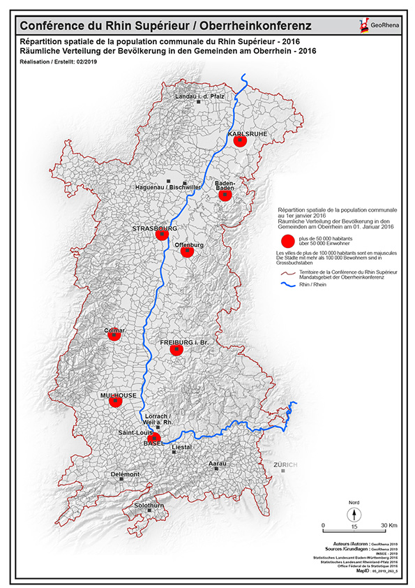
Répartition de la population de plus de 50 000 habitants 2016 PDF / Räumliche Verteilung der Bevölkerung über 50 000 Einwohner - 2016 PDF
Carte PDF de la répartition spatiale de la population communale de plus de 50 000 habitants du Rhin Supérieur au 01/01/2016
PDF Karte der Räumliche Verteilung der Bevölkerung in den Gemeinden über 50 000 Einwohner am Oberrhein am 01/01/2016
Simple
- Date (Creation)
- 2019-04-08
- Presentation form
- Hardcopy map
- Status
- Completed
- Topic category
-
- M Society
Extent
Extent
N
S
E
W
))
- Maintenance and update frequency
- Unknown
- Keywords
-
-
über 50 000 Einwohner; plus de 50 000 habitants; répartition;population;PDF;carte;Karte;Rhin Supérieur;Rhin;Supérieur;2016;Bevölkerung;communale;Gemeinden;Verteilung;Räumliche;spatiale
-
Resource constraints
- Use limitation
-
© OSM contributors - INSEE - STAL BW - STALA RP - OFS - GeoRhena
- Access constraints
- Copyright
- Use constraints
- Copyright
- Language
- Français
- Distribution format
-
-
PDF
-
Metadata
- Metadata identifier
- 912ac097-723f-4478-a8ba-f0ca058eaa35
- Language
- Français
- Character encoding
- UTF8
Type of resource
- Resource scope
- staticMap
- Name
-
1
- Date info (Revision)
- 2025-06-18T12:51:36.772646Z
Metadata standard
- Title
-
ISO 19115-3:2018
- Edition
-
1.0
)))