geocat.ch
Natural hazard maps
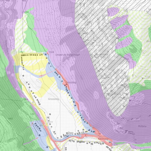
The natural hazard maps show the predominant natural hazards in Liechtenstein: water/debris flow, landslides, avalanches and rockfall. The natural hazard map is of an indicative nature and is analysed and specified when the hazard zone plans are drawn up.
Simple
- Date (Publication)
- 2015-07-14
- Identifier
- https://metadata.geo.llv.li/8f1c5a43-810b-4f23-b612-a183bc71a2c7
- Purpose
-
Planning basis for authorities and private individuals; implementation of forest law; basis for building law
- Status
- On going
Publisher
- Hours of service
-
8:00-11:30 und 13:30-17:00
Owner
- Hours of service
-
8:00-11:30 und 13:30-17:00
- Spatial representation type
- Vector
Spatial resolution
- Spatial resolution
- 0.1 m
- Topic category
-
- F Geoscientific information
Extent
Extent
- Description
-
Liechtenstein
))

- Maintenance and update frequency
- Continual
Resource format
- Title
-
INTERLIS 1 (ITF)
- Date
Resource format
- Title
-
ESRI Shapefile (SHP)
- Date
- geocat.ch
-
-
rockfall
-
slide
-
hazard map
-
OpenData
-
INSPIRE
-
debris flow
-
- GEMET
-
-
hazard
-
natural hazard
-
danger analysis
-
hazard area
-
- GEMET - INSPIRE themes, version 1.0
-
-
Natural risk zones
-
- Räumlicher Anwendungsbereich
-
-
National
-
Resource constraints
- Use limitation
-
The technical interpretation of the hazard map in connection with the issue of data and plans is carried out by the Office for Civil Protection
- Access constraints
- Other restrictions
- Use constraints
- Other restrictions
- Other constraints
- No limitations to public access
Resource constraints
- Access constraints
- Other restrictions
- Use constraints
- Other restrictions
- Other constraints
- No conditions to access and use
- Other constraints
- Opendata BY: Open use. Must provide the source.
- Country
- LI
- Title
-
Verordnung über die Gebühren für die Nutzung der Geodateninfrastruktur Liechtenstein
- Alternate title
-
GDI-Gebührenverordnung (GDI-GebV)
- Date (Creation)
- 2015-07-14
- Language
- Deutsch
- Character encoding
- UTF8
- Subtopic Category
- F3 Natural Hazards
- Distribution format
-
-
INTERLIS 1 (ITF)
-
ESRI Shapefile (SHP)
-
Point of contact
- Hours of service
-
8:00-11:30 und 13:30-17:00
- Fees
-
nach Aufwand
- Ordering instructions
-
Vetriebsstelle, wenn Kosten verrechnet werden
Point of contact
- Hours of service
-
8:00-11:30 und 13:30-17:00
Digital transfer options
Digital transfer options
- OnLine resource
-
geodienste.ch
Aggregation infrastructure of the Swiss cantons
Digital transfer options
- OnLine resource
-
Zipp Download über das Geodatenportal
Zipp Download via the geodata portal
- Hierarchy level
- Dataset
Report
Result
- Title
-
VERORDNUNG (EG) Nr. 1089/2010 DER KOMMISSION vom 23. November 2010 zur Durchführung der Richtlinie 2007/2/EG des Europäischen Parlaments und des Rates hinsichtlich der Interoperabilität von Geodatensätzen und -diensten
- Date (Publication)
- 2010-12-08
- Explanation
-
Gemäss INSPIRE Bestandteil des Themas "Gebiete mit naturbedingten Risiken"
- Pass
- true
- Statement
-
Konstruktion aufgrund von Vermessung. (Parzellenscharf)
- Hierarchy level
- Dataset
- Topology level
- Full planar graph
- Geometric object type
- Surface
- Geometric object count
- 500
- Reference system identifier
- http://www.opengis.net/def/crs/EPSG/0/2056
- Reference system identifier
- http://www.opengis.net/def/crs/EPSG/0/4936
Metadata
- Metadata identifier
- 8f1c5a43-810b-4f23-b612-a183bc71a2c7
- Language
- Deutsch
- Character encoding
- UTF8
- Language
- Français
- Character encoding
- UTF8
- Language
- Italiano
- Character encoding
- UTF8
- Language
- English
- Character encoding
- UTF8
Point of contact
- Hours of service
-
8:00-11:30 und 13:30-17:00
Type of resource
- Resource scope
- Dataset
- Metadata linkage
-
https://www.geocat.ch/geonetwork/srv/api/records/8f1c5a43-810b-4f23-b612-a183bc71a2c7
- Date info (Creation)
- 2006-03-17T12:00:00Z
- Date info (Revision)
- 2026-05-05T12:35:46.969658Z
Metadata standard
- Title
-
eCH-0271