geocat.ch
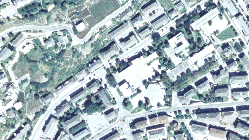
Anciennes SWISSIMAGE (VS)
Archives des SWISSIMAGE.
Simple
- Date (Creation)
- 1998-01-01
- Date (Revision)
- 2024-07-31
- Identifier
- 353
- Purpose
-
fond visuel et données de référence
- Status
- Historical archive
Custodian
- Spatial representation type
- Grid
Spatial resolution
- Spatial resolution
- 0.1 m
- Topic category
-
- A Imagery base maps earth cover
Extent
Extent
- Description
-
Canton of Valais (VS)
))

- Maintenance and update frequency
- Not planned
Resource format
- Title
-
ESRI Enterprise Geodatabase
- Date
- GEMET
-
-
aerial photograph
-
- geocat.ch
-
-
orthophoto
-
digital color orthophoto mosaic
-
official geodata
-
Resource constraints
- Use limitation
-
sous licence
Resource constraints
- Access constraints
- Other restrictions
- Other constraints
-
Géodonnées accessibles au public (niveau A selon l'OGéo)
- Other constraints
-
Les conditions générales d'utilisation des géodonnées du Canton du Valais font foi ( https://www.vs.ch/fr/web/guest/information-legale).
- Language
- Français
- Character encoding
- UTF8
- Language
- Deutsch
- Character encoding
- UTF8
- Environment description
-
S:\Géodonnées VS\A3 Images\Vue d_ensemble des anciennes SwissImage.lyr
- Subtopic Category
- A1 Base Maps, Landscape Models
- Subtopic Category
- A3 Aerial and Satellite Imagery
- Basic Geodata
- true
- Basic Geodata ID
-
35.1
- Basic Geodata Legal Level
- Federal
- Basic Geodata Type
- Reference Geodata
- Distribution format
-
-
GeoTIFF (GEOTIFF)
-
Cloud Optimized GeoTIFF (TIFF / TIF)
-
Distributor
- Statement
-
Se base sur les images aériennes
- Hierarchy level
- Dataset
- Reference system identifier
- EPSG:2056/CH1903+_MN95
Metadata
- Metadata identifier
- 8d19318b-6616-4a44-b29f-8d51940c557c
- Language
- Français
- Character encoding
- UTF8
- Language
- Deutsch
- Character encoding
- UTF8
- Language
- Italiano
- Character encoding
- UTF8
- Language
- English
- Character encoding
- UTF8
- Language
- Rumantsch
- Character encoding
- UTF8
Distributor
Type of resource
- Resource scope
- Dataset
- Metadata linkage
-
https://www.geocat.ch/geonetwork/srv/api/records/8d19318b-6616-4a44-b29f-8d51940c557c
- Date info (Creation)
- 2014-12-17T13:47:06Z
- Date info (Revision)
- 2026-05-18T12:07:19.155798Z
Metadata standard
- Title
-
eCH-0271