geocat.ch
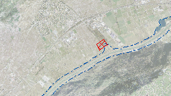
Couloirs de gestion des risques résiduels Plan d'Aménagement de la troisième correction du Rhône
L’aménagement de la 3e correction du Rhône apporte un gain énorme de sécurité par rapport aux crues. Une sécurité absolue n’est néanmoins ni techniquement ni financièrement réalisable. Peu importe le niveau de protection, des événements extrêmes peuvent provoquer une surcharge du système et créer des inondations. Ce risque résiduel est considéré pour des crues très rares et significativement plus élevées que la Q100cible ou que la crue d’octobre 2000.
Simple
- Alternate title
-
PAR3-couloirs-RR
- Date (Creation)
- 2016-03-02
- Date (Revision)
- 2016-03-02
- Identifier
- 455
- Purpose
-
Les concepts de protection contre les crues doivent inclure la gestion des risques résiduels, c’est-à-dire la réduction des risques liés aux événements plus importants que la crue de dimensionnement.
- Status
- Completed
Custodian
- Spatial representation type
- Vector
Spatial resolution
Equivalent scale
- Denominator
- 25000
- Topic category
-
- I Inland waters
- F Geoscientific information
Extent
Extent
- Description
-
Canton of Valais (VS)
))

- Maintenance and update frequency
- Not planned
Resource format
- Title
-
ESRI Enterprise Geodatabase
- Date
- GEMET themes
-
-
disasters, accidents, risk
-
- GEMET themes
-
-
water
-
- GEMET themes
-
-
space
-
- GEMET - INSPIRE themes, version 1.0
-
-
Hydrography
-
- GEMET - INSPIRE themes, version 1.0
-
-
Human health and safety
-
- GEMET - INSPIRE themes, version 1.0
-
-
Natural risk zones
-
- GEMET
-
-
hazard
-
- GEMET
-
-
flood
-
Resource constraints
- Use limitation
-
aucune
Resource constraints
- Access constraints
- Other restrictions
- Other constraints
-
Géodonnées partiellement accessibles aux public (niveau B selon l'OGéo)
- Other constraints
-
Les conditions générales d'utilisation des géodonnées du Canton du Valais font foi ( https://www.vs.ch/fr/web/guest/information-legale).
- Language
- Français
- Character encoding
- UTF8
- Subtopic Category
- F3 Natural Hazards
- Distribution format
-
-
ESRI Shapefile (SHP)
-
autres formats sur demande / andere Formate auf Anfrage
-
Distributor
- Statement
-
CN 1:25'000
- Hierarchy level
- Dataset
- Description
-
Digitalisation
- Geometric object type
- Surface
- Geometric object count
- 9
- Reference system identifier
- EPSG:2056/CH1903+_MN95
Metadata
- Metadata identifier
- 8afc7ab8-96ef-4fc0-911b-adc755045515
- Language
- Français
- Character encoding
- UTF8
- Language
- Deutsch
- Character encoding
- UTF8
- Language
- Italiano
- Character encoding
- UTF8
- Language
- English
- Character encoding
- UTF8
- Language
- Rumantsch
- Character encoding
- UTF8
Distributor
Type of resource
- Resource scope
- Dataset
- Metadata linkage
-
https://www.geocat.ch/geonetwork/srv/api/records/8afc7ab8-96ef-4fc0-911b-adc755045515
- Date info (Creation)
- 2018-02-27T15:53:21Z
- Date info (Revision)
- 2026-04-13T09:48:23.88836Z
Metadata standard
- Title
-
eCH-0271