geocat.ch
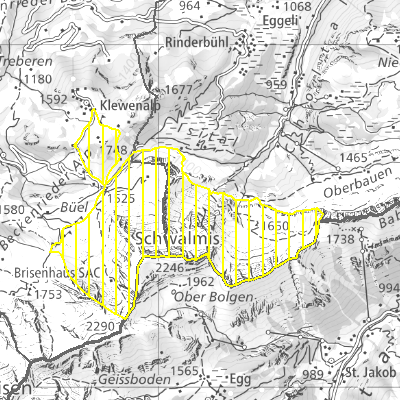
Pflanzenschutzgebiete (NW)
Der Geodatensatz umfasst die Pflanzenschutzgebiete.
Simple
- Date (Creation)
- 2010-01-01
- Date (Revision)
- 2025-02-18
- Identifier
- nw_pflanzenschutzgebiete
- Status
- On going
Owner
- Spatial representation type
- Vector
- Topic category
-
- L Environment
- G Biota
Extent
Extent
- Description
-
Canton of Nidwalden (NW)
N
S
E
W
))

- Maintenance and update frequency
- As needed
- GEMET
-
-
conservation of species
-
grazing
-
biotope
-
flora (biology)
-
forest
-
wildlife habitat
-
plant protection
-
vegetation
-
wood
-
wild plant
-
Resource constraints
- Access constraints
- Other restrictions
- Use constraints
- Other restrictions
- Other constraints
- Die Geodaten sind öffentlich zugänglich (Zugangsberechtigungsstufe A gemäss GeoIV Art. 21).
- Language
- Deutsch
- Character encoding
- UTF8
- Environment description
-
QGIS
- Subtopic Category
- L2 Nature and Landscape Protection
- Basic Geodata
- true
- Basic Geodata ID
-
31-NW.1
- Basic Geodata Legal Level
- Kanton
- Distribution format
-
-
INTERLIS
-
andere Formate auf Anfrage
-
Distributor
Digital transfer options
- OnLine resource
-
Geoshop NW
Datenbezug
Digital transfer options
- OnLine resource
-
Geobasisdatenkatalog
Digital transfer options
- OnLine resource
-
Webkarte Natur und Landschaftsschutz
Landschaftsschutz - regionale Inventare
Identifier
- Code
- 2056
Metadata
- Metadata identifier
- 8AF25ECF-5AEB-4ED9-8ED0-F5DE95008F63
- Language
- Deutsch
- Character encoding
- UTF8
- Language
- Français
- Character encoding
- UTF8
- Language
- English
- Character encoding
- UTF8
- Language
- Italiano
- Character encoding
- UTF8
Custodian
Type of resource
- Resource scope
- Dataset
- Date info (Revision)
- 2026-05-12T10:10:46.000Z
Metadata standard
- Title
-
GM03_2