geocat.ch
Register of Protected Cultural Property
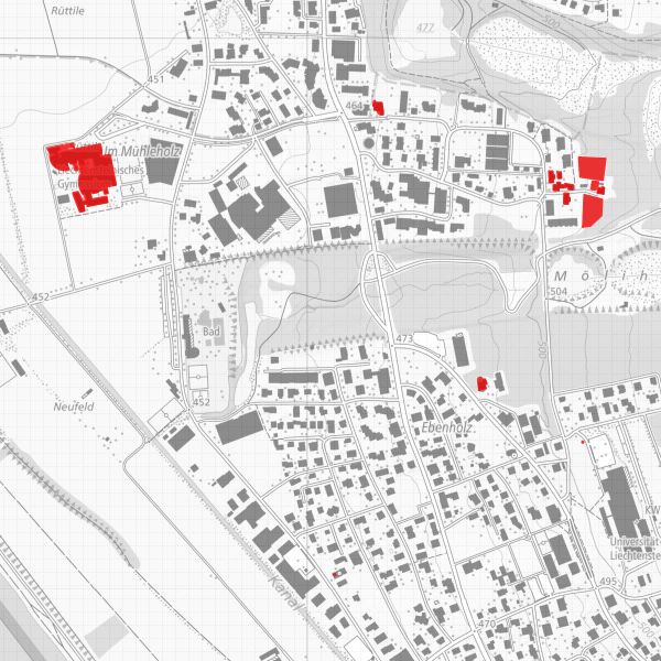
Inventory of Registered and Protected Cultural Property in the Principality of Liechtenstein (Cultural Property Register). The register contains a description of each listed cultural asset, as well as information on its provenance, ownership and usage rights, place of storage or location, and classification.
The Cultural Property Register is publicly accessible insofar as it concerns immovable cultural property. Further information is provided by the Office of Culture, Division of Historic Preservation.
Simple
- Date (Publication)
- 2010-05-19
- Identifier
- https://metadata.geo.llv.li/88c57464-3a56-41c1-b8d4-45b019b62ce2
- Purpose
-
Information for authorities and private individuals
- Status
- On going
Publisher
- Hours of service
-
8:00-11:30 und 13:30-17:00
Owner
- Hours of service
-
8:00-11:30 und 13:30-17:00
- Spatial representation type
- Vector
Spatial resolution
- Spatial resolution
- 0.1 m
- Topic category
-
- M Society
- O Structure
Extent
Extent
- Description
-
Liechtenstein
))

- Maintenance and update frequency
- As needed
Resource format
- Title
-
INTERLIS 1 (ITF)
- Date
- GEMET
-
-
conservation of monuments
-
monument
-
built structure
-
historical monument
-
- GEMET - INSPIRE themes, version 1.0
-
-
Protected sites
-
- Räumlicher Anwendungsbereich
-
-
National
-
- geocat.ch
-
-
OpenData
-
geodata
-
Resource constraints
- Use limitation
-
keine
- Access constraints
- Other restrictions
- Use constraints
- Other restrictions
- Other constraints
- No limitations to public access
Resource constraints
- Access constraints
- Other restrictions
- Use constraints
- Other restrictions
- Other constraints
- No conditions to access and use
- Other constraints
- Opendata BY: Open use. Must provide the source.
- Language
- Deutsch
- Character encoding
- UTF8
- Language
- Deutsch
- Included with dataset
- 0
- Title
-
Datenmodell Denkmalschutz und Archäologische Perimeter
- Date (Creation)
- 2001-12-10
- Distribution format
-
-
INTERLIS 1 (ITF)
-
AutoCAD DXF (DXF)
-
ESRI Shapefile (SHP)
-
Point of contact
- Hours of service
-
8:00-11:30 und 13:30-17:00
Digital transfer options
- OnLine resource
-
Geodatenportal der Liechtensteinischen Landesverwaltung
Geodata portal of the National Administration
Digital transfer options
- OnLine resource
-
Zip Download über das Geodatenportal
Zip download via the geodata portal
- Hierarchy level
- Dataset
Report
Result
- Title
-
VERORDNUNG (EG) Nr. 1089/2010 DER KOMMISSION vom 23. November 2010 zur Durchführung der Richtlinie 2007/2/EG des Europäischen Parlaments und des Rates hinsichtlich der Interoperabilität von Geodatensätzen und -diensten
- Date (Publication)
- 2010-12-08
- Explanation
-
gemäss INSPIRE Bestandteil des Themas Schutzgebiete.
- Pass
- false
- Statement
-
Konstruktion auf der Grundlage der Amtlichen Vermessung
- Hierarchy level
- Dataset
- Topology level
- Full planar graph
- Geometric object type
- Surface
- Geometric object count
- 300
- Reference system identifier
- http://www.opengis.net/def/crs/EPSG/0/2056
- Maintenance and update frequency
- As needed
Metadata
- Metadata identifier
- 88c57464-3a56-41c1-b8d4-45b019b62ce2
- Language
- Deutsch
- Character encoding
- UTF8
- Language
- Français
- Character encoding
- UTF8
- Language
- Italiano
- Character encoding
- UTF8
- Language
- English
- Character encoding
- UTF8
Point of contact
- Hours of service
-
8:00-11:30 und 13:30-17:00
Type of resource
- Resource scope
- Dataset
- Metadata linkage
-
https://www.geocat.ch/geonetwork/srv/api/records/88c57464-3a56-41c1-b8d4-45b019b62ce2
- Date info (Creation)
- 2006-05-09T12:00:00Z
- Date info (Revision)
- 2026-04-13T09:32:38.539498Z
Metadata standard
- Title
-
eCH-0271