 geocat.ch
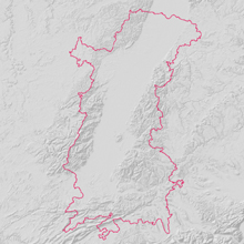
Upper Rhine Perimeter
Upper Rhine Perimeter
Simple
- Alternate title
-
Upper Rhine Perimeter
- Date (Creation)
- 2016-01-01
- Date (Publication)
- 2016-01-01
- Identifier
- ContourCRS_UmrissORK
- Status
- Completed
Point of contact
- mri:deliveryPoint
-
100, avenue d'Alsace
- mri:city
-
COLMAR
- mri:postalCode
-
68000
- Country
-
FRANCE
- Spatial representation type
- Vector
Spatial resolution
Equivalent scale
- Denominator
- 100000
- Topic category
-
- D Boundaries
Extent
Extent
Temporal extent
- Time period
- 2016-01-01 2030-01-01
Extent
Extent
N
S
E
W
))
- Maintenance and update frequency
- Annually
- Keywords
-
-
Open-Data
-
URP
-
- Place
-
-
Upper Rhine
-
- GEMET - INSPIRE themes, version 1.0
-
-
Administrative units
-
Geographical names
-
Statistical units
-
- GEMET - Concepts, version 2.4
-
-
administrative boundary
-
urban community
-
municipality
-
Resource constraints
- Use limitation
-
© + OSM contributors + Add GeoRhena logo in case of reuse
Resource constraints
- Access constraints
- Other restrictions
- Use constraints
- Other restrictions
- Other constraints
-
No other limitation
- Language
- English
- Character encoding
- UTF8
- Distribution format
-
-
SHP GeoData
-
Digital transfer options
- OnLine resource
-
limite_crs
Périmètre de la Conférence du Rhin Supérieur et de la Région Métropolitaine Trinationale du Rhin Supérieur
Digital transfer options
- OnLine resource
-
limite_crs
Périmètre de la Conférence du Rhin Supérieur et de la Région Métropolitaine Trinationale du Rhin Supérieur
Digital transfer options
- OnLine resource
-
Téléchargement du Shapefile Téléchargement du Shapefile
- Statement
-
GeoRhena + OSM contributors - 2020
- Hierarchy level
- Dataset
Metadata
- Metadata identifier
- 7b11840e-f144-4c80-bc76-19155199316c
- Language
- Français
- Character encoding
- UTF8
- Language
- Deutsch
- Character encoding
- UTF8
- Language
- English
- Character encoding
- UTF8
Contact
- mdb:deliveryPoint
-
100, avenue d'Alsace
- mdb:city
-
COLMAR
- mdb:postalCode
-
68000
- mdb:country
-
FR
Type of resource
- Resource scope
- Dataset
- Date info (Revision)
- 2025-06-13T11:39:38.415863Z
Metadata standard
- Title
-
ISO 19115-3:2018
- Edition
-
1.0
)))