geocat.ch
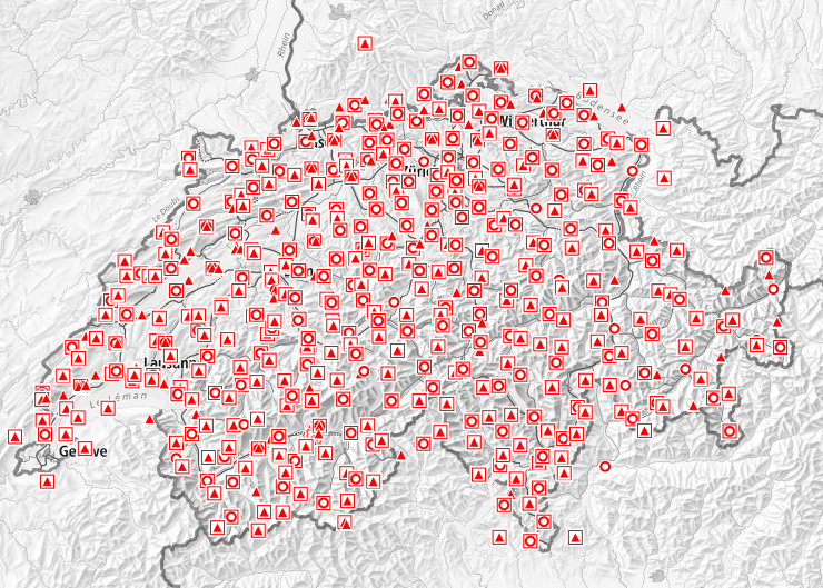
Planimetric control Points LFP1 (National Survey)
All spatial data is based on measurement points. It is recommended to use the so-called fixed control points for all technical works which need reliable and accurate position measurements. A planimetric fixed control point ("Lagefixpunkte" in german) is a surveyed point permanently marked with a stone monument or a bolt (sometimes covered by a manhole) with known coordinates and potentially height. The Swiss national land survey is responsible for the first category of planimetric fixed control points. There are several types of those: * Planimetric fixed points of the first categorie LFP1 provide the reference framework for all survey work in Switzerland. LV03 coordinates from historical fixed control points have been established by triangulation at the beginning of the 20th century. * TSP1 pass points (“Transformationsstützpunkte” in german) are very accurately measured surveying points in both reference frames LV03 and LV95, . * EUREF points are planimetric fixed points from the European GNSS reference network EUREF (European Reference Frame). * LV95 points are planimetric fixed points used as basis for the new reference frame LV95. Their coordinates have been with GNSS precisely measured. Since a planimetric fixed points can be simultaneously from different types, the symbols of this layer can be overlayed.
Simple
- Alternate title
-
Planimetric control points LFP1
- Date (Revision)
- 2007-09-20
- Date (Creation)
- 1860-01-01T00:00:00
- Identifier
- ch.swisstopo.fixpunkte-lfp1
- Status
- On going
Owner
Point of contact
- Spatial representation type
- Vector
- Topic category
-
- B Location
Extent
Extent
- Description
-
Topographic Landscape Model
- Geographic identifier
- TLM
))

- Maintenance and update frequency
- userDefined
- User defined maintenance frequency
-
P12Y0M0DT0H0M0S
- Maintenance note
-
Der Unterhalt der LFP1 / HFP1 unterliegt der periodischen Nachführung (PNF), wobei nach eingegangener Schadenmeldungen die Mängel laufend behoben werden.
- Duration of Conservation
- 275
- Appraisal of Archival Value
- A
- Reason for Archiving Value
- Evidence of business practice
- geocat.ch
-
-
coordinate
-
reference frame
-
national survey
-
Conservation and archiving planning AAP - Confederation
-
official geodata
-
national coordinates
-
opendata.swiss
-
- GEMET
-
-
geodesy
-
- GEMET - INSPIRE themes, version 1.0
-
-
Elevation
-
Coordinate reference systems
-
- geocat.ch
-
-
opendata.swiss
-
- geocat.ch
-
-
FSDI Federal Spatial Data Infrastructure
-
Associated resource
- Title
-
Planimetric control Points LFP1 (National Survey)
- Association Type
- Reference to a master resource of which this one is a part
- Language
- Deutsch
- Character encoding
- UTF8
- Language
- Français
- Character encoding
- UTF8
- Language
- Italiano
- Character encoding
- UTF8
- Basic Geodata
- true
- Basic Geodata ID
-
53.1
- Basic Geodata Legal Level
- Federal
- Basic Geodata Type
- openData referenceGeodata
- Language
- Deutsch
- Language
- Français
- Included with dataset
- 0
- Title
-
Datenmodell 2001 der Amtlichen Vermessung «Bund» (DM.01-AV-CH)
- Date (Publication)
- 2004-06-04
- Other citation details
-
https://www.cadastre-manual.admin.ch/de/datenmodell-der-amtlichen-vermessung-dm01-av-ch
- Distribution format
-
-
nan
-
Digital transfer options
- OnLine resource
-
Vorschau map.geo.admin.ch
Preview map.geo.admin.ch
Digital transfer options
- OnLine resource
-
ch.swisstopo.fixpunkte-lfp1
WMS-FSDI service, layer "Planimetric control points LFP1"
Digital transfer options
Digital transfer options
Digital transfer options
- OnLine resource
-
RESTful API von geo.admin.ch
RESTful API from geo.admin.ch
Digital transfer options
- OnLine resource
-
Download von data/geo.admin.ch
- Geometric object type
- Point
- Geometric object count
- 600
- Geometric object type
- Point
- Geometric object count
- 8500
- Geometric object type
- Point
- Geometric object count
- 210
- Reference system identifier
- CH1903
- Reference system identifier
- CH1903+
- Reference system identifier
- CHTRS95
- Maintenance and update frequency
- Continual
Metadata
- Metadata identifier
- 7a49183b-9766-40dd-936c-fb09fdded185
- Language
- Deutsch
- Character encoding
- UTF8
- Language
- Français
- Character encoding
- UTF8
- Language
- Italiano
- Character encoding
- UTF8
- Language
- English
- Character encoding
- UTF8
- Language
- Rumantsch
- Character encoding
- UTF8
Point of contact
Type of resource
- Resource scope
- Dataset
- Metadata linkage
-
https://www.geocat.ch/geonetwork/srv/api/records/7a49183b-9766-40dd-936c-fb09fdded185
- Date info (Creation)
- 2009-01-28T12:00:00Z
- Date info (Revision)
- 2026-04-13T09:41:30.884668Z
Metadata standard
- Title
-
eCH-0271