 geocat.ch
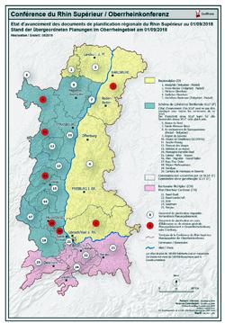
Etat d'avancement des documents de planification régionale PDF / Übergeordneten Planungen PDF - 2018
Carte PDF des Etat d'avancement des documents de planification régionale du Rhin Supérieur au 01/08/2018
PDF Karte der Stand der übergeordneten Planungen im Oberrheingebiet am 01/08/2018
Simple
- Date (Creation)
- 2018-09-27
- Presentation form
- Hardcopy map
- Status
- Obsolete
- Topic category
-
- Q Utilities communication
Extent
Extent
N
S
E
W
))
- Maintenance and update frequency
- Unknown
- Keywords
-
-
avancement;documents;planification régionale;Stand;übergeordneten;Planungen;2018;PDF;carte;Karte
-
- Language
- Français
- Distribution format
-
-
PDF
-
Metadata
- Metadata identifier
- 77a367cd-3704-4178-8bc0-18424c906264
- Language
- Français
- Character encoding
- UTF8
Type of resource
- Resource scope
- staticMap
- Name
-
Dataset
- Date info (Revision)
- 2025-06-18T12:55:02.76323Z
Metadata standard
- Title
-
ISO 19115-3:2018
- Edition
-
1.0
)))