 geocat.ch
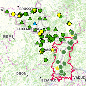
Interactive map of air quality
Interactive map showing the latest air quality data (PM10, PM2.5, nitrogen dioxide and ozone) for the Upper Rhine and Greater Region, aggregated over the year.
Simple
- Date (Publication)
- 2024-12-13T08:33:49
- Presentation form
- Digital map
- Status
- Completed
- Topic category
-
- L Environment
- N Health
Extent
Extent
N
S
E
W
))
- Maintenance and update frequency
- Unknown
- Language
- Français
- Distribution format
-
-
OGC:OWS-C
-
Digital transfer options
- OnLine resource
-
Air quality in the Upper Rhine region
- Reference system identifier
- EPSG:3857
Metadata
- Metadata identifier
- 73fe4de4-42ef-42c3-b633-574c22381c29
- Language
- Français
- Character encoding
- UTF8
- Language
- Deutsch
- Character encoding
- UTF8
- Language
- English
- Character encoding
- UTF8
Type of resource
- Resource scope
- interactiveMap
- Name
-
1.0
- Date info (Revision)
- 2024-12-13T14:27:53.335377Z
Metadata standard
- Title
-
ISO 19115-3:2018
- Edition
-
1.0
)))