geocat.ch
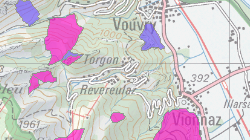
Périmètres de protection des eaux souterraines
Les périmètres de protection des eaux souterraines servent à protéger les eaux souterraines sur une certaine surface, en vue d’une utilisation future (exploitation ou alimentation artificielle). Ils constituent un élément central de la carte de protection des eaux établie et actualisée par les cantons, puis transmise à l’OFEV.
Simple
- Alternate title
-
Carte de protection des eaux (Périmètres)
- Date (Creation)
- 2012-11-11
- Date (Revision)
- 2025-08-29
- Identifier
- 92
- Purpose
-
Jeux de géodonnées de droit fédéral N° 132
- Status
- On going
Custodian
- Spatial representation type
- Vector
Spatial resolution
Equivalent scale
- Denominator
- 25000
- Topic category
-
- L Environment
Extent
Extent
- Description
-
Canton of Valais (VS)
))

- Maintenance and update frequency
- Quarterly
- Maintenance note
-
Les géodonnées relatives aux périmètres de protection des eaux souterraines sont mises à jour et intégrées à la base de données hydrogéologiques cantonale gérée par la section Protection des eaux du SPE, suite à la délimitation de nouveaux périmètres, à la modification ou suppression de périmètre existants et à l'approbation de périmètres provisoires.
Resource format
- Title
-
ESRI Enterprise Geodatabase
- Date
- GEMET
-
-
geology
-
resources
-
subsoil
-
water resources management
-
groundwater
-
land management and planning
-
exploitation of underground water
-
hydrogeology
-
- geocat.ch
-
-
groundwater protection area
-
zonal use plan
-
opendata.swiss
-
lithology
-
official geodata
-
Resource constraints
- Use limitation
-
Aucune
Resource constraints
- Access constraints
- Other restrictions
- Other constraints
-
Géodonnées accessibles au public (niveau A selon l'OGéo)
- Other constraints
-
Les conditions générales d'utilisation des géodonnées du Canton du Valais font foi ( https://www.vs.ch/fr/web/guest/information-legale).
Associated resource
- Association Type
- Reference from one resource to another
- Metadata Reference
- Language
- Français
- Character encoding
- UTF8
- Language
- Deutsch
- Character encoding
- UTF8
- Environment description
-
S:\Géodonnées VS\L2 Protection de la nature\Périmètres de protection des eaux souterraines.lyr
- Subtopic Category
- L2 Nature and Landscape Protection
- Basic Geodata
- true
- Basic Geodata ID
-
132>A.1
- Basic Geodata Legal Level
- Communal
- Basic Geodata Type
- basicGeodata oerebRegister openGovernmentData
- Included with dataset
- 0
- Title
-
Aide à l'Exécution 4 - Annexe A: Modèle sémantique (Catalogue des objets)
- Date (Creation)
- 2023-08-23
- Distribution format
-
-
ESRI Shapefile (SHP)
-
OGC Web Map Service (WMS)
-
ArcGIS REST Feature Service
-
Distributor
Digital transfer options
- OnLine resource
-
Géoportail du Canton du Valais
Géoportail du Canton du Valais
Digital transfer options
- OnLine resource
-
geodienste.ch le portail intercantonal
Téléchargement de géodonnées conformes au modèle minimal (divers formats)
Digital transfer options
- OnLine resource
-
Landing Page
Landing Page pour opendata
Digital transfer options
- OnLine resource
-
OpenData
Permalink opendata.swiss
Digital transfer options
- OnLine resource
-
32
ESOUTERR_Perimetre_de_protection
Digital transfer options
- OnLine resource
-
eaux_souterrainesSPE
Cartes des eaux souterraines
- Statement
-
Géodonnées surfaciques provenant d'études hydrogéologiques
- Hierarchy level
- Dataset
- Description
-
Digitalisation ou vectorisation.Précision planimétique : 10 à 25 m selon le plan d'origine voire <1 m pour les zones modélisées. Précision altimétrie 5 m. Echelle de saisie: Fonction du substrat géologique et du degré d'hétérogénéité. Généralement 1:10'000
Equivalent scale
- Denominator
- 10000
- Geometric object type
- Surface
- Geometric object count
- 71
- Reference system identifier
- EPSG:2056/CH1903+_MN95
- Title
-
Annexe 3: b. « Zones, périmètres et secteurs Ao de protection »
- Date (Publication)
- 2025-03-31
Metadata
- Metadata identifier
- 70e3d319-3b88-4518-8bc8-4abb8524fcdb
- Language
- Français
- Character encoding
- UTF8
- Language
- Deutsch
- Character encoding
- UTF8
- Language
- Italiano
- Character encoding
- UTF8
- Language
- English
- Character encoding
- UTF8
- Language
- Rumantsch
- Character encoding
- UTF8
Distributor
Type of resource
- Resource scope
- Dataset
- Metadata linkage
-
https://www.geocat.ch/geonetwork/srv/api/records/70e3d319-3b88-4518-8bc8-4abb8524fcdb
- Date info (Creation)
- 2016-11-14T12:25:55Z
- Date info (Revision)
- 2026-05-06T14:11:17.297577Z
Metadata standard
- Title
-
eCH-0271