geocat.ch
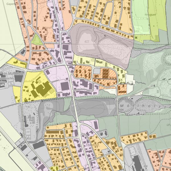
INSPIRE Planned Land Use
INSPIRE compliant dataset planned land use derived form landUse plans of the cummunities
Simple
- Alternate title
-
INSPIRE dataset planned land use
- Date (Creation)
- 2019-04-01T00:00:00
- Identifier
- https://metadata.geo.llv.li/6e0267a6-6160-49f6-9e2c-48a9a24b84c8
- Purpose
-
INSPIRE Implementation
- Status
- On going
Point of contact
- Hours of service
-
8:00-11:30 und 13:30-17:00
- Spatial representation type
- Vector
Spatial resolution
Equivalent scale
- Denominator
- 500
- Topic category
-
- A Imagery base maps earth cover
Extent
Extent
- Description
-
Liechtenstein
))

- Maintenance and update frequency
- As needed
- GEMET
-
-
soil use
-
vector
-
- geocat.ch
-
-
INSPIRE
-
- GEMET - INSPIRE themes, version 1.0
-
-
Land use
-
- GEMET themes
-
-
forestry
-
agriculture
-
building
-
administration
-
tourism
-
- Räumlicher Anwendungsbereich
-
-
National
-
Resource constraints
- Access constraints
- Other restrictions
- Other constraints
- no limitations to public access
- Country
- LI
- Legislation Type
- Ordinance
- Legislation Level
- national
- Title
-
Verordnung vom 30. August 2011 über die Gebühren für die Nutzung der Geodateninfrastruktur Liechtenstein
- Date (Creation)
- 2011-08-30
Resource constraints
- Use limitation
-
Zugangs- und Nutzungsbedingungen
- Use constraints
- Other restrictions
- Other constraints
-
charges apply
- Language
- Deutsch
- Character encoding
- UTF8
- Subtopic Category
- A2 Land Cover, Land Use
- Distribution format
-
-
Geographic Markup Language (GML)
-
ESRI Shapefile (SHP)
-
Point of contact
- Hours of service
-
8:00-11:30 und 13:30-17:00
Digital transfer options
- OnLine resource
-
Geodatenportal der Liechtensteinische Landesverwaltung
Geoportal
Digital transfer options
- OnLine resource
-
Homepage ATG, Datenausgabestelle
Data distribution office of the national administration
Digital transfer options
- OnLine resource
-
LU
INSPIRE View Service
Digital transfer options
- OnLine resource
-
INSPIRE Download Service (ATOM)
GML Download
- Hierarchy level
- Dataset
- Other
-
Alle Ebenen
Report
Result
- Title
-
COMMISSION REGULATION (EU) No 1089/2010 of 23 November 2010 implementing Directive 2007/2/EC of the European Parliament and of the Council as regards interoperability of spatial data sets and services
- Date (Publication)
- 2010-12-08
- Explanation
-
nicht geprüft
- Pass
- false
Result
- Title
-
D2.8.II.2 INSPIRE Data Specification on Land Cover – Technical Guidelines
- Date (Creation)
- 2013-12-10
- Explanation
-
konform
- Pass
- true
- Statement
-
dataset was tranformed from national standard to a INSPIRE compliant dataset
- Hierarchy level
- Dataset
- Other
-
Alle Ebenen
- Source
-
- Zonenplan der Gemeinde Balzers
- Zonenplan der Gemeinde Triesen
- Zonenplan der Gemeinde Eschen
- Zonenplan der Gemeinde Mauren
- Zonenplan der Gemeinde Vaduz
- Zonenplan der Gemeinde Schaan
- Zonenplan der Gemeinde Planken
- Zonenplan der Gemeinde Gamprin
- Zonenplan der Gemeinde Ruggell
- Zonenplan der Gemeinde Schellenberg
- Zonenpläne der Gemeinde Triesenberg
- Topology level
- Full planar graph
- Geometric object type
- Surface
- Geometric object count
- 100
- Reference system identifier
- http://www.opengis.net/def/crs/EPSG/0/21782
- Reference system identifier
- http://www.opengis.net/def/crs/EPSG/0/4258
- Maintenance and update frequency
- As needed
Metadata
- Metadata identifier
- 6e0267a6-6160-49f6-9e2c-48a9a24b84c8
- Language
- Deutsch
- Character encoding
- UTF8
- Language
- Français
- Character encoding
- UTF8
- Language
- Italiano
- Character encoding
- UTF8
- Language
- English
- Character encoding
- UTF8
- Language
- Rumantsch
- Character encoding
- UTF8
Point of contact
- Hours of service
-
8:00-11:30 und 13:30-17:00
Type of resource
- Resource scope
- Dataset
- Metadata linkage
-
https://www.geocat.ch/geonetwork/srv/api/records/6e0267a6-6160-49f6-9e2c-48a9a24b84c8
- Date info (Creation)
- 2019-05-16T06:20:46Z
- Date info (Revision)
- 2026-04-13T09:48:09.644978Z
Metadata standard
- Title
-
eCH-0271