geocat.ch
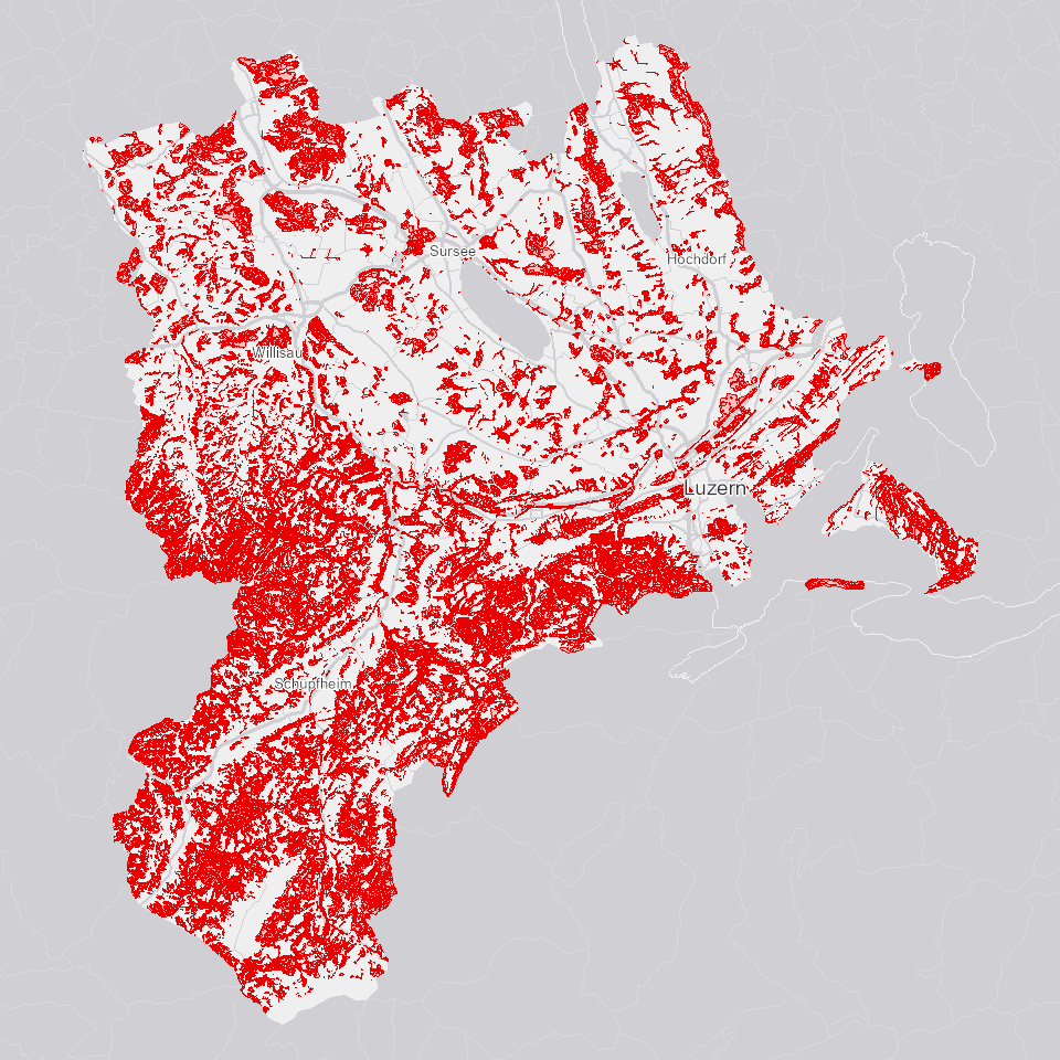
Standortstypen Wald
Standortstypen (Potenzial): Pflanzensoziologische Kartierung. Standorttypen werden durch floristische, standörtliche und strukturelle Merkmale charakterisiert, basiernd auf Standard NaiS-LFI.
Simple
Identification info
- Alternate title
-
STAOTYWA_DS
- Date (Creation)
- 2022-02-18
- Presentation form
- Digital map
- Purpose
-
Zeigt die Standortstypen Wald im Kt. Luzern (Pflanzensoziologie) gemäss dem Standard NaiS-LFI 2021.In der traditionellen Pflanzensoziologie werden die Pflanzengesellschaften rein floristisch definiert. Insbesondere im naturnahen Waldbau genügen diese Definitionen nicht. Deshalb wurde im Rahmen des NaiS-Projekts (NaiS für «Nachhaltigkeit im Schutzwald») das System Standortstypen entwickelt, das floristische, standörtliche und waldbauliche Merkmale verwendet. Mit dem System der NaiS-Standorttypen wurde ein in der ganzen Schweiz anwendbares, praxisorientiertes Hilfsmittel geschaffen, mit dem sich die vielfältigen Wälder des Landes standörtlich und waldbaubezogen beschreiben lassen.Auf Initiative des Bundesamts für Umwelt wurden im Projekt «NaiS-LFI: Zuordnung der LFI-Stichprobenpunkte zu Waldgesellschaften» von 2014 bis 2019 alle 6357 Probeflächen des vierten Landesforstinventars (LFI) einem aktualisierten NaiS-Standorttyp (Nachhaltigkeit und Erfolgskontrolle im Schutzwald) zugeordnet.
- Status
- On going
Point of contact
Responsible party
- Organisation name
-
Kanton Luzern, Abteilung Geoinformation
- Voice
-
041 228 51 83
Address
- City
-
Luzern
- Postal code
-
6002
- Country
-
CH
- Electronic mail address
- Streetname
-
Murbacherstrasse
- Streetnumber
-
21
- Website
- https://geoportal.lu.ch/ ( https )
- Role
- Publisher
Point of contact
Responsible party
- Organisation name
-
Dienststelle Landwirtschaft und Wald (lawa)
- Voice
-
041 349 74 00
Address
- City
-
Sursee
- Postal code
-
6210
- Country
-
CH
- Electronic mail address
- Streetname
-
Centralstrasse
- Streetnumber
-
33
- Role
- Owner
- Last Name
-
Dienststelle Landwirtschaft und Wald (lawa)
- Organisation Acronym
-
lawa
- Maintenance and update frequency
- As needed
-
geocat.ch
-
-
opendata.swiss
-
Biodiversität
-
Forstwirtschaft
-
Vegetation
-
Wald
-
- Access constraints
- none
- Use constraints
- Copyright
- Use limitation
-
öffentlich zugängliche Geobasisdaten
- Access constraints
- none
- Use constraints
- none
- Use limitation
-
Freie Nutzung. Quellenangabe ist Pflicht
- Aggregate Datasetindentifier
- 1fdc46fe-88d5-4db1-a971-3ecf1a4254b0
- Association Type
- Larger work citation
- Aggregate Datasetindentifier
- a0610b38-3a85-4f3a-a423-88d10b97e197
- Association Type
- Larger work citation
- Aggregate Datasetindentifier
- 9003e085-bf63-4544-9274-0a0c11b5fbc2
- Association Type
- Larger work citation
- Spatial representation type
- Vector
- Language
- Deutsch
- Character set
- UTF8
- Topic category
-
- G Forest, Flora, Fauna
- Description
-
Kanton Luzern
))
- Distribution format
-
-
ESRI Geodatabase (.gdb)
(
)
-
ESRI Shapefile (.shp)
(
)
-
OGC GeoPackage (.gpkg)
(
)
-
ESRI Geodatabase (.gdb)
(
)
Distributor contact
Responsible party
- Organisation name
-
Dienststelle Raum und Wirtschaft (rawi)
- Voice
-
041 228 51 83
Address
- City
-
Luzern
- Postal code
-
6002
- Country
-
CH
- Electronic mail address
- Streetname
-
Murbacherstrasse
- Streetnumber
-
21
- Website
- https://geoportal.lu.ch ( https )
- Role
- Point of contact
- First Name
-
Geodaten
- Last Name
-
Kanton Luzern
- Organisation Acronym
-
rawi
- OnLine resource
-
Datenshop
(
https
)
Produktansicht Geodatenshop
- Hierarchy level
- Dataset
- Statement
-
unbekannt
- Geometric object type
- polygon
- Reference system identifier
- CH1903+
Content Information
- Metadata language
-
ger
- Included with dataset
- Date (Publication)
- 2021-12-09
Class
- Name
-
Flächen
Attribute
- Name
-
OBJECTID
- Description
-
OBJECTID
Attribute
- Name
-
FARBE
- Description
-
Farbe
Attribute
- Name
-
HS
- Description
-
Hoehenstufe
Attribute
- Name
-
NAIS1
- Description
-
NaiS
Attribute
- Name
-
NAIS2
- Description
-
NaiS Uebergang
Attribute
- Name
-
PLOTTXT
- Description
-
Bezeichnung
Attribute
- Name
-
PRIO
- Description
-
Prioritaet
Attribute
- Name
-
STO1
- Description
-
Hauptgesellschaft_cod
Attribute
- Name
-
STO1_TXT
- Description
-
Hauptgesellschaft
Attribute
- Name
-
STO2
- Description
-
Spezifikation_cod
Attribute
- Name
-
STO2_TXT
- Description
-
Spezifikation
Attribute
- Name
-
STO3
- Description
-
Subklasse_cod
Attribute
- Name
-
STO3_TXT
- Description
-
Subklasse
Attribute
- Name
-
STO4
- Description
-
Unterteilung_cod
Attribute
- Name
-
STO4_TXT
- Description
-
Unterteilung
Attribute
- Name
-
STO5
- Description
-
Unterteilung_2_cod
Attribute
- Name
-
STO5_TXT
- Description
-
Unterteilung_2
Attribute
- Name
-
TYP
- Description
-
Gesellschaftstyp
Attribute
- Name
-
VERDRISK
- Description
-
Verdichtungsrisiko
Attribute
- Name
-
SHAPE
- Description
-
Shape
Attribute
- Name
-
SHAPE.AREA
- Description
-
SHAPE.AREA
Attribute
- Name
-
SHAPE.LEN
- Description
-
SHAPE.LEN
- Model type
- Feature description
Metadata
- Metadata language
- Deutsch
- Character set
- UTF8
- Hierarchy level
- Dataset
- Date stamp
- 2025-09-03
- Metadata standard name
-
GM03 2+
Metadata author
Responsible party
- Organisation name
-
Dienststelle Raum und Wirtschaft (rawi)
- Voice
-
041 228 51 83
Address
- City
-
Luzern
- Postal code
-
6002
- Country
-
CH
- Electronic mail address
- Streetname
-
Murbacherstrasse
- Streetnumber
-
21
- Website
- https://geoportal.lu.ch ( https )
- Role
- Point of contact
- First Name
-
PhulbaDoma
- Last Name
-
Lama
- Organisation Acronym
-
rawi
- Maintenance and update frequency
- Not planned