geocat.ch
Wassermessstellen
Wassermessstellen: Seewasserstand, Abfluss-, Grundwasser- u. Quellwassermessstellen
Simple
Informazioni di identificazione
- Titolo alternativo
-
WASMESST_DS
- Data (Creazione)
- 2020-12-31
- Formato di presentazione
- Mappa digitale
- Finalità
-
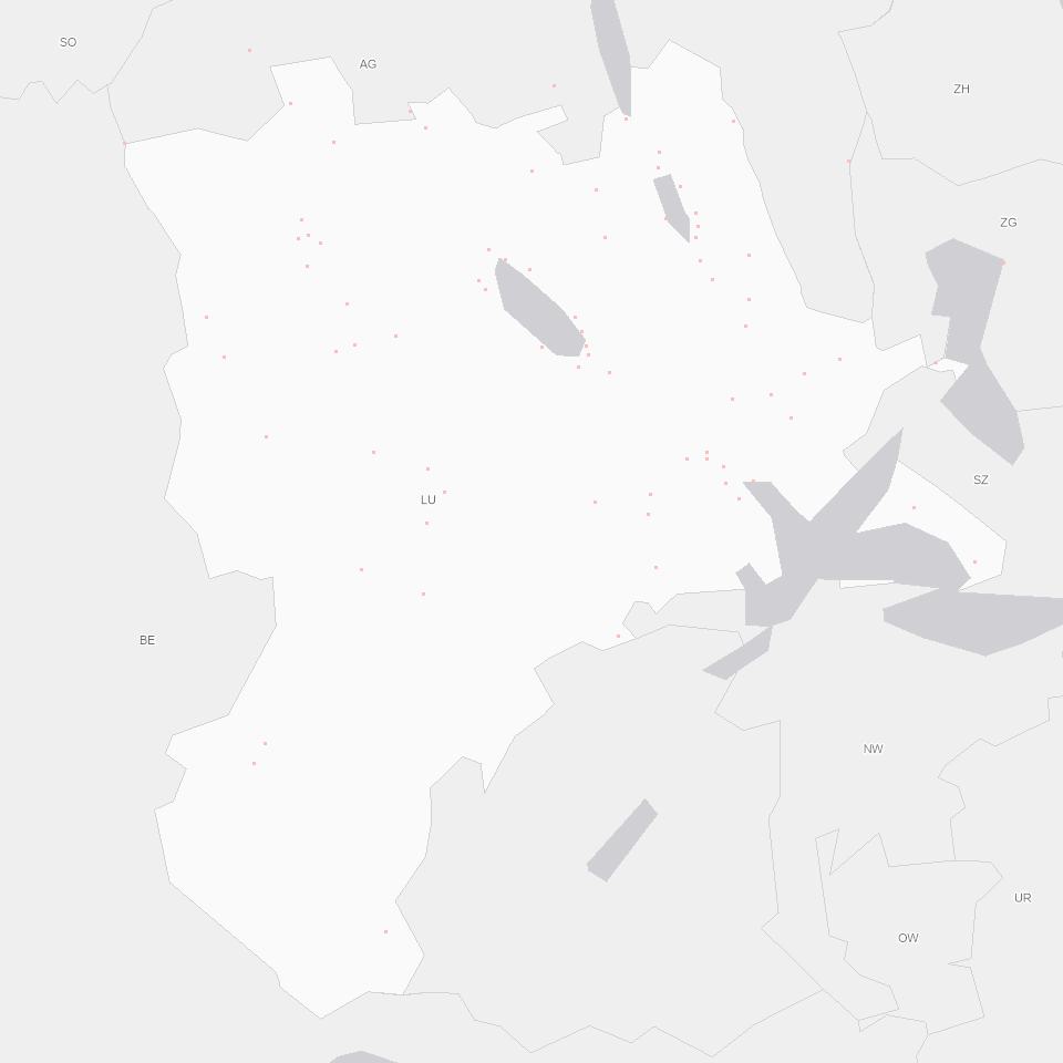
Wasserstand und Abfluss von Fliessgewässern An 14 Stellen im Kanton Luzern werden der Wasserstand und der Abfluss von Fliessgewässern erfasst.Die Datenaufzeichnung geht teilweise bis ins Jahr 1970 zurück. Die grösseren Fliessgewässer und Seepegel werden zusätzlich vom BAFU gemessen. Weitere für den Kanton Luzern relevante Abflussdaten werden in den Nachbarkantonen Aargau und Zug erhoben. Grundwasserstände An rund 40 Stellen im Kanton werden Grundwasserstand und Quellschüttungen gemessen. Die Datenaufzeichnung geht teilweise bis ins Jahr 1970 zurück. Niederschlagsmengen an rund 20 Stationen im Kanton Luzern und dessen Umgebung erfasst MeteoSchweiz.NiederschlagsdatenAn weiteren 10 Stationen tut dies auch der Kanton Luzern (seit 2003). Das Niederschlagsmessnetz wird zusammen mit dem Kanton Aargau betrieben.
- Status
- In corso
Punto di contatto
Servizio responsabile
- Nome dell'ente
-
Kanton Luzern, Abteilung Geoinformation
- Telefono
-
041 228 51 83
Indirizzo
- Risorsa online
- https://geoportal.lu.ch/ ( https )
- Ruolo
- Publisher
Punto di contatto
Servizio responsabile
- Nome dell'ente
-
Dienststelle Umwelt und Energie (uwe)
- Telefono
-
041 228 60 60
Indirizzo
- Risorsa online
- https://uwe.lu.ch/ ( https )
- Ruolo
- Owner
- Cognome
-
Dienststelle Umwelt und Energie (uwe)
- Abbreviazione dell'organizzazione
-
uwe
- Frequenza di aggiornamento
- Secondo necessità
-
geocat.ch
-
-
opendata.swiss
-
Fliessgewässer
-
Grundwasser
-
Hydrologie
-
Oberflächengewässer
-
See
-
Statistik
-
Umweltbeobachtung
-
- Vincoli di accesso
- none
- Vincoli di fruibilità
- Proprietà intellettuale dei dati
- Limitazione d’uso
-
öffentlich zugängliche Geobasisdaten
- Vincoli di accesso
- none
- Vincoli di fruibilità
- none
- Limitazione d’uso
-
Freie Nutzung. Quellenangabe ist Pflicht
- Identificatore aggregato del dataset
- cc5745db-bca9-4fd4-8bd9-c9148aa21e45
- Tipo di associazione
- Larger work citation
- Identificatore aggregato del dataset
- 0437c911-9018-4200-bb7c-49e340151922
- Tipo di associazione
- Larger work citation
- Identificatore aggregato del dataset
- 6cab09b0-d50b-45fd-a28b-46ad17077791
- Tipo di associazione
- Larger work citation
- Identificatore aggregato del dataset
- 6248a316-e53e-423d-96be-bad56073d3c1
- Tipo di associazione
- Larger work citation
- Identificatore aggregato del dataset
- 5398bfa1-93c8-48df-bcaa-01ea882fda9f
- Tipo di associazione
- Larger work citation
- Identificatore aggregato del dataset
- d0036624-4736-4f67-b33d-c2b30ced0aff
- Tipo di associazione
- Larger work citation
- Identificatore aggregato del dataset
- dce1bb54-d811-4733-81d9-c68d67d3e4a7
- Tipo di associazione
- Larger work citation
- Identificatore aggregato del dataset
- 44a6844e-8d5b-42e3-84e7-b2e0b00c3c28
- Tipo di associazione
- Larger work citation
- Tipo di rappresentazione spaziale
- Dati vettoriali
- Denominatore
- 25000
- Lingua dei metadati
- Deutsch
- Set dei caratteri dei metadati
- UTF8
- Tema
-
- O Edifici, infrastrutture, costruzioni
- Descrizione
-
Kanton Luzern
))
- Formato di distribuzione
-
-
ESRI Geodatabase (.gdb)
(
)
-
ESRI Shapefile (.shp)
(
)
-
OGC GeoPackage (.gpkg)
(
)
-
ESRI Geodatabase (.gdb)
(
)
Distributore
Servizio responsabile
- Nome dell'ente
-
Dienststelle Raum und Wirtschaft (rawi)
- Telefono
-
041 228 51 83
Indirizzo
- Risorsa online
- https://geoportal.lu.ch ( https )
- Ruolo
- Point of contact
- Nome
-
Geodaten
- Cognome
-
Kanton Luzern
- Abbreviazione dell'organizzazione
-
rawi
- Risorsa online
-
Datenshop
(
https
)
Produktansicht Geodatenshop
- Livello
- Set di dati
- Genealogia del dato – Processo di produzione
-
Grundlagen: Landeskarte 1:25'000 (LK25)
- Oggetto di tipo geometrico
- Punto
- Identificatore del sistema di riferimento
- CH1903+
Informazioni sul contenuto
- Lingua dei metadati
-
ger
- Included with dataset
- Data (Pubblicazione)
- 2017-06-19
Classe
- Designazione
-
Punkte
- Descrizione
-
Wassermessstellen
Attributo
- Nome
-
CODE_UWE
- Descrizione
-
Code gemäss Tabelle
(nur für Messstellen Kanton)
Attributo
- Nome
-
CODE_BUWAL
- Descrizione
-
Code gemäss Tabelle
(nur für Messstellen Bund)
Attributo
- Nome
-
BESCHRIFTU
- Descrizione
-
Beschriftung für Karte (entspricht
Code_uwe, resp. Code_buwal)
Attributo
- Nome
-
ART
- Descrizione
-
Art der Messungen
Attributo
- Nome
-
K_WERT
- Descrizione
-
Höhe des k-Werts an der Messstelle
Attributo
- Nome
-
EBENE
- Descrizione
-
Kanton, Bund
Attributo
- Nome
-
MESSSTELLE
- Descrizione
-
Kurzbeschreibung Standort
Attributo
- Nome
-
GEMEINDE
- Descrizione
-
Gemeindename
Attributo
- Nome
-
WINKEL
- Descrizione
-
Winkel zur Symboldarstellung
- Genere del modello
- Descrizione di oggetto
Metadata
- Lingua dei metadati
- Deutsch
- Set dei caratteri dei metadati
- UTF8
- Livello gerarchico
- Set di dati
- Data dei metadati
- 2025-09-03
- Nome dello Standard dei metadati
-
GM03 2+
Contatto
Servizio responsabile
- Nome dell'ente
-
Dienststelle Raum und Wirtschaft (rawi)
- Telefono
-
041 228 51 83
Indirizzo
- Risorsa online
- https://geoportal.lu.ch ( https )
- Ruolo
- Point of contact
- Nome
-
Marius
- Cognome
-
Menz
- Abbreviazione dell'organizzazione
-
rawi
- Frequenza di aggiornamento
- Non pianificato