geocat.ch
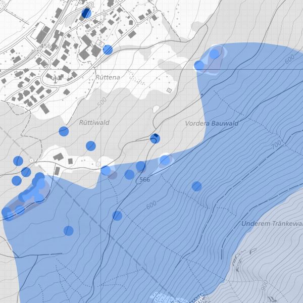
Wasserschutzzonen und Grundwasserschutzgebiete des planerischen Gewässerschutzes
Wasserschutzzonen und Grundwasserschutzgebiete gemäss Gewässerschutzgesetz (LGBl. 2003 Nr. 159). In Gewässerschutzzonen und Grundwasserschutzgebiet gelten besondere Vorschriften für die landwirtschaftliche und bauliche Nutzung. Wasserschutzzonen sind unterteilt in Fassungsbereich S1, engere Schutzzone S2, weiter Schutzzone S3, Schutzareal und Zustroembereich.
Semplice
- Altri nomi o acronimi
-
Planerischer Gewässerschutz, Wasserschutzzonen und Grundwasserschutzgebiete
- Data (Pubblicazione)
- 2006-03-17
- Identificatore
- https://metadata.geo.llv.li/6b6ffa6b-8c8c-4a6a-988b-0bd8e102f12f
- Scopo
-
Gewässerschutz, Umweltschutz
- Stato
- Completato
Editore
- Orario di servizio
-
8:00-11:30 und 13:30-17:00
Proprietario
- Orario di servizio
-
8:00-11:30 und 13:30-17:00
- Tipo di rappresentazione spaziale
- Vettoriale
- Categoria ISO
-
- I Acque interne
Estensione
Estensione
- Descrizione
-
Liechtenstein
))

- Frequenza di aggiornamento
- Secondo necessità
- GEMET
-
-
conservazione delle acque
-
acque (geografia)
-
- GEMET - INSPIRE themes, version 1.0
-
-
Siti protetti
-
- geocat.ch
-
-
settore di protezione delle acque
-
OpenData
-
INSPIRE
-
- Räumlicher Anwendungsbereich
-
-
Nazionali
-
Vincoli sulle risorse
- Limitazione d'uso
-
keine
- Vincoli di accesso
- Altre restrizioni
- Vincoli d'uso
- Altre restrizioni
- Altri vincoli
- No limitations to public access
Vincoli sulle risorse
- Vincoli di accesso
- Altre restrizioni
- Vincoli d'uso
- Altre restrizioni
- Altri vincoli
- No conditions to access and use
- Lingua
- Deutsch
- Codifica dei caratteri
- UTF8
- Fornito con set di dati
- 0
- Titolo
-
Datenmodell Planerischer Gewässerschutz Version 1
- Data (Creazione)
- 2007-07-03
- Formato (codifica)
-
-
INTERLIS 1 (ITF)
-
ESRI Shapefile (SHP)
-
AutoCAD DXF (DXF)
-
Punto di contatto
- Orario di servizio
-
8:00-11:30 und 13:30-17:00
Opzioni di trasferimento digitale
- Risorsa online
-
Geodatenportal
Geodatenportal der Liechtensteinischen Landesverwaltung
Opzioni di trasferimento digitale
- Risorsa online
-
OGC WMS Service der Liechtensteinen Landesverwaltung
OGC WMS Service der Liechtensteinen Landesverwaltung
Opzioni di trasferimento digitale
- Risorsa online
-
Zip Download über das Geodatenportal
Zip Download über das Geodatenportal
Opzioni di trasferimento digitale
- Risorsa online
-
li.au.pg_schutzzone
OGC-WMS Service der Liechtensteinischen Landesverwaltung
- Livello
- Set di dati
Rapporto sulla qualità
Risultato
- Titolo
-
VERORDNUNG (EG) Nr. 1089/2010 DER KOMMISSION vom 23. November 2010 zur Durchführung der Richtlinie 2007/2/EG des Europäischen Parlaments und des Rates hinsichtlich der Interoperabilität von Geodatensätzen und -diensten
- Data (Pubblicazione)
- 2010-12-08
- Spiegazione
-
Gemäss INSPIRE Bestandteil der Themen "Gewässernetz" sowie "Versorgungswirtschaft und staatliche Dienste" sowie "Bewirtschaftungsgebiete/Schutzgebiete/geregelte Gebiete und Berichterstattungseinheiten"
- Grado di conformità
- false
- Informazioni generali sulla provenienza
-
Konstruktion auf der Grundlage der Amtlichen Vermessung
- Livello
- Set di dati
- Livello di topologia
- Grafo planare completo
- Tipo di oggetto geometrico
- Superficie
- Numero di oggetti geometrici
- 20
- Nome del sistema di riferimento
- http://www.opengis.net/def/crs/EPSG/0/2056
- Nome del sistema di riferimento
- http://www.opengis.net/def/crs/EPSG/0/4936
- Frequenza di aggiornamento
- Secondo necessità
Metadati
- Identificativo della scheda
- 6b6ffa6b-8c8c-4a6a-988b-0bd8e102f12f
- Lingua
- Deutsch
- Codifica dei caratteri
- UTF8
- Lingua
- Français
- Codifica dei caratteri
- UTF8
- Lingua
- Italiano
- Codifica dei caratteri
- UTF8
- Lingua
- English
- Codifica dei caratteri
- UTF8
Punto di contatto
- Orario di servizio
-
8:00-11:30 und 13:30-17:00
Tipo di risorsa
- Ambito di applicazione della risorsa
- Set di dati
- Collegamento ai metadati
-
https://www.geocat.ch/geonetwork/srv/api/records/6b6ffa6b-8c8c-4a6a-988b-0bd8e102f12f
- Informazioni sulla data (Creazione)
- 2006-05-18T12:00:00Z
- Informazioni sulla data (Revisione)
- 2026-04-13T09:15:57.036223Z
Standard dei metadati
- Titolo
-
eCH-0271