geocat.ch
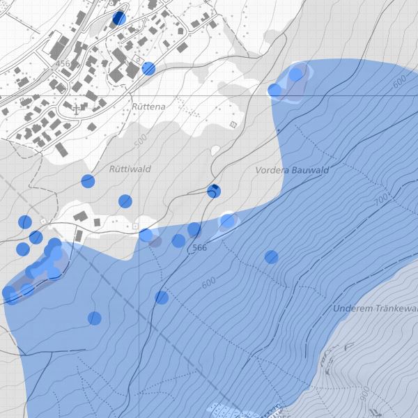
Water protection zones and groundwater protection areas for water protection planning
Water protection zones and groundwater protection areas in accordance with the Water Protection Act (LGBl. 2003 No. 159). Special regulations for agricultural and constructional use apply in water protection zones and groundwater protection areas. Water protection zones are divided into catchment area S1, narrower protection zone S2, wider protection zone S3, protection area and tributary area.
Simple
- Alternate title
-
Planned water protection, water protection zones and groundwater protection areas
- Date (Publication)
- 2006-03-17
- Identifier
- https://metadata.geo.llv.li/6b6ffa6b-8c8c-4a6a-988b-0bd8e102f12f
- Purpose
-
Water protection, environmental protection
- Status
- Completed
Publisher
- Hours of service
-
8:00-11:30 und 13:30-17:00
Owner
- Hours of service
-
8:00-11:30 und 13:30-17:00
- Spatial representation type
- Vector
- Topic category
-
- I Inland waters
Extent
Extent
- Description
-
Liechtenstein
))

- Maintenance and update frequency
- As needed
- GEMET
-
-
water conservation
-
water (geographic)
-
- GEMET - INSPIRE themes, version 1.0
-
-
Protected sites
-
- geocat.ch
-
-
water protection sector
-
OpenData
-
INSPIRE
-
- Räumlicher Anwendungsbereich
-
-
National
-
Resource constraints
- Use limitation
-
keine
- Access constraints
- Other restrictions
- Use constraints
- Other restrictions
- Other constraints
- No limitations to public access
Resource constraints
- Access constraints
- Other restrictions
- Use constraints
- Other restrictions
- Other constraints
- No conditions to access and use
- Other constraints
- Opendata BY: Open use. Must provide the source.
- Language
- Deutsch
- Character encoding
- UTF8
- Included with dataset
- 0
- Title
-
Datenmodell Planerischer Gewässerschutz Version 1
- Date (Creation)
- 2007-07-03
- Distribution format
-
-
INTERLIS 1 (ITF)
-
ESRI Shapefile (SHP)
-
AutoCAD DXF (DXF)
-
Point of contact
- Hours of service
-
8:00-11:30 und 13:30-17:00
Digital transfer options
- OnLine resource
-
Geodatenportal
Geodata Portal of the National Administration
Digital transfer options
- OnLine resource
-
OGC WMS Service der Liechtensteinen Landesverwaltung
OGC-WMS Service of the National Administration
Digital transfer options
- OnLine resource
-
Zip Download über das Geodatenportal
Zip download via the geodata portal
Digital transfer options
- OnLine resource
-
li.au.pg_schutzzone
OGC-WMS Service of the National Administration
- Hierarchy level
- Dataset
Report
Result
- Title
-
VERORDNUNG (EG) Nr. 1089/2010 DER KOMMISSION vom 23. November 2010 zur Durchführung der Richtlinie 2007/2/EG des Europäischen Parlaments und des Rates hinsichtlich der Interoperabilität von Geodatensätzen und -diensten
- Date (Publication)
- 2010-12-08
- Explanation
-
Gemäss INSPIRE Bestandteil der Themen "Gewässernetz" sowie "Versorgungswirtschaft und staatliche Dienste" sowie "Bewirtschaftungsgebiete/Schutzgebiete/geregelte Gebiete und Berichterstattungseinheiten"
- Pass
- false
- Statement
-
Konstruktion auf der Grundlage der Amtlichen Vermessung
- Hierarchy level
- Dataset
- Topology level
- Full planar graph
- Geometric object type
- Surface
- Geometric object count
- 20
- Reference system identifier
- http://www.opengis.net/def/crs/EPSG/0/2056
- Reference system identifier
- http://www.opengis.net/def/crs/EPSG/0/4936
- Maintenance and update frequency
- As needed
Metadata
- Metadata identifier
- 6b6ffa6b-8c8c-4a6a-988b-0bd8e102f12f
- Language
- Deutsch
- Character encoding
- UTF8
- Language
- Français
- Character encoding
- UTF8
- Language
- Italiano
- Character encoding
- UTF8
- Language
- English
- Character encoding
- UTF8
Point of contact
- Hours of service
-
8:00-11:30 und 13:30-17:00
Type of resource
- Resource scope
- Dataset
- Metadata linkage
-
https://www.geocat.ch/geonetwork/srv/api/records/6b6ffa6b-8c8c-4a6a-988b-0bd8e102f12f
- Date info (Creation)
- 2006-05-18T12:00:00Z
- Date info (Revision)
- 2026-04-13T09:15:57.036223Z
Metadata standard
- Title
-
eCH-0271