geocat.ch
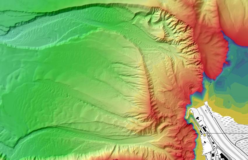
swissBATHY3D, Bathymetric data of Swiss lakes
swissBATHY3D contains bathymetric data in the form of a very accurate digital elevation model that describes the topography of the some Swiss lakebeds.
Simple
- Alternate title
-
swissBATHY3D
- Date (Creation)
- 2018-08-01T00:00:00
- Identifier
- ch.swisstopo.swissbathy3d
Point of contact
Federal Office of Topography swisstopo - geodata (Geodata Distribution)
Seftigenstrasse 264
Wabern
3084
CH
- Spatial representation type
- Grid
Spatial resolution
- Spatial resolution
- 1 m
- Topic category
-
- C Elevation
Extent
Extent
- Description
-
swissBATHY3D
N
S
E
W
))

- Maintenance and update frequency
- As needed
- GEMET
-
-
laser
-
altitude
-
geographic information system
-
digital land model
-
relief (land)
-
- geocat.ch
-
-
contour in lakes
-
digital terrain model DTM
-
Airborne-Laser-Scanning
-
opendata.swiss
-
FSDI Federal Spatial Data Infrastructure
-
- GEMET - INSPIRE themes, version 1.0
-
-
Elevation
-
Resource constraints
- Use constraints
- Other restrictions
- Other constraints
- Opendata BY: Open use. Must provide the source.
Associated resource
- Association Type
- Reference to a master resource of which this one is a part
- Metadata Reference
Associated resource
- Title
-
Höhendaten (Landesvermessung)
- Association Type
- Reference to a master resource of which this one is a part
- Language
- Deutsch
- Character encoding
- UTF8
- Language
- English
- Character encoding
- UTF8
- Basic Geodata
- true
- Basic Geodata ID
-
41.6
- Basic Geodata Legal Level
- Federal
- Distribution format
-
-
GRID ASCII (XYZ)
-
ESRI ASCII Grid (.grd/.asc)
-
Digital transfer options
Digital transfer options
- Number of dimensions
- 2
- Cell geometry
- Point
- Transformation parameter availability
- 1
- Reference system identifier
- EPSG:2056
- Reference system identifier
- EPSG:5728
Metadata
- Metadata identifier
- 651fe1b8-ca54-41df-85ec-e8b9035f99a1
- Language
- Deutsch
- Character encoding
- UTF8
- Language
- Français
- Character encoding
- UTF8
- Language
- Italiano
- Character encoding
- UTF8
- Language
- English
- Character encoding
- UTF8
- Language
- Rumantsch
- Character encoding
- UTF8
Point of contact
Federal Office of Topography swisstopo - metadata (Metadata contact)
Seftigenstrasse 264
Wabern
3084
CH
Type of resource
- Resource scope
- Dataset
- Metadata linkage
-
https://www.geocat.ch/geonetwork/srv/api/records/651fe1b8-ca54-41df-85ec-e8b9035f99a1
- Date info (Creation)
- 2020-12-16T11:01:12Z
- Date info (Revision)
- 2026-04-13T09:28:49.323665Z
Metadata standard
- Title
-
eCH-0271