geocat.ch
Bourgeoisies
Description des bourgeoisies valaisannes sous forme de polygones.
Simple
- Alternate title
-
Bourgeoisies
- Date (Creation)
- 2002-01-01
- Date (Revision)
- 2021-01-01
- Identifier
- 335
- Purpose
-
Les données ont été constituées principalement pour établir des cartes chloroplètes en fonction des bourgeoisies
- Status
- Completed
Custodian
- Spatial representation type
- Vector
Spatial resolution
Equivalent scale
- Denominator
- 10000
- Topic category
-
- D Boundaries
Extent
Extent
- Description
-
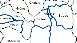
Canton of Valais (VS)
))

- Maintenance and update frequency
- Annually
Resource format
- Title
-
ESRI Enterprise Geodatabase
- Date
- GEMET themes
-
-
administration
-
- GEMET - INSPIRE themes, version 1.0
-
-
Geographical names
-
Administrative units
-
- GEMET
-
-
municipality
-
administrative boundary
-
- geocat.ch
-
-
sovereign border
-
Resource constraints
- Use limitation
-
Aucunes
Resource constraints
- Access constraints
- Other restrictions
- Other constraints
-
Géodonnées accessibles au public (niveau A selon l'OGéo)
- Other constraints
-
Les conditions générales d'utilisation des géodonnées du Canton du Valais font foi ( https://www.vs.ch/fr/web/guest/information-legale).
- Language
- Français
- Character encoding
- UTF8
- Environment description
-
S:\Géodonnées VS\D Limites\Bourgeoisies.lyr
- Distribution format
-
-
ESRI Shapefile (SHP)
-
autres formats sur demande / andere Formate auf Anfrage
-
Distributor
- Statement
-
Les limites des bourgeoisies sont dérivées du jeu de données des limites communales en tenant compte des annonces officielles de fusion ou non-fusion.
- Hierarchy level
- Dataset
- Description
-
Le jeu de données des limites communales est repris. Dans le cas de fusion de communes sans fusion des bourgeoisies, il est nécessaire de rajouter les anciennes limites bourgeoisiales.
- Geometric object type
- Surface
- Geometric object count
- 148
- Reference system identifier
- EPSG:2056/CH1903+_MN95
Metadata
- Metadata identifier
- 613a255e-049d-41cd-87f0-f07ae2875847
- Language
- Français
- Character encoding
- UTF8
- Language
- Deutsch
- Character encoding
- UTF8
- Language
- Italiano
- Character encoding
- UTF8
- Language
- English
- Character encoding
- UTF8
- Language
- Rumantsch
- Character encoding
- UTF8
Distributor
Type of resource
- Resource scope
- Dataset
- Metadata linkage
-
https://www.geocat.ch/geonetwork/srv/api/records/613a255e-049d-41cd-87f0-f07ae2875847
- Date info (Creation)
- 2016-07-29T17:22:48Z
- Date info (Revision)
- 2026-04-13T09:43:32.676989Z
Metadata standard
- Title
-
eCH-0271