 geocat.ch
Pachtgewässer
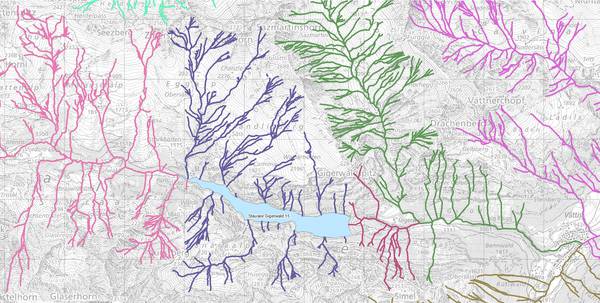
Das Thema Pachtgewässer umfasst die als Pacht- und Patentgewässer verwalteten Fischereigewässer sowie weitere private Fischereirechte. Die Geodaten basieren auf einem eingefrorenen Stand des digitalen Gewässernetzes GN10 und umfassen sowohl Fliessgewässer (Linien) als auch stehende Gewässer (Flächen).
Simple
- Date (Creation)
- 2015-01-29
- Date (Revision)
- 2026-06-21
- Other citation details
-
Wald, Flora, Fauna
- Status
- Completed
partner
Amt für Raumentwicklung und Geoinformation - geodaten@sg.ch
Lämmlisbrunnenstrasse 54
St. Gallen
9001
CH
Homepage
- Hours of service
-
Mo. - Fr. von 8:00 - 17:00 Uhr
- Spatial representation type
- Vector
Spatial resolution
Equivalent scale
- Denominator
- 10000
- Topic category
-
- G Biota
Extent
Extent
- Description
-
Kanton St.Gallen
N
S
E
W
))
- Maintenance and update frequency
- As needed
- geocat.ch
-
-
opendata.swiss
-
Resource constraints
- Access constraints
- Other restrictions
- Other constraints
-
A = öffentlich
Resource constraints
- Classification
- Unclassified
- Language
- Deutsch
- Distribution format
-
-
ESRI Shapefile
-
Distributor
Amt für Raumentwicklung und Geoinformation - geodaten@sg.ch
Lämmlisbrunnenstrasse 54
St. Gallen
9001
CH
Homepage
- Hours of service
-
Mo. - Fr. von 8:00 - 17:00 Uhr
- Statement
-
Die Ersterhebung des Themas Pachtgewässer basiert auf einem eingefroren Stand des kantonalen Gewässernetzes GN10.
- Hierarchy level
- Dataset
- Reference system identifier
- CH1903+_LV95 / EPSG 2056
Metadata
- Metadata identifier
- 5fe9bed7-d968-4db3-90cc-ab7f1b7f5ba4-8371
- Language
- Deutsch
- Character encoding
- UTF8
Resource provider
Amt für Raumentwicklung und Geoinformation - geodaten@sg.ch
Lämmlisbrunnenstrasse 54
St. Gallen
9001
CH
Homepage
- Hours of service
-
Mo. - Fr. von 8:00 - 17:00 Uhr
Type of resource
- Resource scope
- Dataset
- Date info (Revision)
- 2026-06-21T01:15:34+02:00
Metadata standard
- Title
-
GM03 Core
)))
