geocat.ch
SwissNames (Nom de la CN200) (VS)
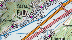
SwissNames200 constitue l'ensemble des données toponymiques de la Suisse basé sur le contenu de la Carte nationale 1:200'000. A chaque toponyme sont affectés les coordonnées du barycentre de même que plusieurs attributs tels que le numéro officiel de la commune, le nom de la commune et le canton où il se trouve ou encore le type d'objet dont il s'agit. Une altitude est également attribuée à certains toponymes.
Simple
- Alternate title
-
SwissNames200 (VS)
- Date (Creation)
- 2006-06-07
- Date (Revision)
- 2009-12-10
- Identifier
- 328
- Purpose
-
jeu de référence
- Status
- Completed
Custodian
- Spatial representation type
- Vector
Spatial resolution
Equivalent scale
- Denominator
- 200000
- Topic category
-
- B Location
Extent
Extent
- Description
-
Canton of Valais (VS)
))

- Maintenance and update frequency
- Not planned
- Maintenance note
-
La version 2008 est la dernière mise à jour du produit SwissNames. En effet, dans le cadre du projet modèle topographique du paysage (MTP), l'Office fédéral de topographie swisstopo a revu complètement la production de ses géodonnées vectorielles à grande échelle.
Resource format
- Title
-
ESRI Enterprise Geodatabase
- Date
- geocat.ch
-
-
place
-
place name
-
official geodata
-
- GEMET
-
-
nomenclature
-
Resource constraints
- Use limitation
-
sous licence
Resource constraints
- Access constraints
- Other restrictions
- Other constraints
-
Géodonnées accessibles au public (niveau A selon l'OGéo)
- Other constraints
-
Les conditions générales d'utilisation des géodonnées du Canton du Valais font foi ( https://www.vs.ch/fr/web/guest/information-legale).
- Language
- Français
- Character encoding
- UTF8
- Language
- Deutsch
- Character encoding
- UTF8
- Environment description
-
S:\Géodonnées VS\B Localisation\SwissNames 200.lyr
- Basic Geodata
- true
- Basic Geodata ID
-
40.1
- Basic Geodata Legal Level
- Federal
- Basic Geodata Type
- Reference Geodata
- Distribution format
-
-
ESRI Shapefile (SHP)
-
autres formats sur demande / andere Formate auf Anfrage
-
Distributor
- Statement
-
Se base sur le contenu et la géométrie de la carte nationale suisse au 1:200'000.
- Hierarchy level
- Dataset
- Source
- Geometric object type
- Point
- Geometric object count
- 863
- Reference system identifier
- EPSG:2056/CH1903+_MN95
Metadata
- Metadata identifier
- 5fab6006-180d-44f9-9ba2-e27bc2026979
- Language
- Français
- Character encoding
- UTF8
- Language
- Deutsch
- Character encoding
- UTF8
- Language
- Italiano
- Character encoding
- UTF8
- Language
- English
- Character encoding
- UTF8
- Language
- Rumantsch
- Character encoding
- UTF8
Point of contact
Type of resource
- Resource scope
- Dataset
- Metadata linkage
-
https://www.geocat.ch/geonetwork/srv/api/records/5fab6006-180d-44f9-9ba2-e27bc2026979
- Date info (Creation)
- 2014-12-17T13:53:14Z
- Date info (Revision)
- 2026-05-18T12:20:52.458811Z
Metadata standard
- Title
-
eCH-0271