geocat.ch
Organisations barrage hydrocarbure sur cours d'eaux
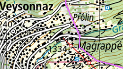
Les CSI Région Leuk et Haut-Lac ont été équipés pour intervenir sur les cours et plans d'eau en cas d'accident et de fuite de produits hydrocarbures. La région d'intervention de chaque CSI est définie par cette couche.
Simple
- Alternate title
-
Organisations barrage hydrocarbure
- Date (Creation)
- 2022-07-18
- Identifier
- 557
- Purpose
-
Afficher les secteurs d'intervention des CSI B Haut-Lac et Leuk en cas d'intervention hydrocarbure sur cours d'eau
- Status
- On going
Custodian
- Spatial representation type
- Vector
- Topic category
-
- R Intelligence military
Extent
Extent
- Description
-
Canton of Valais (VS)
))

- Maintenance and update frequency
- Not planned
Resource format
- Title
-
ESRI Enterprise Geodatabase
- Date
- GEMET
-
-
pollution
-
- GEMET
-
-
water
-
- GEMET
-
-
disasters, accidents, risk
-
- GEMET - INSPIRE themes, version 1.0
-
-
Hydrography
-
- GEMET
-
-
accident
-
- GEMET
-
-
pollutant analysis
-
- GEMET
-
-
storage dam
-
- GEMET
-
-
dam
-
- GEMET
-
-
hydrologic disaster
-
- GEMET
-
-
freshwater ecosystem
-
Resource constraints
- Use limitation
-
Aucunes
Resource constraints
- Access constraints
- Other restrictions
- Other constraints
-
Non-publicly accessible basic geodata : level C (GeoIV, art. 21).
- Other constraints
-
Les conditions générales d'utilisation des géodonnées du Canton du Valais font foi ( https://www.vs.ch/fr/web/guest/information-legale).
- Language
- Français
- Character encoding
- UTF8
- Language
- Deutsch
- Character encoding
- UTF8
- Included with dataset
- false
- Title
-
Organisations barrage hydrocarbure - Attributs de la table
- Date (Creation)
- 2022-07-18
- Distribution format
-
-
ESRI Shapefile (SHP)
-
Distributor
Digital transfer options
- OnLine resource
-
Géoportail du Canton du Valais
Géoportail du Canton du Valais
- Statement
-
Données numérisés sur la base de la directive en vigueur "Engagement hydrocarbure"
- Hierarchy level
- Dataset
- Geometric object type
- Surface
- Geometric object count
- 2
- Reference system identifier
- EPSG:2056/CH1903+_MN95
Metadata
- Metadata identifier
- 5be84f92-3c05-4b29-9d60-d32b2810d909
- Language
- Français
- Character encoding
- UTF8
- Language
- Deutsch
- Character encoding
- UTF8
- Language
- Italiano
- Character encoding
- UTF8
- Language
- English
- Character encoding
- UTF8
- Language
- Rumantsch
- Character encoding
- UTF8
Distributor
Type of resource
- Resource scope
- Dataset
- Metadata linkage
-
https://www.geocat.ch/geonetwork/srv/api/records/5be84f92-3c05-4b29-9d60-d32b2810d909
- Date info (Creation)
- 2022-09-20T08:36:41Z
- Date info (Revision)
- 2026-05-06T15:03:07.087514Z
Metadata standard
- Title
-
eCH-0271