geocat.ch
Jeux de données géologiques vectorielles 1:25000 (VS)
Les jeux de données vectorielles se basent sur les feuilles de l'Atlas géologique Suisse (GA25) lorsque celles-ci sont disponibles en version imprimée. Dans les autres cas, les jeux de données sont digitalisés sur la base d'une compilation de cartes spéciales et d'originaux à différentes échelles, disponibles au Service géologique national.
Simple
- Alternate title
-
GeoCover (VS)
- Date (Revision)
- 2025-08-31
- Identifier
- 222
- Purpose
-
Renseignements détaillés sur les couches supérieures du sous-sol de la Suisse
- Status
- Completed
Custodian
- Spatial representation type
- Vector
Spatial resolution
Equivalent scale
- Denominator
- 25000
- Topic category
-
- F Geoscientific information
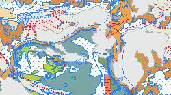
Extent
Extent
- Description
-
Canton of Valais (VS)
))

- Maintenance and update frequency
- Continual
Resource format
- Title
-
ESRI Enterprise Geodatabase
- Date
- GEMET
-
-
atlas
-
- geocat.ch
-
-
official geodata
-
Resource constraints
- Use limitation
-
sous licence
Resource constraints
- Access constraints
- Other restrictions
- Other constraints
-
Géodonnées accessibles au public (niveau A selon l'OGéo)
- Other constraints
-
Les conditions générales d'utilisation des géodonnées du Canton du Valais font foi ( https://www.vs.ch/fr/web/guest/information-legale).
- Language
- Français
- Character encoding
- UTF8
- Language
- Deutsch
- Character encoding
- UTF8
- Environment description
-
S:\Géodonnées VS\F1 Géologie\Atlas géologique (Vector).lyr
- Subtopic Category
- F1 Geology
- Basic Geodata
- true
- Basic Geodata ID
-
46.9
- Basic Geodata Legal Level
- Federal
- Basic Geodata Type
- basicGeodata
- Title
-
Modèle de donnée géologique 2D (GeoCover)
- Date (Creation)
- 2025-08-31
- Distribution format
-
-
ESRI Shapefile (SHP)
-
autres formats sur demande / andere Formate auf Anfrage
-
Distributor
- Statement
-
En attendant la rédaction complète de l'Atlas géologique 1:25'000 en format papier, la qualité des jeux de données vectorielles peut ainsi varier.
- Hierarchy level
- Dataset
- Geometric object type
- Surface
- Reference system identifier
- EPSG:2056/CH1903+_MN95
Metadata
- Metadata identifier
- 5bc22da1-a003-43c7-8ff2-094f2ba90121
- Language
- Français
- Character encoding
- UTF8
- Language
- Deutsch
- Character encoding
- UTF8
- Language
- Italiano
- Character encoding
- UTF8
- Language
- English
- Character encoding
- UTF8
- Language
- Rumantsch
- Character encoding
- UTF8
Distributor
Type of resource
- Resource scope
- Dataset
- Metadata linkage
-
https://www.geocat.ch/geonetwork/srv/api/records/5bc22da1-a003-43c7-8ff2-094f2ba90121
- Date info (Creation)
- 2014-12-16T17:54:31Z
- Date info (Revision)
- 2026-04-13T09:41:08.41286Z
Metadata standard
- Title
-
eCH-0271