geocat.ch
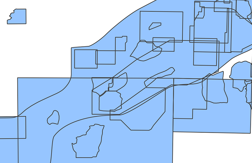
Einteilung Geologische Spezialkarten Raster
Découpage cartes géologiques spéciales Raster
Divisione carte geologiche speciali Raster
Division special geological maps Raster
Divisiun da chartas geologicas spezialas Retagl
Die Geologische Spezialkarten (GSK) liegen in Massstäben zwischen 1:25000 und 1:100000 vor. Ihre Umgrenzung wurde nach geografischen oder thematischen Gesichtspunkt gewählt; sie geben Auskunft über regional-geologische Verhältnisse und beleuchten ausgewählte thematische Schwerpunkte. Ein wichtiges Hilfsmittel für Geologen, Ingenieure, Planer, öffentliche Ämter, Wissenschaftler und Schulen. Zur Zeit sind nicht alle Blätter lieferbar.
Les cartes géologiques spéciales (GSK) existent dans des échelles entre le 1:25000 et le 1:100000. Leur délimitation a été choisie dans une perspective géographique ou thématique; elles renseignent sur les conditions géologiques régionales et mettent en lumière des priorités thématiques choisies. Un auxiliaire important pour les géologues, les ingénieurs, les aménagistes, les services officiels, les scientifiques et les écoles. Actuellement, non toutes les feuilles sont livrables.
Le carte geologiche speciali (GSK) sono disponibili in scale comprese tra 1:25'000 e 1:100'000. La loro delimitazione è stata determinata secondo criteri geografici o tematici. Esse forniscono informazioni sulle condizioni geologiche delle rispettive regioni e approfondiscono i temi selezionati. Queste carte costituiscono un importante strumento ausiliario per geologi, ingegneri, progettisti, enti pubblici, scienziati e scuole. Attualmente tutti i fogli non sono ancora disponibili.
The Special Geological Maps (GSK) are available at scales between 1:25,000 and 1:100,000. They are defined on the basis of geographical or thematic perspectives. They provide information about regional geological conditions and highlight selected subjects. They represent an important tool for geologists, engineers, planners, public authorities, scientists and schools. Some of the sheets are not currently available.
Las chartas geologicas spezialas (GSK) datti en las scalas tranter 1:25'000 ed 1:100'000. Lur cunfinaziuns èn vegnidas fatgas tenor criteris geografics u tematics; ellas infurmeschan davart las relaziuns geologicas regiunalas e descrivan ina selecziun d'accents tematics. Ellas èn in med auxiliar impurtant per geologs, inschigners, planisaders, uffizis publics, scienziads e scolas. Actualmain n'èn betg tut ils fegls disponibels.
Simple
-
Autre titreAltri nomi o acronimiAlternate titleAlternate titleAlternativtitel
-
Einteilung GSK Raster
Découpage GSK Raster
Divisione GSK Raster
Division GSK Raster
Divisiun GSK Retagl
-
Date (Publication)Data (Pubblicazione)Date (Publication)Date (Publication)Datum (Publikation)
- 2011-01-01
-
IdentifiantIdentificatoreIdentifierIdentifierKennung
- ch.swisstopo.geologie-spezialkarten_schweiz.metadata
-
Forme de la présentationForma della presentazionePresentation formPresentation formPräsentationsform
-
Carte numériqueMappa digitaleDigital mapDigital mapDigitale Karte
-
ÉtatStatoStatusStatusBearbeitungsstatus
-
TerminéCompletatoCompletedCompletedAbgeschlossen
Distributeur
Distributore
Distributor
Distributor
Verteiler
Point de contact
Punto di contatto
Point of contact
Point of contact
Ansprechpartner
-
Type de représentation spatialeTipo di rappresentazione spazialeSpatial representation typeSpatial representation typeRäumliche Darstellungsart
-
grilleRasterGridGridRaster, Gitter
-
Type de représentation spatialeTipo di rappresentazione spazialeSpatial representation typeSpatial representation typeRäumliche Darstellungsart
-
paperMappaperMappaperMappaperMappaperMap
-
Catégorie de thèmeCategoria ISOTopic categoryTopic categoryThematik
-
-
F Informations géoscientifiquesF Informazioni geoscientificheF Geoscientific informationF Geoscientific informationF Erdwissenschaften
-
Étendue
Estensione
Extent
Extent
Ausdehnung
Étendue
Estensione
Extent
Extent
Ausdehnung
-
DescriptionDescrizioneDescriptionDescriptionBeschreibung
-
Switzerland
Schweiz
Suisse
Svizzera
Svizra
))

-
Fréquence de mise à jourFrequenza di aggiornamentoMaintenance and update frequencyMaintenance and update frequencyWartungsintervall
-
Non planifiéeNon pianificatoNot plannedNot plannedNicht geplant
- GEMET - INSPIRE themes, version 1.0
-
-
Géologie
Geologia
Geology
-
- GEMET
-
-
pierre
pietra (edilizia)
stone
-
sédimentation
sedimentazione (geologia)
sedimentation (geology)
-
sciences de la terre
scienze della terra
earth science
-
- geocat.ch
-
-
zone spécifique
zona speciale
special zone
-
carte géologique
carta geologica
geologic map
-
- geocat.ch
-
-
BGDI Bundesgeodaten-Infrastruktur
IFDG l’Infrastructure Fédérale de données géographiques
IFDG Infrastruttura federale dei dati geografici
FSDI Federal Spatial Data Infrastructure
-
Ressource associée
Risorsa associata
Associated resource
Associated resource
Verlinkte Ressource
-
Type d'associationTipo di associazioneAssociation TypeAssociation TypeAssoziationstyp
-
Citation de travail plus largeCitazione di un'opera più ampiaReference to a master resource of which this one is a partReference to a master resource of which this one is a partÜbergeordneter Datenbestand
-
Metadata ReferenceRiferimento metadatiMetadata ReferenceMetadata ReferenceMetadatenreferenz
Ressource associée
Risorsa associata
Associated resource
Associated resource
Verlinkte Ressource
-
TitreTitoloTitleTitleTitel
-
Geologisches Kartenwerk
Cartes géologiques
-
Type d'associationTipo di associazioneAssociation TypeAssociation TypeAssoziationstyp
-
Citation de travail plus largeCitazione di un'opera più ampiaReference to a master resource of which this one is a partReference to a master resource of which this one is a partÜbergeordneter Datenbestand
-
LangueLinguaLanguageLanguageSprache
- Deutsch
-
Encodage de caractèresCodifica dei caratteriCharacter encodingCharacter encodingZeichenkodierung
-
Utf8UTF8UTF8UTF8Utf8
-
LangueLinguaLanguageLanguageSprache
- Français
-
Encodage de caractèresCodifica dei caratteriCharacter encodingCharacter encodingZeichenkodierung
-
Utf8UTF8UTF8UTF8Utf8
-
Informations supplémentairesInformazioni supplementariSupplemental InformationSupplemental InformationZusätzliche Informationen
-
Einige Karten sind vergriffen.
Quelques cartes sont épuisées.
-
Catégorie de sous-thèmeCategoria di sottotemaSubtopic CategorySubtopic CategoryThematische Unterkategorien
-
F1 GéologieF1 GeologiaF1 GeologyF1 GeologyF1 Geologie
-
Géodonnées de baseGeodati di baseBasic GeodataBasic GeodataGeobasisdaten
- true
-
Identifiant Géodonnées de baseIdentificativo dei geodati di baseBasic Geodata IDBasic Geodata IDIdentifikator des Geobasisdatensatzes
-
46.2
-
Niveau des géodonnées de baseLivello legale dei geodati di baseBasic Geodata Legal LevelBasic Geodata Legal LevelGeobasisdatenebene
-
FédéralFederaleFederalFederalNational
-
Format de distributionFormato (codifica)Distribution formatDistribution formatAbgabeformat
-
-
GeoTIFF (GEOTIFF)
-
Options de transfert numérique
Opzioni di trasferimento digitale
Digital transfer options
Digital transfer options
Optionen für die digitale Übertragung
-
Ressource en ligneRisorsa onlineOnLine resourceOnLine resourceOnline
-
Vorschau map.geo.admin.ch
Vorschau map.geo.admin.chAperçu map.geo.admin.chPrevisione map.geo.admin.chPreview map.geo.admin.ch
Options de transfert numérique
Opzioni di trasferimento digitale
Digital transfer options
Digital transfer options
Optionen für die digitale Übertragung
-
Ressource en ligneRisorsa onlineOnLine resourceOnLine resourceOnline
-
ch.swisstopo.geologie-spezialkarten_schweiz.metadata
WMS-BGDI Dienst, Layer "Einteilung Geologische Spezialkarten Raster"Service WMS-IFDG, couche "Découpage cartes géologiques spéciales Raster"Servizio WMS-IFDG, strato "Divisione carte geologiche speciali Raster"WMS-FSDI service, layer "Division special geological maps Raster"WMS-BGDI Dienst, Layer "Einteilung Geologische Spezialkarten Raster"
Options de transfert numérique
Opzioni di trasferimento digitale
Digital transfer options
Digital transfer options
Optionen für die digitale Übertragung
-
Ressource en ligneRisorsa onlineOnLine resourceOnLine resourceOnline
-
ch.swisstopo.geologie-spezialkarten_schweiz.metadata
WMTS-BGDI Dienst, Layer "Einteilung Geologische Spezialkarten Raster"Service WMTS-IFDG, couche , Layer "Découpage cartes géologiques spéciales Raster"Servizio WMTS-IFDG, strato "Divisione carte geologiche speciali Raster"WMTS-FSDI service, layer "Division special geological maps Raster"WMTS-BGDI Dienst, Layer "Einteilung Geologische Spezialkarten Raster"
Options de transfert numérique
Opzioni di trasferimento digitale
Digital transfer options
Digital transfer options
Optionen für die digitale Übertragung
Options de transfert numérique
Opzioni di trasferimento digitale
Digital transfer options
Digital transfer options
Optionen für die digitale Übertragung
-
Ressource en ligneRisorsa onlineOnLine resourceOnLine resourceOnline
-
Geologischer Datenviewer
Options de transfert numérique
Opzioni di trasferimento digitale
Digital transfer options
Digital transfer options
Optionen für die digitale Übertragung
-
Ressource en ligneRisorsa onlineOnLine resourceOnLine resourceOnline
-
RESTful API von geo.admin.ch
RESTful API von geo.admin.chRESTful API de geo.admin.chRESTful API da geo.admin.chRESTful API from geo.admin.chRESTful API dad geo.admin.ch
-
Généralités sur la provenanceInformazioni generali sulla provenienzaStatementStatementErklärung
-
Verschiedene geologische und tektonische Karten in Massstäben zwischen 1:25'000 und 1:250'000 ergänzen den Geologischen Atlas der Schweiz und die Geokarten 1:500'000. Publiziert zwischen 1923 und 1999.
Diverses cartes géologiques et tectoniques aux échelles entre 1:25'000 et 1:100'000 complètent l'Atlas géologique de la Suisse et les cartes géologiques au 1:500'000. Publiées entre 1923 et 1999.
-
NiveauLivelloHierarchy levelHierarchy levelBezugsebene
-
Jeu de donnéesSet di datiDatasetDatasetDatenbestand
-
Nom du système de référenceNome del sistema di riferimentoReference system identifierReference system identifierName des Referenzsystems
- Referenzsystem entsprechend der zugrundeliegenden topographischen Karte (CH1903)
Metadata
-
Identifiant des métadonnéesIdentificativo della schedaMetadata identifierMetadata identifierIdentifikator des Metadatensatzes
- 5a7e79b5-0aef-4514-9df4-62fb92edee97
-
LangueLinguaLanguageLanguageSprache
- Deutsch
-
Encodage de caractèresCodifica dei caratteriCharacter encodingCharacter encodingZeichenkodierung
-
Utf8UTF8UTF8UTF8Utf8
-
LangueLinguaLanguageLanguageSprache
- Français
-
Encodage de caractèresCodifica dei caratteriCharacter encodingCharacter encodingZeichenkodierung
-
Utf8UTF8UTF8UTF8Utf8
-
LangueLinguaLanguageLanguageSprache
- Italiano
-
Encodage de caractèresCodifica dei caratteriCharacter encodingCharacter encodingZeichenkodierung
-
Utf8UTF8UTF8UTF8Utf8
-
LangueLinguaLanguageLanguageSprache
- English
-
Encodage de caractèresCodifica dei caratteriCharacter encodingCharacter encodingZeichenkodierung
-
Utf8UTF8UTF8UTF8Utf8
-
LangueLinguaLanguageLanguageSprache
- Rumantsch
-
Encodage de caractèresCodifica dei caratteriCharacter encodingCharacter encodingZeichenkodierung
-
Utf8UTF8UTF8UTF8Utf8
Point de contact
Punto di contatto
Point of contact
Point of contact
Ansprechpartner
Type de ressource
Tipo di risorsa
Type of resource
Type of resource
Anwendungsbereich der Metadaten
-
Domaine d'application de la ressourceAmbito di applicazione della risorsaResource scopeResource scopeDomäne der Ressourcenanwendung
-
Jeu de donnéesSet di datiDatasetDatasetDatenbestand
-
Lien vers la métadonnéeCollegamento ai metadatiMetadata linkageMetadata linkageLink zu den Metadaten
-
Informations de date (Création)Informazioni sulla data (Creazione)Date info (Creation)Date info (Creation)Datumsangaben (Erstellung)
- 2015-10-16T17:07:04Z
-
Informations de date (Révision)Informazioni sulla data (Revisione)Date info (Revision)Date info (Revision)Datumsangaben (Aktualisierung)
- 2026-04-13T09:21:59.640757Z
Norme des métadonnées
Standard dei metadati
Metadata standard
Metadata standard
Metadatenstandard
-
TitreTitoloTitleTitleTitel
-
eCH-0271