geocat.ch
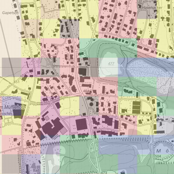
Area statistics for the Principality of Liechtenstein 2014
For the visual interpretation of land use and land cover, aerial photographs were overlaid with a 100x100m sampling grid. The exact land use and land cover at each sampling point was assessed on the stereoscope by a team of trained interpreters according to a catalogue of 25 land cover categories and 47 land use categories.
For easier use, possible combinations were examined and divided into 75 combination categories. For easier interpretation of the combination categories, these were summed up in addition to the 27 and 17 aggregation.
Simple
- Alternate title
-
Land use data (in 47 categories) and land cover data (in 25 categories) and combination categories (75 combination categories, 17 and 27 aggregation)
- Date (Creation)
- 2014-12-08
- Identifier
- https://metadata.geo.llv.li/599ec934-2446-4edb-b367-42a0a4852f9b
- Purpose
-
Spatial observation, continuous survey of land use and land cover in Liechtenstein with the aim of periodically and statistically significantly reporting their condition and development.
- Status
- Completed
Point of contact
- Hours of service
-
8:00-11:30 und 13:30-17:00
Publisher
- Hours of service
-
8:00-11:30 und 13:30-17:00
- Spatial representation type
- Grid
Spatial resolution
- Spatial resolution
- 100 m
- Topic category
-
- I Inland waters
- S Farming
- O Structure
Extent
Extent
- Description
-
Liechtenstein
))

- Maintenance and update frequency
- Continual
- User defined maintenance frequency
-
P6Y0M0DT0H0M0S
Resource format
- Title
-
GeoTIFF (GEOTIFF)
- Date
- geocat.ch
-
-
raster data
-
- GEMET
-
-
land cover
-
statistics
-
statistical information
-
- GEMET - INSPIRE themes, version 1.0
-
-
Statistical units
-
- Räumlicher Anwendungsbereich
-
-
National
-
Resource constraints
- Access constraints
- Other restrictions
- Other constraints
- no limitations to public access
- Country
- LI
- Title
-
Verordnung über die Gebühren für die Nutzung der Geodateninfrastruktur Liechtenstein
- Alternate title
-
GDI-Gebührenverordnung (GDI-GebV)
- Date (Creation)
- 2011-08-30
Resource constraints
- Use limitation
-
Zugangs- und Nutzungsbedingungen
- Use constraints
- Other restrictions
- Other constraints
-
gebührenpflichtig
- Language
- Deutsch
- Character encoding
- UTF8
- Environment description
-
Photogrammetrische Auswertung beim Bundesamt für Statistik
- Attribute description
- Bodenbedeckung
- Distribution format
-
-
GeoTIFF (GEOTIFF)
-
Point of contact
- Hours of service
-
8:00-11:30 und 13:30-17:00
Digital transfer options
- Units of distribution
-
ganzes Land
- OnLine resource
-
Geodatenportal der Liechtensteinischen Landesverwaltung
Geodata Portal of the National Administration
Digital transfer options
- Units of distribution
-
ganzes Land
- OnLine resource
-
INSPIRE Download Service (ATOM)
GML Download
Digital transfer options
- Units of distribution
-
ganzes Land
- OnLine resource
-
li.abi.arealstatistik-bodennutzung-2014
OGC-WMS Service of the National Administration
- Hierarchy level
- Dataset
Report
Result
- Title
-
VERORDNUNG (EG) Nr. 1089/2010 DER KOMMISSION vom 23. November 2010 zur Durchführung der Richtlinie 2007/2/EG des Europäischen Parlaments und des Rates hinsichtlich der Interoperabilität von Geodatensätzen und -diensten
- Date (Publication)
- 2010-12-08
- Explanation
-
nicht überprüft
- Pass
- false
- Statement
-
Hauptgrundlage für die Erfassung ist ein Orthophoto
Das Staatsgebeit wird in ein regelmässiges Gitter von 100x100 Meter eingetteilt. Pro Quadrat wird am Punkt rechts unten Stickprobenwert für die Bodennutzung und die Bodenbedckung erhoben und dem ganzen Quadrat zugeteilt.
- Hierarchy level
- Dataset
- Description
-
Grundlage für die Datenerfassung bilden die Luftbilder von 2002
- Number of dimensions
- 2
- Cell geometry
- Area
- Transformation parameter availability
- 1
- Reference system identifier
- http://www.opengis.net/def/crs/EPSG/0/2056
- Reference system identifier
- http://www.opengis.net/def/crs/EPSG/0/4936
- Maintenance and update frequency
- As needed
Metadata
- Metadata identifier
- 599ec934-2446-4edb-b367-42a0a4852f9b
- Language
- Deutsch
- Character encoding
- UTF8
- Language
- Français
- Character encoding
- UTF8
- Language
- Italiano
- Character encoding
- UTF8
- Language
- English
- Character encoding
- UTF8
Point of contact
- Hours of service
-
8:00-11:30 und 13:30-17:00
Type of resource
- Resource scope
- Dataset
- Metadata linkage
-
https://www.geocat.ch/geonetwork/srv/api/records/599ec934-2446-4edb-b367-42a0a4852f9b
- Date info (Creation)
- 2017-02-17T11:34:57Z
- Date info (Revision)
- 2026-05-05T12:36:00.191036Z
Metadata standard
- Title
-
eCH-0271