geocat.ch
Arealstatistik Fürstentum Liechtenstein 2014
Area statistics for the Principality of Liechtenstein 2014
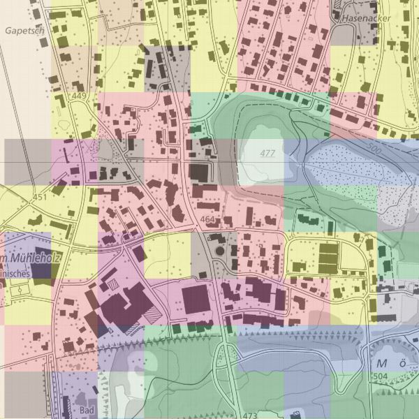
Für die visuelle Interpretation der Bodennutzung und Bodenbedeckung wurden Luftbilder mit einem Stichprobennetz von 100x100m überlagert. Die exakte Bodennutzung und -bedeckung an jedem Stichprobenpunkt wurde am Stereoskop von einem Team geschulter Interpreten nach einem Katalog von 25 Kategorien der Bodenbedeckung und 47 Kategorien der Bodennutzung beurteilt.
Zur einfacheren Nutzung wurden mögliche Kombinationen untersucht und in 75 Kombinationskategorien unterteilt. Zur einfacheren Interpretation der Kombinationskategorien wurden diese zusätzlich zur 27er und 17er Aggregation aufsummiert.
For the visual interpretation of land use and land cover, aerial photographs were overlaid with a 100x100m sampling grid. The exact land use and land cover at each sampling point was assessed on the stereoscope by a team of trained interpreters according to a catalogue of 25 land cover categories and 47 land use categories.
For easier use, possible combinations were examined and divided into 75 combination categories. For easier interpretation of the combination categories, these were summed up in addition to the 27 and 17 aggregation.
Simple
-
Autre titreAltri nomi o acronimiAlternate titleAlternativtitel
-
Bodennutzungsdaten (in 47 Kategorien) und Bodenbeckungsdaten (in 25 Kategorien) und Kombinationskategrien (75 Kombinationskategrorien, 17er und 27er Aggregation)
Land use data (in 47 categories) and land cover data (in 25 categories) and combination categories (75 combination categories, 17 and 27 aggregation)
-
Date (Création)Data (Creazione)Date (Creation)Datum (Erstellung)
- 2014-12-08
-
IdentifiantIdentificatoreIdentifierKennung
- https://metadata.geo.llv.li/599ec934-2446-4edb-b367-42a0a4852f9b
-
ButScopoPurposeZweck
-
Raumbeobachtung, kontinuierliche Erhebung der Bodennutzung und -bedeckung von Liechtenstein mit dem Ziel, deren Zustand und Entwicklung periodisch und statistisch signifikant auszuweisen.
Spatial observation, continuous survey of land use and land cover in Liechtenstein with the aim of periodically and statistically significantly reporting their condition and development.
-
ÉtatStatoStatusBearbeitungsstatus
-
TerminéCompletatoCompletedAbgeschlossen
Point de contact
Punto di contatto
Point of contact
Ansprechpartner
-
Heures de serviceOrario di servizioHours of serviceBetriebszeiten
-
8:00-11:30 und 13:30-17:00
responsable de la publication
Editore
Publisher
Herausgeber
-
Heures de serviceOrario di servizioHours of serviceBetriebszeiten
-
8:00-11:30 und 13:30-17:00
-
Type de représentation spatialeTipo di rappresentazione spazialeSpatial representation typeRäumliche Darstellungsart
-
grilleRasterGridRaster, Gitter
Résolution spatiale
Risoluzione spaziale
Spatial resolution
Räumliche Auflösung
-
Distance de résolutionDistanza di risoluzioneSpatial resolutionDistanz
- 100 m
-
Catégorie de thèmeCategoria ISOTopic categoryThematik
-
-
I Eaux intérieuresI Acque interneI Inland watersI Binnengewässer
-
S ÉlevageS AgricolturaS FarmingS Landwirtschaft
-
O StructureO StrutturaO StructureO Bauwerke
-
Étendue
Estensione
Extent
Ausdehnung
Étendue
Estensione
Extent
Ausdehnung
-
DescriptionDescrizioneDescriptionBeschreibung
-
Liechtenstein
Liechtenstein
Liechtenstein
Liechtenstein
))

-
Fréquence de mise à jourFrequenza di aggiornamentoMaintenance and update frequencyWartungsintervall
-
ContinueContinuaContinualKontinuierlich
-
Autre fréquence de mise à jourAltra frequenza di aggiornamentoUser defined maintenance frequencyAndere Wartungsintervall
-
P6Y0M0DT0H0M0S
Format de la ressource
Formato della risorsa
Resource format
Format der Ressource
-
TitreTitoloTitleTitel
-
GeoTIFF (GEOTIFF)
-
DateDataDateDatum
- geocat.ch
-
-
données raster
dati raster
raster data
-
- GEMET
-
-
couverture spatiale (SIG)
copertura del suolo
land cover
-
statistiques
statistica
statistics
-
informations statistiques
informazione statistica
statistical information
-
- GEMET - INSPIRE themes, version 1.0
-
-
Unités statistiques
Unità statistiche
Statistical units
-
- Räumlicher Anwendungsbereich
-
-
Nationales
Nazionali
National
-
Contraintes sur la ressource
Vincoli sulle risorse
Resource constraints
Ressourcenbeschränkungen
-
Contraintes d'accèsVincoli di accessoAccess constraintsZugriffsbeschränkungen
-
Autres restrictionsAltre restrizioniOther restrictionsAndere Beschränkungen
-
Autres contraintesAltri vincoliOther constraintsAndere Einschränkungen
- no limitations to public access
-
PaysPaeseCountryStaat
-
LILILILI
-
TitreTitoloTitleTitel
-
Verordnung über die Gebühren für die Nutzung der Geodateninfrastruktur Liechtenstein
-
Autre titreAltri nomi o acronimiAlternate titleAlternativtitel
-
GDI-Gebührenverordnung (GDI-GebV)
-
Date (Création)Data (Creazione)Date (Creation)Datum (Erstellung)
- 2011-08-30
Contraintes sur la ressource
Vincoli sulle risorse
Resource constraints
Ressourcenbeschränkungen
-
Limitation d'utilisationLimitazione d'usoUse limitationNutzungsbeschränkung
-
Zugangs- und Nutzungsbedingungen
-
Contraintes d'utilisationVincoli d'usoUse constraintsNutzungseinschränkungen
-
Autres restrictionsAltre restrizioniOther restrictionsAndere Beschränkungen
-
Autres contraintesAltri vincoliOther constraintsAndere Einschränkungen
-
gebührenpflichtig
-
LangueLinguaLanguageSprache
- Deutsch
-
Encodage de caractèresCodifica dei caratteriCharacter encodingZeichenkodierung
-
Utf8UTF8UTF8Utf8
-
Description de l'environnement de travailDescrizione dell'ambiente di lavoroEnvironment descriptionBeschreibung der Arbeitsumgebung
-
Photogrammetrische Auswertung beim Bundesamt für Statistik
-
Description de l'attributDescrizione dell'attributoAttribute descriptionBeschreibung des Attributs
- Bodenbedeckung
-
Format de distributionFormato (codifica)Distribution formatAbgabeformat
-
-
GeoTIFF (GEOTIFF)
-
Point de contact
Punto di contatto
Point of contact
Ansprechpartner
-
Heures de serviceOrario di servizioHours of serviceBetriebszeiten
-
8:00-11:30 und 13:30-17:00
Options de transfert numérique
Opzioni di trasferimento digitale
Digital transfer options
Optionen für die digitale Übertragung
-
Unités de distributionUnità di distribuzioneUnits of distributionVerteilungseinheiten
-
ganzes Land
-
Ressource en ligneRisorsa onlineOnLine resourceOnline
-
Geodatenportal der Liechtensteinischen Landesverwaltung
Geodatenportal der Liechtensteinischen LandesverwaltungGeodata Portal of the National Administration
Options de transfert numérique
Opzioni di trasferimento digitale
Digital transfer options
Optionen für die digitale Übertragung
-
Unités de distributionUnità di distribuzioneUnits of distributionVerteilungseinheiten
-
ganzes Land
-
Ressource en ligneRisorsa onlineOnLine resourceOnline
-
INSPIRE Download Service (ATOM)
GML DownloadGML Download
Options de transfert numérique
Opzioni di trasferimento digitale
Digital transfer options
Optionen für die digitale Übertragung
-
Unités de distributionUnità di distribuzioneUnits of distributionVerteilungseinheiten
-
ganzes Land
-
Ressource en ligneRisorsa onlineOnLine resourceOnline
-
li.abi.arealstatistik-bodennutzung-2014
OGC-WMS Service der Liechtensteinischen LandesverwaltungOGC-WMS Service of the National Administration
-
NiveauLivelloHierarchy levelBezugsebene
-
Jeu de donnéesSet di datiDatasetDatenbestand
Rapport sur la qualité
Rapporto sulla qualità
Report
Qualitätsbericht
Result
Risultato
Result
Ergebnis
-
TitreTitoloTitleTitel
-
VERORDNUNG (EG) Nr. 1089/2010 DER KOMMISSION vom 23. November 2010 zur Durchführung der Richtlinie 2007/2/EG des Europäischen Parlaments und des Rates hinsichtlich der Interoperabilität von Geodatensätzen und -diensten
-
Date (Publication)Data (Pubblicazione)Date (Publication)Datum (Publikation)
- 2010-12-08
-
ExplicationSpiegazioneExplanationErläuterung
-
nicht überprüft
-
Degré de conformitéGrado di conformitàPassKonformitätsgrad
- false
-
Généralités sur la provenanceInformazioni generali sulla provenienzaStatementErklärung
-
Hauptgrundlage für die Erfassung ist ein Orthophoto
Das Staatsgebeit wird in ein regelmässiges Gitter von 100x100 Meter eingetteilt. Pro Quadrat wird am Punkt rechts unten Stickprobenwert für die Bodennutzung und die Bodenbedckung erhoben und dem ganzen Quadrat zugeteilt.
-
NiveauLivelloHierarchy levelBezugsebene
-
Jeu de donnéesSet di datiDatasetDatenbestand
-
DescriptionDescrizioneDescriptionBeschreibung
-
Grundlage für die Datenerfassung bilden die Luftbilder von 2002
-
Nombre de dimensionsNumero di dimensioniNumber of dimensionsAnzahl der Dimensionen
- 2
-
Géométrie de la celluleGeometria della cellaCell geometryZellgeometrie
-
SurfaceAreaAreaFläche
-
Disponibilité des paramètres de transformationDisponibilità dei parametri di trasformazioneTransformation parameter availabilityVerfügbarkeit der Transformationsparameter
- 1
-
Nom du système de référenceNome del sistema di riferimentoReference system identifierName des Referenzsystems
- http://www.opengis.net/def/crs/EPSG/0/2056
-
Nom du système de référenceNome del sistema di riferimentoReference system identifierName des Referenzsystems
- http://www.opengis.net/def/crs/EPSG/0/4936
-
Fréquence de mise à jourFrequenza di aggiornamentoMaintenance and update frequencyWartungsintervall
-
Comme nécessaireSecondo necessitàAs neededBei Bedarf
Metadata
-
Identifiant des métadonnéesIdentificativo della schedaMetadata identifierIdentifikator des Metadatensatzes
- 599ec934-2446-4edb-b367-42a0a4852f9b
-
LangueLinguaLanguageSprache
- Deutsch
-
Encodage de caractèresCodifica dei caratteriCharacter encodingZeichenkodierung
-
Utf8UTF8UTF8Utf8
-
LangueLinguaLanguageSprache
- Français
-
Encodage de caractèresCodifica dei caratteriCharacter encodingZeichenkodierung
-
Utf8UTF8UTF8Utf8
-
LangueLinguaLanguageSprache
- Italiano
-
Encodage de caractèresCodifica dei caratteriCharacter encodingZeichenkodierung
-
Utf8UTF8UTF8Utf8
-
LangueLinguaLanguageSprache
- English
-
Encodage de caractèresCodifica dei caratteriCharacter encodingZeichenkodierung
-
Utf8UTF8UTF8Utf8
Point de contact
Punto di contatto
Point of contact
Ansprechpartner
-
Heures de serviceOrario di servizioHours of serviceBetriebszeiten
-
8:00-11:30 und 13:30-17:00
Type de ressource
Tipo di risorsa
Type of resource
Anwendungsbereich der Metadaten
-
Domaine d'application de la ressourceAmbito di applicazione della risorsaResource scopeDomäne der Ressourcenanwendung
-
Jeu de donnéesSet di datiDatasetDatenbestand
-
Informations de date (Création)Informazioni sulla data (Creazione)Date info (Creation)Datumsangaben (Erstellung)
- 2017-02-17T11:34:57Z
-
Informations de date (Révision)Informazioni sulla data (Revisione)Date info (Revision)Datumsangaben (Aktualisierung)
- 2026-05-05T12:36:00.191036Z
Norme des métadonnées
Standard dei metadati
Metadata standard
Metadatenstandard
-
TitreTitoloTitleTitel
-
eCH-0271