 geocat.ch
Digitale Luftbilder swisstopo
Images aériennes numériques swisstopo
Immagini aeree digitali swisstopo
Digital aerial images swisstopo
Fotografias aerias digitalas da swisstopo
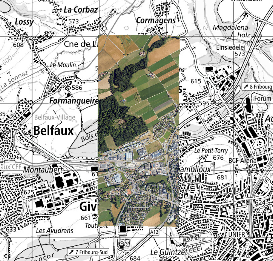
Digitale Luftbilder umfassen die von swisstopo seit 2026 durchgeführten Luftaufnahmen. Jedes einzelne Bild besteht aus 4 Kanälen (Rot, Grün, Blau und Nahinfrarot) mit 8 Bit. Es wird durch die Koordinaten des Bildzentrums, das von ihm abgedeckte Gebiet (Footprint) sowie durch Metadaten beschrieben. Diese Daten werden erfasst, um die Produkte der amtlichen Vermessung (Orthofoto, topografisches Landschaftsmodell, Landeskarten usw.) zu aktualisieren. Derzeit wird jedes Jahr ein Drittel des Territoriums produziert. Die Schweiz ist entsprechend den Kantonsgrenzen in drei Regionen unterteilt. Luftbilder werden zudem regelmässig für nationale Programme zur Umweltüberwachung erstellt.
Les images aériennes numériques regroupent les prise de vue aériennes effectuées par swisstopo depuis 2026. Chaque image individuelle est composée de 4 canaux (rouge, vert, bleu et proche infrarouge) en 8 bits. Elle est décrite par les coordonnées du centre de l'image, la zones qu'elle couvre (footprint) et des métadonnées. Ces données sont saisies pour mettre jour les produits de la mensuration nationale (orthophoto, modèle topographique du paysage, cartes nationales, etc.). Actuellement, un tiers du territoire est produit chaque année. La Suisse est divisée en 3 régions suivant les limites cantonales. Des images aériennes sont aussi produites régulièrement pour des programmes nationaux de surveillance de l’environnement.
Le immagini aeree digitali comprendono le riprese aeree effettuate da swisstopo dal 2026. Ogni singola immagine è composta da 4 canali (rosso, verde, blu e infrarosso vicino) a 8 bit. È descritta dalle coordinate del centro dell'immagine, dall’area che copre (footprint) e dai metadati. Questi dati vengono raccolti per aggiornare i prodotti della misurazione nazionale (ortofoto, modello topografico del paesaggio, carte nazionali, ecc.). Attualmente, un terzo del territorio viene prodotto ogni anno. La Svizzera è suddivisa in tre regioni secondo i confini cantonali. Le immagini aeree sono inoltre prodotte regolarmente per programmi nazionali di monitoraggio ambientale.
Digital aerial images include aerial photographs captured by swisstopo since 2026. Each individual image consists of 4 channels (red, green, blue, and near-infrared) in 8 bits. It is described by the coordinates of the image center, the area it covers (footprint), and metadata. These data are collected to update national surveying products (orthophotos, topographic landscape model, national maps, etc.). Currently, one third of the territory is produced each year. Switzerland is divided into three regions according to cantonal boundaries. Aerial images are also regularly produced for national environmental monitoring programs.
Simple
-
Autre titreAltri nomi o acronimiAlternate titleAlternate titleAlternativtitel
-
Digitale Luftbilder swisstopo
Images aér. numériques swisstopo
Immagini aer. digitali swisstopo
Digital aerial Images swisstopo
Fotografias aerias digitalas da swisstopo
-
Date (Création)Data (Creazione)Date (Creation)Date (Creation)Datum (Erstellung)
- 2026-01-01
-
IdentifiantIdentificatoreIdentifierIdentifierKennung
- ch.swisstopo.lubis-luftbilder_digital
Propriétaire
Proprietario
Owner
Owner
Eigentümer
-
Catégorie de thèmeCategoria ISOTopic categoryTopic categoryThematik
-
-
A Imagerie, cartes de base et occupation du solA Mappe di base con immagini della copertura terrestreA Imagery base maps earth coverA Imagery base maps earth coverA Oberflächenbeschreibung
-
Étendue
Estensione
Extent
Extent
Ausdehnung
Étendue
Estensione
Extent
Extent
Ausdehnung
-
DescriptionDescrizioneDescriptionDescriptionBeschreibung
-
Switzerland
Schweiz
Suisse
Svizzera
Svizra
))

Étendue
Estensione
Extent
Extent
Ausdehnung
Étendue
Estensione
Extent
Extent
Ausdehnung
-
DescriptionDescrizioneDescriptionDescriptionBeschreibung
-
Liechtenstein
Liechtenstein
Liechtenstein
Liechtenstein
Liechtenstein
))

-
Fréquence de mise à jourFrequenza di aggiornamentoMaintenance and update frequencyMaintenance and update frequencyWartungsintervall
-
ContinueContinuaContinualContinualKontinuierlich
-
Durée de conservationDurata di conservazioneDuration of ConservationDuration of ConservationAufbewahrungsdauer NV in Jahren
- 275
-
Évaluation de la valeur archivistiqueValutazione del valore archivisticoAppraisal of Archival ValueAppraisal of Archival ValueBewertung Archivwürdigkeit
-
AAAAA
-
Raison de la valeur d'archivageMotivo del valore archivisticoReason for Archiving ValueReason for Archiving ValueBegründung Archivwürdigkeit
-
Preuve de la pratique couranteProva della pratica commercialeEvidence of business practiceEvidence of business practiceNachweis der Geschäftspraxis
- geocat.ch
-
-
Planification de la conservation et de l'archivage AAP - Conféderation
Pianificazione della conservazione e dell’archiviazione AAP - Confederazione
Conservation and archiving planning AAP - Confederation
-
opendata.swiss
opendata.swiss
opendata.swiss
opendata.swiss
-
- GEMET - INSPIRE themes, version 1.0
-
-
Ortho-imagerie
Orto immagini
Orthoimagery
-
- geocat.ch
-
-
IFDG l’Infrastructure Fédérale de données géographiques
IFDG Infrastruttura federale dei dati geografici
FSDI Federal Spatial Data Infrastructure
-
Contraintes sur la ressource
Vincoli sulle risorse
Resource constraints
Resource constraints
Ressourcenbeschränkungen
-
Autres contraintesAltri vincoliOther constraintsOther constraintsAndere Einschränkungen
- Opendata BY: Freie Nutzung. Quellenangabe ist Pflicht.Opendata BY: Utilisation libre. Obligation d’indiquer la source.Opendata BY: Libero utilizzo. Indicazione della fonte obbligatoria.Opendata BY: Open use. Must provide the source.
Ressource associée
Risorsa associata
Associated resource
Associated resource
Verlinkte Ressource
-
TitreTitoloTitleTitleTitel
-
Digitale Luftbilder / Flugaufnahmen
Photographies aériennes numériques
Fotografie aeree digitali
Digital aerial photographs
-
Type d'associationTipo di associazioneAssociation TypeAssociation TypeAssoziationstyp
-
Citation de travail plus largeCitazione di un'opera più ampiaReference to a master resource of which this one is a partReference to a master resource of which this one is a partÜbergeordneter Datenbestand
-
LangueLinguaLanguageLanguageSprache
- Deutsch
-
Encodage de caractèresCodifica dei caratteriCharacter encodingCharacter encodingZeichenkodierung
-
Utf8UTF8UTF8UTF8Utf8
-
Catégorie de sous-thèmeCategoria di sottotemaSubtopic CategorySubtopic CategoryThematische Unterkategorien
-
A3 Images aériennes, satellitesA3 Immagini aeree e satellitariA3 Aerial and Satellite ImageryA3 Aerial and Satellite ImageryA3 Luft-, Satellitenbilder
-
Géodonnées de baseGeodati di baseBasic GeodataBasic GeodataGeobasisdaten
- true
-
Identifiant Géodonnées de baseIdentificativo dei geodati di baseBasic Geodata IDBasic Geodata IDIdentifikator des Geobasisdatensatzes
-
36.1
-
Niveau des géodonnées de baseLivello legale dei geodati di baseBasic Geodata Legal LevelBasic Geodata Legal LevelGeobasisdatenebene
-
FédéralFederaleFederalFederalNational
-
Format de distributionFormato (codifica)Distribution formatDistribution formatAbgabeformat
-
-
Cloud Optimized GeoTIFF (TIFF / TIF)
-
Options de transfert numérique
Opzioni di trasferimento digitale
Digital transfer options
Digital transfer options
Optionen für die digitale Übertragung
-
Ressource en ligneRisorsa onlineOnLine resourceOnLine resourceOnline
-
ch.swisstopo.lubis-digitale_luftbilder
WMS-BGDI Dienst, Layer "Digitale Luftbilder swisstopo"Service WMS-IFDG, couche "Images aériennes numériques swisstopo"Servizio WMS-IFDG, strato "Immagini aeree digitali swisstopo"WMS-FSDI service, layer "Digital aerial images swisstopo"WMS-BGDI Dienst, Layer "Digitale Luftbilder swisstopo"
Options de transfert numérique
Opzioni di trasferimento digitale
Digital transfer options
Digital transfer options
Optionen für die digitale Übertragung
-
Ressource en ligneRisorsa onlineOnLine resourceOnLine resourceOnline
-
Vorschau map.geo.admin.ch
Vorschau map.geo.admin.chAperçu map.geo.admin.chPrevisione map.geo.admin.chPreview map.geo.admin.ch
Options de transfert numérique
Opzioni di trasferimento digitale
Digital transfer options
Digital transfer options
Optionen für die digitale Übertragung
-
Ressource en ligneRisorsa onlineOnLine resourceOnLine resourceOnline
-
ch.swisstopo.lubis-luftbilder_digital
WMS-BGDI Dienst, Layer "Digitale Luftbilder swisstopo"Service WMS-IFDG, couche "Images aériennes numériques swisstopo"Servizio WMS-IFDG, strato "Immagini aeree digitali swisstopo"WMS-FSDI service, layer "Digital aerial images swisstopo"WMS-BGDI Dienst, Layer "Digitale Luftbilder swisstopo"
Options de transfert numérique
Opzioni di trasferimento digitale
Digital transfer options
Digital transfer options
Optionen für die digitale Übertragung
Options de transfert numérique
Opzioni di trasferimento digitale
Digital transfer options
Digital transfer options
Optionen für die digitale Übertragung
-
Ressource en ligneRisorsa onlineOnLine resourceOnLine resourceOnline
-
Webseite Luftbilder
Options de transfert numérique
Opzioni di trasferimento digitale
Digital transfer options
Digital transfer options
Optionen für die digitale Übertragung
-
Ressource en ligneRisorsa onlineOnLine resourceOnLine resourceOnline
-
Link für Datenbezug
Options de transfert numérique
Opzioni di trasferimento digitale
Digital transfer options
Digital transfer options
Optionen für die digitale Übertragung
-
Ressource en ligneRisorsa onlineOnLine resourceOnLine resourceOnline
-
LUBIS-Viewer
Options de transfert numérique
Opzioni di trasferimento digitale
Digital transfer options
Digital transfer options
Optionen für die digitale Übertragung
-
Ressource en ligneRisorsa onlineOnLine resourceOnLine resourceOnline
-
RESTful API von geo.admin.ch
RESTful API von geo.admin.chRESTful API de geo.admin.chRESTful API da geo.admin.chRESTful API from geo.admin.chRESTful API dad geo.admin.ch
Metadata
-
Identifiant des métadonnéesIdentificativo della schedaMetadata identifierMetadata identifierIdentifikator des Metadatensatzes
- 53df902c-b2b4-4c95-8299-ededc0897040
-
LangueLinguaLanguageLanguageSprache
- Deutsch
-
Encodage de caractèresCodifica dei caratteriCharacter encodingCharacter encodingZeichenkodierung
-
Utf8UTF8UTF8UTF8Utf8
-
LangueLinguaLanguageLanguageSprache
- Français
-
Encodage de caractèresCodifica dei caratteriCharacter encodingCharacter encodingZeichenkodierung
-
Utf8UTF8UTF8UTF8Utf8
-
LangueLinguaLanguageLanguageSprache
- Italiano
-
Encodage de caractèresCodifica dei caratteriCharacter encodingCharacter encodingZeichenkodierung
-
Utf8UTF8UTF8UTF8Utf8
-
LangueLinguaLanguageLanguageSprache
- English
-
Encodage de caractèresCodifica dei caratteriCharacter encodingCharacter encodingZeichenkodierung
-
Utf8UTF8UTF8UTF8Utf8
-
LangueLinguaLanguageLanguageSprache
- Rumantsch
-
Encodage de caractèresCodifica dei caratteriCharacter encodingCharacter encodingZeichenkodierung
-
Utf8UTF8UTF8UTF8Utf8
Point de contact
Punto di contatto
Point of contact
Point of contact
Ansprechpartner
-
Heures de serviceOrario di servizioHours of serviceHours of serviceBetriebszeiten
-
08h30 - 11h00 / 14h00 - 16h00 GMT+1
Type de ressource
Tipo di risorsa
Type of resource
Type of resource
Anwendungsbereich der Metadaten
-
Domaine d'application de la ressourceAmbito di applicazione della risorsaResource scopeResource scopeDomäne der Ressourcenanwendung
-
Jeu de donnéesSet di datiDatasetDatasetDatenbestand
-
Lien vers la métadonnéeCollegamento ai metadatiMetadata linkageMetadata linkageLink zu den Metadaten
-
Informations de date (Création)Informazioni sulla data (Creazione)Date info (Creation)Date info (Creation)Datumsangaben (Erstellung)
- 2026-03-10T14:44:03.666Z
-
Informations de date (Révision)Informazioni sulla data (Revisione)Date info (Revision)Date info (Revision)Datumsangaben (Aktualisierung)
- 2026-09-14T04:36:22.68523Z
Norme des métadonnées
Standard dei metadati
Metadata standard
Metadata standard
Metadatenstandard
-
TitreTitoloTitleTitleTitel
-
eCH-0271
Overviews
Spatial extent

Provided by
