geocat.ch
INSPIRE Datensatz Flurstuecke/Grundstuecke (Katasterparzellen)
INSPIRE dataset cadastral parcels
Datensatz für INSPIRE
Der Datensatz der Amtlichen Vermessung gemäss Datenstruktur von INSPIRE Thema Flurstücke/Grundstücke (Katasterparzellen).
INSPIRE dataset
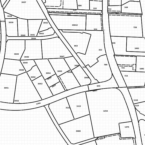
The dataset of the official cadastral survey according to data structure of INSPIRE topic parcels (cadastral parcels).
Simple
-
Autre titreAltri nomi o acronimiAlternate titleAlternate titleAlternativtitel
-
Datensatz der Parzellen gemaess INSPIRE Struktur
dataset cadastral parcels according to INSPIRE structure
-
Date (Publication)Data (Pubblicazione)Date (Publication)Date (Publication)Datum (Publikation)
- 2013-11-13
-
IdentifiantIdentificatoreIdentifierIdentifierKennung
- https://metadata.geo.llv.li/50fb7bec-c4bd-4b71-a3f3-9b223ee998bb
-
ButScopoPurposePurposeZweck
-
Umsetzung INSPIRE
INSPIRE Implementation
-
ÉtatStatoStatusStatusBearbeitungsstatus
-
ContinuIn corsoOn goingOn goingKontinuierliche Aktualisierung
Point de contact
Punto di contatto
Point of contact
Point of contact
Ansprechpartner
-
Heures de serviceOrario di servizioHours of serviceHours of serviceBetriebszeiten
-
8:00-11:30 und 13:30-17:00
-
Type de représentation spatialeTipo di rappresentazione spazialeSpatial representation typeSpatial representation typeRäumliche Darstellungsart
-
vecteurVettorialeVectorVectorVektor
Résolution spatiale
Risoluzione spaziale
Spatial resolution
Spatial resolution
Räumliche Auflösung
Fraction représentative
Frazione rappresentativa
Equivalent scale
Equivalent scale
Vergleichsmassstab
-
DénominateurDenominatoreDenominatorDenominatorMassstabszahl
- 500
-
Catégorie de thèmeCategoria ISOTopic categoryTopic categoryThematik
-
-
E Planification et cadastreE Catasto urbanisticoE Planning cadastreE Planning cadastreE Planungsunterlagen und Kataster
-
Étendue
Estensione
Extent
Extent
Ausdehnung
Étendue
Estensione
Extent
Extent
Ausdehnung
-
DescriptionDescrizioneDescriptionDescriptionBeschreibung
-
Liechtenstein
Liechtenstein
Liechtenstein
Liechtenstein
Liechtenstein
))

-
Fréquence de mise à jourFrequenza di aggiornamentoMaintenance and update frequencyMaintenance and update frequencyWartungsintervall
-
Comme nécessaireSecondo necessitàAs neededAs neededBei Bedarf
Format de la ressource
Formato della risorsa
Resource format
Resource format
Format der Ressource
-
TitreTitoloTitleTitleTitel
-
INTERLIS
-
DateDataDateDateDatum
-
ÉditionEdizioneEditionEditionAusgabe
-
-
Format de la ressource
Formato della risorsa
Resource format
Resource format
Format der Ressource
-
TitreTitoloTitleTitleTitel
-
Geographic Markup Language (GML)
-
DateDataDateDateDatum
- geocat.ch
-
-
INSPIRE
INSPIRE
INSPIRE
-
propriété foncière
proprietà fondiaria
landed property
-
terrain
fondo
site
-
- GEMET
-
-
vecteur
vettore
vector
-
vecteur
vettore
vector
-
cadastre
catasto dei terreni e delle proprietà
land and property register
-
- GEMET - INSPIRE themes, version 1.0
-
-
Parcelles cadastrales
Parcelle catastali
Cadastral parcels
-
- Räumlicher Anwendungsbereich
-
-
Nationales
Nazionali
National
-
Contraintes sur la ressource
Vincoli sulle risorse
Resource constraints
Resource constraints
Ressourcenbeschränkungen
-
Contraintes d'accèsVincoli di accessoAccess constraintsAccess constraintsZugriffsbeschränkungen
-
Autres restrictionsAltre restrizioniOther restrictionsOther restrictionsAndere Beschränkungen
-
Autres contraintesAltri vincoliOther constraintsOther constraintsAndere Einschränkungen
- no limitations to public access
-
PaysPaeseCountryCountryStaat
-
LILILILILI
-
Type de législationTipo di legislazioneLegislation TypeLegislation TypeGesetzestyp
-
OrdonnanceOrdinanzaOrdinanceOrdinanceVerordnung
-
Niveau de la disposition légaleLivello della disposizione legaleLegislation LevelLegislation LevelEbene der gesetzlichen Bestimmung
-
nationalnationalnationalnationalnational
-
TitreTitoloTitleTitleTitel
-
Verordnung vom 30. August 2011 über die Gebühren für die Nutzung der Geodateninfrastruktur Liechtenstein
-
Date (Création)Data (Creazione)Date (Creation)Date (Creation)Datum (Erstellung)
- 2011-08-30
Contraintes sur la ressource
Vincoli sulle risorse
Resource constraints
Resource constraints
Ressourcenbeschränkungen
-
Limitation d'utilisationLimitazione d'usoUse limitationUse limitationNutzungsbeschränkung
-
Zugangs- und Nutzungsbedingungen
-
Contraintes d'utilisationVincoli d'usoUse constraintsUse constraintsNutzungseinschränkungen
-
Autres restrictionsAltre restrizioniOther restrictionsOther restrictionsAndere Beschränkungen
-
Autres contraintesAltri vincoliOther constraintsOther constraintsAndere Einschränkungen
-
Lizenz
-
LangueLinguaLanguageLanguageSprache
- Deutsch
-
Encodage de caractèresCodifica dei caratteriCharacter encodingCharacter encodingZeichenkodierung
-
Utf8UTF8UTF8UTF8Utf8
-
Catégorie de sous-thèmeCategoria di sottotemaSubtopic CategorySubtopic CategoryThematische Unterkategorien
-
E1 Aménagement du territoire, développement spatialE1 Pianificazione territoriale, sviluppo territorialeE1 Spatial Planning, Spatial DevelopmentE1 Spatial Planning, Spatial DevelopmentE1 Raumplanung, Raumentwicklung
-
Catégorie de sous-thèmeCategoria di sottotemaSubtopic CategorySubtopic CategoryThematische Unterkategorien
-
E2 Cadastre foncierE2 Catasto, Registro fondiarioE2 Cadastre, Land RegistryE2 Cadastre, Land RegistryE2 Grundstückskataster
-
Format de distributionFormato (codifica)Distribution formatDistribution formatAbgabeformat
-
-
Geographic Markup Language (GML)
-
ESRI Shapefile (SHP)
-
Point de contact
Punto di contatto
Point of contact
Point of contact
Ansprechpartner
-
Heures de serviceOrario di servizioHours of serviceHours of serviceBetriebszeiten
-
8:00-11:30 und 13:30-17:00
Options de transfert numérique
Opzioni di trasferimento digitale
Digital transfer options
Digital transfer options
Optionen für die digitale Übertragung
-
Ressource en ligneRisorsa onlineOnLine resourceOnLine resourceOnline
-
Geodatenportal der Liechtensteinische Landesverwaltung
Geodatenportal
Options de transfert numérique
Opzioni di trasferimento digitale
Digital transfer options
Digital transfer options
Optionen für die digitale Übertragung
-
Ressource en ligneRisorsa onlineOnLine resourceOnLine resourceOnline
-
Homepage ATG Datenausgabestelle
Datenausgabestelle der Liechteinsteinischen Landesverwaltung
Options de transfert numérique
Opzioni di trasferimento digitale
Digital transfer options
Digital transfer options
Optionen für die digitale Übertragung
-
Ressource en ligneRisorsa onlineOnLine resourceOnLine resourceOnline
-
CP
INSPIRE View ServiceINSPIRE View ServiceINSPIRE View ServiceINSPIRE View ServiceINSPIRE View Service
Options de transfert numérique
Opzioni di trasferimento digitale
Digital transfer options
Digital transfer options
Optionen für die digitale Übertragung
-
Ressource en ligneRisorsa onlineOnLine resourceOnLine resourceOnline
-
INSPIRE Download Service (ATOM)
GML DownloadGML DownloadGML DownloadGML DownloadGML Download
-
NiveauLivelloHierarchy levelHierarchy levelBezugsebene
-
Jeu de donnéesSet di datiDatasetDatasetDatenbestand
-
AutreAltroOtherOtherSonstiges
-
dataset
Rapport sur la qualité
Rapporto sulla qualità
Report
Report
Qualitätsbericht
Result
Risultato
Result
Result
Ergebnis
-
TitreTitoloTitleTitleTitel
-
VERORDNUNG (EG) Nr. 1089/2010 DER KOMMISSION vom 23. November 2010 zur Durchführung der Richtlinie 2007/2/EG des Europäischen Parlaments und des Rates hinsichtlich der Interoperabilität von Geodatensätzen und -diensten
Règlement (UE) n o 1089/2010 de la commission du 23 novembre 2010 portant modalités d'application de la directive 2007/2/ce du Parlement Européen et du conseil en ce qui concerne l'interopérabilité des séries et des services de données géographiques
REGOLAMENTO (UE) N. 1089/2010 DELLA COMMISSIONE del 23 novembre 2010 recante attuazione della direttiva 2007/2/CE del Parlamento europeo e del Consiglio per quanto riguarda l'interoperabilità dei set di dati territoriali e dei servizi di dati territoriali
COMMISSION REGULATION (EU) No 1089/2010 of 23 November 2010 implementing Directive 2007/2/EC of the European Parliament and of the Council as regards interoperability of spatial data sets and services
-
Autre titreAltri nomi o acronimiAlternate titleAlternate titleAlternativtitel
-
INSPIRE Conformity
-
Date (Publication)Data (Pubblicazione)Date (Publication)Date (Publication)Datum (Publikation)
- 2010-11-23
-
ExplicationSpiegazioneExplanationExplanationErläuterung
-
INSPIRE Technical Guidelines
-
Degré de conformitéGrado di conformitàPassPassKonformitätsgrad
- true
-
Généralités sur la provenanceInformazioni generali sulla provenienzaStatementStatementErklärung
-
Daten der Amtlichen Vermessung gemäss Datenmdoell und Richtlinien AV93, mit Transformtionsdiesnten auf die Struktur von INSPIRE transformiert
-
NiveauLivelloHierarchy levelHierarchy levelBezugsebene
-
Jeu de donnéesSet di datiDatasetDatasetDatenbestand
-
AutreAltroOtherOtherSonstiges
-
dataset
-
Niveau de topologieLivello di topologiaTopology levelTopology levelTopologieebene
-
Topologie de réseau complèteGrafo planare completoFull planar graphFull planar graphVollständige Netzwerktopologie
-
Type d’objet géométriqueTipo di oggetto geometricoGeometric object typeGeometric object typeTyp des geometrischen Objekts
-
PolygoneSuperficieSurfaceSurfacesurface
-
Nombre d’objets géométriquesNumero di oggetti geometriciGeometric object countGeometric object countAnzahl geometrischer Objekte
- 30000
-
Nom du système de référenceNome del sistema di riferimentoReference system identifierReference system identifierName des Referenzsystems
- http://www.opengis.net/def/crs/EPSG/0/4258
-
Fréquence de mise à jourFrequenza di aggiornamentoMaintenance and update frequencyMaintenance and update frequencyWartungsintervall
-
Comme nécessaireSecondo necessitàAs neededAs neededBei Bedarf
Metadata
-
Identifiant des métadonnéesIdentificativo della schedaMetadata identifierMetadata identifierIdentifikator des Metadatensatzes
- 50fb7bec-c4bd-4b71-a3f3-9b223ee998bb
-
LangueLinguaLanguageLanguageSprache
- Deutsch
-
Encodage de caractèresCodifica dei caratteriCharacter encodingCharacter encodingZeichenkodierung
-
Utf8UTF8UTF8UTF8Utf8
-
LangueLinguaLanguageLanguageSprache
- Français
-
Encodage de caractèresCodifica dei caratteriCharacter encodingCharacter encodingZeichenkodierung
-
Utf8UTF8UTF8UTF8Utf8
-
LangueLinguaLanguageLanguageSprache
- Italiano
-
Encodage de caractèresCodifica dei caratteriCharacter encodingCharacter encodingZeichenkodierung
-
Utf8UTF8UTF8UTF8Utf8
-
LangueLinguaLanguageLanguageSprache
- English
-
Encodage de caractèresCodifica dei caratteriCharacter encodingCharacter encodingZeichenkodierung
-
Utf8UTF8UTF8UTF8Utf8
-
LangueLinguaLanguageLanguageSprache
- Rumantsch
-
Encodage de caractèresCodifica dei caratteriCharacter encodingCharacter encodingZeichenkodierung
-
Utf8UTF8UTF8UTF8Utf8
Point de contact
Punto di contatto
Point of contact
Point of contact
Ansprechpartner
-
Heures de serviceOrario di servizioHours of serviceHours of serviceBetriebszeiten
-
8:00-11:30 und 13:30-17:00
Type de ressource
Tipo di risorsa
Type of resource
Type of resource
Anwendungsbereich der Metadaten
-
Domaine d'application de la ressourceAmbito di applicazione della risorsaResource scopeResource scopeDomäne der Ressourcenanwendung
-
Jeu de donnéesSet di datiDatasetDatasetDatenbestand
-
NomNomeNameNameName
-
Datensatz
-
Lien vers la métadonnéeCollegamento ai metadatiMetadata linkageMetadata linkageLink zu den Metadaten
-
Informations de date (Création)Informazioni sulla data (Creazione)Date info (Creation)Date info (Creation)Datumsangaben (Erstellung)
- 2015-09-01T14:49:03Z
-
Informations de date (Révision)Informazioni sulla data (Revisione)Date info (Revision)Date info (Revision)Datumsangaben (Aktualisierung)
- 2026-04-13T09:37:32.475397Z
Norme des métadonnées
Standard dei metadati
Metadata standard
Metadata standard
Metadatenstandard
-
TitreTitoloTitleTitleTitel
-
eCH-0271