geocat.ch
Triages forestiers
Délimitation des triages forestiers du canton du Valais
Simple
- Alternate title
-
Triages forestiers
- Date (Creation)
- 2011-01-01
- Date (Revision)
- 2017-03-07
- Identifier
- 231
- Status
- Completed
Custodian
- Spatial representation type
- Vector
Spatial resolution
Equivalent scale
- Denominator
- 25000
- Topic category
-
- G Biota
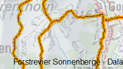
Extent
Extent
- Description
-
Canton of Valais (VS)
))

- Maintenance and update frequency
- Continual
Resource format
- Title
-
ESRI Enterprise Geodatabase
- Date
- GEMET
-
-
forestry
-
- geocat.ch
-
-
opendata.swiss
-
Resource constraints
- Use limitation
-
aucune
Resource constraints
- Access constraints
- Other restrictions
- Other constraints
-
Géodonnées accessibles au public (niveau A selon l'OGéo)
- Other constraints
-
Les conditions générales d'utilisation des géodonnées du Canton du Valais font foi ( https://www.vs.ch/fr/web/guest/information-legale).
- Language
- Français
- Character encoding
- UTF8
- Language
- Deutsch
- Character encoding
- UTF8
- Environment description
-
S:\Géodonnées VS\G Forêt, flore, faune\Triages forestiers.lyr
- Included with dataset
- 0
- Title
-
Description des objets
- Date (Creation)
- 2017-03-07
- Distribution format
-
-
ESRI Shapefile (SHP)
-
autres formats sur demande / andere Formate auf Anfrage
-
ArcGIS REST Feature Service
-
Distributor
Digital transfer options
- OnLine resource
-
Géoportail du Canton du Valais
Géoportail du Canton du Valais
Digital transfer options
- OnLine resource
-
OpenData Valais
OpenData Valais - Site de téléchargement de géodonnées à l'Etat du Valais : multiformat et WebMercator
Digital transfer options
- OnLine resource
-
Landing Page
Landing Page pour opendata
Digital transfer options
- OnLine resource
-
Permalink opendata.swiss
Permalink opendata.swiss
Digital transfer options
- OnLine resource
-
Triage_forestier
Triages forestiers
Digital transfer options
- OnLine resource
-
Arrondissement_forestier
Arrondissements forestiers
- Statement
-
Selon la convention ou approbation communale ainsi que l'approbation du conseil d'Etat
- Hierarchy level
- Dataset
- Description
-
Digitalisation sur la base des limites communales réunies selon les conventions
- Geometric object type
- Surface
- Geometric object count
- 34
- Reference system identifier
- EPSG:2056/CH1903+_MN95
Metadata
- Metadata identifier
- 505a6e05-edde-4501-a3ce-763be3e7e7b4
- Language
- Français
- Character encoding
- UTF8
- Language
- Deutsch
- Character encoding
- UTF8
- Language
- Italiano
- Character encoding
- UTF8
- Language
- English
- Character encoding
- UTF8
- Language
- Rumantsch
- Character encoding
- UTF8
Distributor
Type of resource
- Resource scope
- Dataset
- Metadata linkage
-
https://www.geocat.ch/geonetwork/srv/api/records/505a6e05-edde-4501-a3ce-763be3e7e7b4
- Date info (Creation)
- 2016-01-15T16:01:21Z
- Date info (Revision)
- 2026-04-13T09:34:24.930263Z
Metadata standard
- Title
-
eCH-0271