 geocat.ch
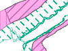
Fischlaichgebiete der drei grossen Seen
Das Geoprodukt Laichgebiete beschreibt Fisch-Laichgebiete im Brienzer-, Thuner-, und Bielersee. Die Informationen sind in drei Ebenen aufgeteilt.
Die Eignung als Laichsubstrat bezeichnet, ob Uferflächen im Brienzer- und Thunersee (ohne Bielersee) als Laichgründe für bestimmte Fischarten geeignet sind.
Die Ebene Laichgebiete beschreibt bekannte und potentielle Laichgebiete, sowie traditionelle Laichfischfanggebiete für diverse Arten in allen drei Seen.
Die Ebene Wasserpflanzen stellt dar, wo im Brienzer-, Thuner-und Bielersee Schilfpflanzen und Makrophyten vorkommen. Diese Ebene ist als Fischlebensraum den Fischlaichgebieten gleichzustellen, da viele Arten diese Strukturen als Laichgebiete nutzen (Pflanzenlaicher).
Simple
- Date (Creation)
- 2013-08-27
- Date (Revision)
- 2022-02-28
- Date (Publication)
- 2024-03-28
- Identifier
- FILAICH
- Status
- On going
Owner
Principal investigator
Principal investigator
- Topic category
-
- I Inland waters
Extent
Extent
- Description
- Kanton Bern (reduziert) Canton de Berne (réduit)
))
- Maintenance and update frequency
- Irregular
- Keywords
-
-
Laichplatz
-
Wasser
-
Fisch
-
Binnengewässer
-
Fischerei
-
Planung
-
opendata.swiss
-
Resource constraints
- Use limitation
-
Auf sämtlichen Plots und Publikationen ist der Vermerk "Fischlaichgebiete der drei grossen Seen © Amt für Landwirtschaft und Natur des Kantons Bern" anzugeben.
Resource constraints
- Use constraints
- Licence End User
- Other constraints
- Die Daten dürfen gemäss Nutzungsbedingungen frei genutzt werden. Les données peuvent être utilisées librement selon les conditions d’utilisation.
Resource constraints
- Other constraints
- Freie Nutzung. Quellenangabe ist Pflicht. Utilisation libre. Obligation d’indiquer la source.
- Language
- Deutsch
- Character encoding
- UTF8
- Language
- Français
- Character encoding
- UTF8
- Language
- Italiano
- Character encoding
- UTF8
- Language
- English
- Character encoding
- UTF8
- Basic Geodata
- true
- Basic Geodata ID
-
98-BE
- Basic Geodata Legal Level
- Cantonal
- Included with dataset
- false
- Distribution format
-
-
SHP
-
GPKG
-
GeoParquet
-
Digital transfer options
- Transfer size
- 1437104
- OnLine resource
-
ZIP-Datei mit Shapefile, Metadaten und Begleitdaten
Digital transfer options
- Transfer size
- 1177005
- OnLine resource
-
ZIP-Datei mit Geopackage mit Metadaten
Digital transfer options
- Transfer size
- 204423
- OnLine resource
-
Geoparquet-Datei - Wasserpflanzen
Digital transfer options
- Transfer size
- 130267
Digital transfer options
- Transfer size
- 120152
- OnLine resource
-
Geoparquet-Datei - Fischlaichgebiete
Digital transfer options
- OnLine resource
-
STAC-Collection - FILAICH
Digital transfer options
- OnLine resource
-
Link zum Geoportal des Kantons Bern
- Reference system identifier
- CH1903+ / LV95 -- Swiss CH1903+ / LV95/EPSG:2056
Metadata
- Metadata identifier
- 4f32caea-f50f-4c47-a0da-2dd53bd5c7eb
- Language
- Deutsch
- Character encoding
- UTF8
- Language
- Français
- Character encoding
- UTF8
Point of contact
Type of resource
- Resource scope
- Dataset
- Name
-
Geoprodukt - Géoproduit
- Date info (Creation)
- 2013-08-27T00:00:00Z
- Date info (Revision)
- 2024-03-28T00:00:00Z
Metadata standard
- Title
-
GM03 2+
)))