geocat.ch
Vector map base (Vector Tileset)
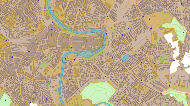
The Base Vector Tileset is a comprehensive package of tiled vector map data designed to be used as a source for dynamic web map representation, specifically the BaseMap Vector Tile Style. The content of the Base Vector tileset is cartographically adapted for each zoom level and optimised for mobile usage. It includes integrated POIs’ on various topics in addition to official data, such as the topographic landscape model, digital cartographic model, public transport stops and the official road directory. Likewise, third party data is integrated. The Base Vector Tileset adheres to the Mapbox Vector Tiles specification and follows the OpenMapTiles schema. The data covers Switzerland and the Principality of Liechtenstein.
Simple
- Alternate title
-
Base Vector Tileset
- Date (Creation)
- 2023-07-01
- Date (Revision)
- 2026-06-01
- Identifier
- ch.swisstopo.base.vt
- Status
- On going
Point of contact
Owner
- Spatial representation type
- Vector
Spatial resolution
Equivalent scale
- Denominator
- 5000
Spatial resolution
Equivalent scale
- Denominator
- 1000000
- Topic category
-
- A Imagery base maps earth cover
Extent
Extent
- Description
-
Switzerland
))

Extent
Extent
- Description
-
Liechtenstein
))

- Maintenance and update frequency
- Quarterly
- geocat.ch
-
-
base map
-
FSDI Federal Spatial Data Infrastructure
-
opendata.swiss
-
official geodata
-
- GEMET - INSPIRE themes, version 1.0
-
-
Geographical names
-
Resource constraints
- Use limitation
-
The terms of use for free geodata and geoservices (OGD) from swisstopo and the general terms of use and operating regulations of the Federal Spatial Data Infrastructure FSDI apply.
For digital or analogue representations and publications, the following source reference must be included: © swisstopo, © FDFA, © FOEN, © FOCP, © SAC, © Naturefriends Switzerland, © opentransportdata.swiss, © pharmaSuisse
For data defined as open data by third-party providers, their terms of use also apply.
- Use constraints
- Other restrictions
- Other constraints
- Terms of use for free geodata and geoservices (OGD) from swisstopo
- Other constraints
- General Terms of Use and Operating Conditions of the Federal Spatial Data Infrastructure FSDI
- Other constraints
- Terms of use opendata.swiss
Associated resource
- Title
-
National survey
- Association Type
- Reference to a master resource of which this one is a part
- Language
- English
- Character encoding
- UTF8
- Subtopic Category
- A1 Base Maps, Landscape Models
- Basic Geodata
- true
- Basic Geodata ID
-
42.17
- Basic Geodata Legal Level
- Federal
- Basic Geodata Type
- Reference Geodata
- Distribution format
-
-
Mapbox Vector Tiles (MBtiles)
-
Digital transfer options
Digital transfer options
Digital transfer options
- OnLine resource
-
Download MBtiles
- Reference system identifier
- EPSG:3857
Metadata
- Metadata identifier
- 4f0a9bae-2581-49fa-99cc-50f1fb5f2c82
- Language
- Deutsch
- Character encoding
- UTF8
- Language
- Français
- Character encoding
- UTF8
- Language
- Italiano
- Character encoding
- UTF8
- Language
- English
- Character encoding
- UTF8
- Language
- Rumantsch
- Character encoding
- UTF8
Point of contact
Type of resource
- Resource scope
- Dataset
- Metadata linkage
-
https://www.geocat.ch/geonetwork/srv/api/records/4f0a9bae-2581-49fa-99cc-50f1fb5f2c82
- Date info (Creation)
- 2023-06-27T07:34:39.657Z
- Date info (Revision)
- 2026-06-09T13:15:51.943306Z
Metadata standard
- Title
-
eCH-0271