geocat.ch
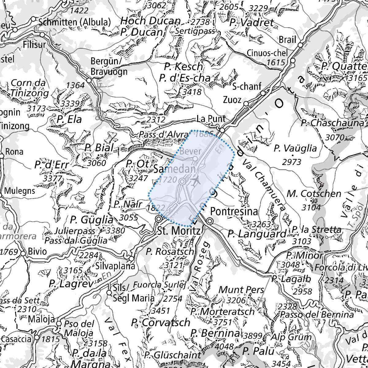
Airspaces: Flight information zones (FIZ)
Based on Article 40, Federal Civil Aviation Act (SR 748.0) and Article 2, paragraph 1, Ordinance on Air Navigation Services (SR 748.132.1), the FOCA is reponsible for defining the airspace structure and classes.
Flight information zones in accordance with the publication date of the most recent ICAO Chart. Other information, e.g. airspace class, conditions for use, plus further details relating to the depicted airspaces, may be obtained from the applicable official publication (AIP and ICAO Chart).
Airspace delimitation is indicated in feet / flight level (FL).
Simple
- Alternate title
-
Airspaces - FIZ
- Date (Creation)
- 2016-10-04T00:00:00
- Date (Publication)
- 2026-03-19T00:00:00
- Identifier
- ch.bazl.luftraeume-fluginformationszonen
Point of contact
- Spatial representation type
- Vector
Spatial resolution
Equivalent scale
- Denominator
- 25000
Spatial resolution
Equivalent scale
- Denominator
- 1000000
- Topic category
-
- P Transportation
Extent
Extent
- Description
-
Aeronautical Chart ICAO 1:500'000
- Geographic identifier
- ICAO
))

- Maintenance and update frequency
- Unknown
- geocat.ch
-
-
airspace
-
air navigation
-
- geocat.ch
-
-
FSDI Federal Spatial Data Infrastructure
-
Resource constraints
- Use constraints
- Other restrictions
- Other constraints
-
-- URL Nutzungsbedingungen (s. Handbuch)
Resource constraints
- Use limitation
-
-- gebührenpflichtig --
- Language
- Deutsch
- Character encoding
- UTF8
- Distribution format
-
-
andere Formate auf Anfrage
-
Digital transfer options
- OnLine resource
-
Vorschau map.geo.admin.ch
Preview map.geo.admin.ch
Digital transfer options
- OnLine resource
-
ch.bazl.luftraeume-fluginformationszonen
WMTS-FSDI service, layer "Airspaces - FIZ"
Digital transfer options
- OnLine resource
-
RESTful API von geo.admin.ch
Digital transfer options
- Geometric object type
- Surface
- Reference system identifier
- EPSG:2056
Metadata
- Metadata identifier
- 4d9bdb6f-3af1-4ef1-aad0-d6560ff996e0
- Language
- Deutsch
- Character encoding
- UTF8
- Language
- Français
- Character encoding
- UTF8
- Language
- Italiano
- Character encoding
- UTF8
- Language
- English
- Character encoding
- UTF8
- Language
- Rumantsch
- Character encoding
- UTF8
Point of contact
Type of resource
- Resource scope
- Dataset
- Metadata linkage
-
https://www.geocat.ch/geonetwork/srv/api/records/4d9bdb6f-3af1-4ef1-aad0-d6560ff996e0
- Date info (Creation)
- 2016-08-04T09:42:49Z
- Date info (Revision)
- 2026-04-13T09:17:26.795189Z
Metadata standard
- Title
-
GM03_2