 geocat.ch
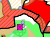
Landwirtschaftliche Kulturen (provisorisch)
Dieser provisorische Datensatz umfasst die geografische Lage der räumlich erfassten landwirtschaftlichen Kulturen im laufenden Beitragsjahr (Flächen und Bäume). Der erste Zeitstand eines Beitragsjahrs wird nach Winter-/Stichtagserhebung publiziert als provisorischer Datensatz. Er wird im Frühjahr einmal nachgeführt.
Simple
- Date (Creation)
- 2015-04-29
- Date (Revision)
- 2026-04-29
- Date (Publication)
- 2026-05-21
- Identifier
- LANDKULP
- Status
- On going
Owner
Principal investigator
Principal investigator
- Topic category
-
- S Farming
Extent
Extent
- Description
- Schweiz Suisse
))
- Maintenance and update frequency
- Biannually
- Keywords
-
-
Bodennutzung
-
Landwirtschaftliche Nutzung
-
Landwirtschaft
-
opendata.swiss
-
Resource constraints
- Use limitation
-
Auf sämtlichen Plots und Publikationen ist der Vermerk "Landwirtschaftliche Kulturen (provisorisch) © Amt für Landwirtschaft und Natur des Kantons Bern" anzugeben.
Resource constraints
- Use constraints
- Licence End User
- Other constraints
- Die Daten dürfen gemäss Nutzungsbedingungen frei genutzt werden. Les données peuvent être utilisées librement selon les conditions d’utilisation.
Resource constraints
- Other constraints
- Freie Nutzung. Quellenangabe ist Pflicht. Utilisation libre. Obligation d’indiquer la source.
- Language
- Deutsch
- Character encoding
- UTF8
- Language
- Français
- Character encoding
- UTF8
- Language
- Italiano
- Character encoding
- UTF8
- Language
- English
- Character encoding
- UTF8
- Basic Geodata
- true
- Basic Geodata ID
-
153
- Basic Geodata Legal Level
- Cantonal
- Included with dataset
- false
- Distribution format
-
-
SHP
-
GPKG
-
GeoParquet
-
Digital transfer options
- Transfer size
- 273222315
- OnLine resource
-
ZIP-Datei mit Shapefile, Metadaten und Begleitdaten
Digital transfer options
- Transfer size
- 252458261
- OnLine resource
-
ZIP-Datei mit Geopackage mit Metadaten
Digital transfer options
- Transfer size
- 24482694
- OnLine resource
-
Geoparquet-Datei - Bewirtschaftungseinheiten (provisorisch)
Digital transfer options
- Transfer size
- 54588865
- OnLine resource
-
Geoparquet-Datei - Nutzungsflächen (provisorisch)
Digital transfer options
- Transfer size
- 717042
- OnLine resource
-
Geoparquet-Datei - Betrieb (provisorisch)
Digital transfer options
- Transfer size
- 125123823
- OnLine resource
-
Geoparquet-Datei - Perimeter LN- und Sömmerungsflächen
Digital transfer options
- Transfer size
- 1586470
- OnLine resource
-
Geoparquet-Datei - Nutzungsflächen (provisorisch), Punkte
Digital transfer options
- Transfer size
- 18441
- OnLine resource
-
Geoparquet-Datei - Produktionsstätte (provisorisch)
Digital transfer options
- OnLine resource
-
STAC-Collection - LANDKULP
Digital transfer options
- OnLine resource
-
Link zum Geoportal des Kantons Bern
- Reference system identifier
- CH1903+ / LV95 -- Swiss CH1903+ / LV95/EPSG:2056
Metadata
- Metadata identifier
- 4cf5cb41-054c-46c4-b7d8-6a25d6c05922
- Language
- Deutsch
- Character encoding
- UTF8
- Language
- Français
- Character encoding
- UTF8
Point of contact
Type of resource
- Resource scope
- Dataset
- Name
-
Geoprodukt - Géoproduit
- Date info (Creation)
- 2015-04-29T00:00:00Z
- Date info (Revision)
- 2026-05-21T00:00:00Z
Metadata standard
- Title
-
GM03 2+
)))