geocat.ch
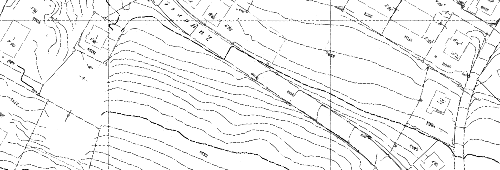
Höhenlinien 1965
Höhenlinien als Raster vom Jahr 1965
Simple
- Date (Creation)
- 2015-01-01
- Status
- Completed
Owner
- Spatial representation type
- Grid
- Topic category
-
- C Elevation
Extent
Extent
- Description
-
Horgen
N
S
E
W
))

- Maintenance and update frequency
- Not planned
Resource format
- Title
-
Oracle DB
- Date
- Edition
-
-
- GEMET
-
-
altitude
-
- geocat.ch
-
-
contour line
-
spot height
-
Resource constraints
- Other constraints
-
Nicht öffentlich sichtbar, bestellbar, kein Dienst verfügbar
- Language
- Deutsch
- Character encoding
- UTF8
- Included with dataset
- true
- Title
-
Höhenlinien 1965
- Date (Creation)
- 2015-01-01
- Name
-
Höhenlinien 1965
- Date
- 2015-01-01
Property description
- Property name
- HK_1965_109_WALDHOF
Property description
- Property name
- HK_1965_11_WALDEGG
Property description
- Property name
- HK_1965_110_BOCKEN
Property description
- Property name
- HK_1965_114_KAEPFN_REIT
Property description
- Property name
- HK_1965_116_RISI_MEILIB
Property description
- Property name
- HK_1965_117_STOTZ_KUMM
Property description
- Property name
- HK_1965_118_SPAE_FUECH
Property description
- Property name
- HK_1965_119_ZENTRUM
Property description
- Property name
- HK_1965_120_TANNENBACH
Property description
- Property name
- HK_1965_210_1
Property description
- Property name
- HK_1965_210_2
Property description
- Property name
- HK_1965_210_3
- Distribution format
-
-
GeoTIFF (GEOTIFF)
-
Tagged Image File Format (TIFF)
-
Distributor
- Reference system identifier
- EPSG:2056
Metadata
- Metadata identifier
- 45d54f37-10db-4707-8916-e8f501dd00ef
- Language
- Deutsch
- Character encoding
- UTF8
- Language
- Français
- Character encoding
- UTF8
- Language
- Italiano
- Character encoding
- UTF8
- Language
- English
- Character encoding
- UTF8
Custodian
Type of resource
- Resource scope
- Dataset
- Metadata linkage
-
https://www.geocat.ch/geonetwork/srv/api/records/45d54f37-10db-4707-8916-e8f501dd00ef
- Date info (Creation)
- 2022-01-06T10:18:40Z
- Date info (Revision)
- 2026-06-15T07:22:49.887893Z
Metadata standard
- Title
-
eCH-0271