geocat.ch
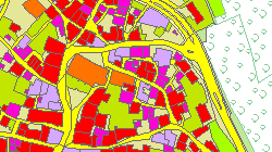
MO - Couverture du sol
Couche d'information de la mensuration officielle qui regroupe les objets tels que bâtiments, surfaces à revêtement dur, surfaces vertes, surfaces eau, surfaces boisées et sans végétation.
Simple
- Alternate title
-
Couverture du sol
- Date (Creation)
- 2001-01-01
- Date (Revision)
- 2026-01-07
- Identifier
- 2
- Purpose
-
Introduction au Registre foncier
- Status
- On going
Custodian
- Spatial representation type
- Vector
Spatial resolution
Equivalent scale
- Denominator
- 1000
- Topic category
-
- A Imagery base maps earth cover
Extent
Extent
- Description
-
Canton of Valais (VS)
))

- Maintenance and update frequency
- Weekly
Resource format
- Title
-
ESRI Enterprise Geodatabase
- Date
- GEMET - INSPIRE themes, version 1.0
-
-
Buildings
-
Land cover
-
Land use
-
- geocat.ch
-
-
opendata.swiss
-
official geodata
-
cadastral surveying
-
Resource constraints
- Use limitation
-
Aucune
Resource constraints
- Access constraints
- Other restrictions
- Other constraints
-
Géodonnées accessibles au public (niveau A selon l'OGéo)
- Other constraints
-
Les conditions générales d'utilisation des géodonnées du Canton du Valais font foi ( https://www.vs.ch/fr/web/guest/information-legale).
Associated resource
- Association Type
- Reference from one resource to another
- Metadata Reference
- Language
- Français
- Character encoding
- UTF8
- Language
- Deutsch
- Character encoding
- UTF8
- Environment description
-
S:\Géodonnées VS\A2 Couverture et utilisation sol\MO-Couverture du sol.lyr
- Supplemental Information
-
GeoMeta - Les métadonnées de la mensuration officielle
- Subtopic Category
- A2 Land Cover, Land Use
- Basic Geodata
- true
- Basic Geodata ID
-
55>A.1
- Basic Geodata Legal Level
- Cantonal
- Basic Geodata Type
- basicGeodata openGovernmentData
- Included with dataset
- 0
- Title
-
Catalogue de données MD.01-MO-CH, version 24
- Date (Creation)
- 2001-01-01
- Included with dataset
- 0
- Title
-
MD.01-MO-VS_MN95_2f.ili
- Date (Creation)
- 2001-01-01
- Distribution format
-
-
OGC Web Map Service (WMS)
-
ZIP
-
ESRI File Geodatabase FileGDB (GDB)
-
OGC Geopackage (GPKG)
-
Distributor
Digital transfer options
- OnLine resource
-
Géoportail du Canton du Valais
Géoportail du Canton du Valais
Digital transfer options
- OnLine resource
-
Geopol Valais
Téléchargement par commune MN95/MN03
Digital transfer options
- OnLine resource
-
MO (GPKG)
Téléchargement (ZIP) des données pour l'ensemble du Canton du Valais, au format GPKG MN95 (CH1903+ / LV95).
Digital transfer options
- OnLine resource
-
MO (GDB)
Téléchargement (ZIP) des données pour l'ensemble du Canton du Valais, au format GDB MN95 (CH1903+ / LV95).
Digital transfer options
- OnLine resource
-
Landing Page
Landing Page pour opendata
Digital transfer options
- OnLine resource
-
Permalink opendata.swiss
Permalink opendata.swiss
Digital transfer options
- OnLine resource
-
OpenData Valais
Site de téléchargement de géodonnées à l'Etat du Valais : multiformat et WebMercator
Digital transfer options
- OnLine resource
-
2
Couverture du sol surfaces
Digital transfer options
- OnLine resource
-
6
CS Nom d'objet
- Statement
-
Bureaux de géomètres
- Hierarchy level
- Dataset
- Description
-
Levé géodésique et calcul
- Reference system identifier
- EPSG:2056/CH1903+_LV95
- Title
-
Plan du RF
- Date (Publication)
- 2001-01-01
Metadata
- Metadata identifier
- 4450d81e-230f-4977-b3fe-7498eb630315
- Language
- Français
- Character encoding
- UTF8
- Language
- Deutsch
- Character encoding
- UTF8
- Language
- Italiano
- Character encoding
- UTF8
- Language
- English
- Character encoding
- UTF8
- Language
- Rumantsch
- Character encoding
- UTF8
Distributor
Type of resource
- Resource scope
- Dataset
- Metadata linkage
-
https://www.geocat.ch/geonetwork/srv/api/records/4450d81e-230f-4977-b3fe-7498eb630315
- Date info (Creation)
- 2014-12-05T17:03:56Z
- Date info (Revision)
- 2026-04-13T09:34:40.036974Z
Metadata standard
- Title
-
eCH-0271