 geocat.ch
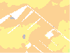
Bodenkarte DSM
Die Bodenkartierung liefert wichtige Grundlagenkarten für Vollzug und Praxis und stellt ein Vorsorgeinstrument für eine nachhaltige Nutzung der Böden dar. Die vorliegenden Prognosekarten wurden mit der Methode Digital Soil Mapping (DSM) erstellt. Diese Modellvorhersage stellt Prognosen für den Wert einer Bodeneigenschaft an einem bestimmten Ort dar. Die Modellvorhersagen wurden für Rasterpunkte mit einer Distanz von 2 x 2m berechnet (Übersichtskarte Bodentypen 25 x 25m). In welchem Massstab die Karten zu interpretieren sind, ist im Layer Kartierperimeter definiert. Sofern vorhanden, ist auch der Fachbericht in diesem Layer verlinkt.
Der Bericht Bodenlandschaften im Kanton Bern ( https://boris-portal.unibe.ch/bitstreams/24be7979-00ab-4d5f-bfc3-d8febec74c8b/download) bietet einen umfassenden Überblick über die Vielfalt der Böden im Kanton Bern.
Simple
- Date (Creation)
- 2024-05-27
- Date (Revision)
- 2026-02-01
- Date (Publication)
- 2026-02-26
- Identifier
- BOKADSM
- Status
- On going
Owner
Principal investigator
Principal investigator
- Topic category
-
- geoscientificInformation_Soils
Extent
Extent
- Description
- Kanton Bern (erweitert) Canton de Berne (étendu)
))
- Maintenance and update frequency
- Irregular
- Keywords
-
-
Bodensenkung
-
Bodenart
-
Boden
-
Perimeter
-
opendata.swiss
-
Resource constraints
- Use limitation
-
Auf sämtlichen Plots und Publikationen ist der Vermerk "Bodenkarte DSM © Amt für Landwirtschaft und Natur des Kantons Bern" anzugeben.
Resource constraints
- Use constraints
- Licence End User
- Other constraints
- Die Daten dürfen gemäss Nutzungsbedingungen frei genutzt werden. Les données peuvent être utilisées librement selon les conditions d’utilisation.
Resource constraints
- Other constraints
- Freie Nutzung. Quellenangabe ist Pflicht. Utilisation libre. Obligation d’indiquer la source.
- Language
- Deutsch
- Character encoding
- UTF8
- Language
- Français
- Character encoding
- UTF8
- Language
- Italiano
- Character encoding
- UTF8
- Language
- English
- Character encoding
- UTF8
- Basic Geodata
- true
- Basic Geodata ID
-
91-BE
- Basic Geodata Legal Level
- Cantonal
- Included with dataset
- false
- Distribution format
-
-
SHP
-
GPKG
-
GeoParquet
-
Digital transfer options
- Transfer size
- 120177460
- OnLine resource
-
ZIP-Datei mit Shapefile, Esri Grid, Metadaten und Begleitdaten
Digital transfer options
- Transfer size
- 4788972
- OnLine resource
-
ZIP-Datei mit Geopackage mit Metadaten
Digital transfer options
- Transfer size
- 93888
- OnLine resource
-
Cloud-optimierte GeoTiff-Datei - Bodentyp
Digital transfer options
- Transfer size
- 1468524
- OnLine resource
-
Cloud-optimierte GeoTiff-Datei - Nutzungseignungsklasse (NEK)
Digital transfer options
- Transfer size
- 11144041
Digital transfer options
- Transfer size
- 1432625
- OnLine resource
-
Cloud-optimierte GeoTiff-Datei - Wasserhaushaltsuntergruppe
Digital transfer options
- Transfer size
- 1254213
- OnLine resource
-
Cloud-optimierte GeoTiff-Datei - Wasserhaushaltsklasse
Digital transfer options
- Transfer size
- 1496121
- OnLine resource
-
Cloud-optimierte GeoTiff-Datei - Bodentypen, Übersichtskarte
Digital transfer options
- Transfer size
- 11107744
- OnLine resource
-
Cloud-optimierte GeoTiff-Datei - Obergrenze r-Horizont(e)
Digital transfer options
- Transfer size
- 1751132
- OnLine resource
-
Cloud-optimierte GeoTiff-Datei - Sackungspotential
Digital transfer options
- Transfer size
- 9176620
- OnLine resource
-
Cloud-optimierte GeoTiff-Datei - Obergrenze gg-Horizont(e)
Digital transfer options
- Transfer size
- 4522431
- OnLine resource
-
Cloud-optimierte GeoTiff-Datei - Obergrenze T-Horizonte
Digital transfer options
- Transfer size
- 7155095
Digital transfer options
- Transfer size
- 6252802
Digital transfer options
- Transfer size
- 7510
- OnLine resource
-
Geoparquet-Datei - Blatteinteilung DSM
Digital transfer options
- Transfer size
- 536468
- OnLine resource
-
Geoparquet-Datei - Kartierperimeter DSM
Digital transfer options
- Transfer size
- 2474787
- OnLine resource
-
Cloud-optimierte GeoTiff-Datei - Sandgehalt, 0cm-20cm
Digital transfer options
- Transfer size
- 4509796
- OnLine resource
-
Cloud-optimierte GeoTiff-Datei - Sandgehalt, 0cm-30cm
Digital transfer options
- Transfer size
- 2601429
- OnLine resource
-
Cloud-optimierte GeoTiff-Datei - Sandgehalt, 20cm-50cm
Digital transfer options
- Transfer size
- 7029478
- OnLine resource
-
Cloud-optimierte GeoTiff-Datei - Sandgehalt, 30cm-60cm
Digital transfer options
- Transfer size
- 2765714
- OnLine resource
-
Cloud-optimierte GeoTiff-Datei - Sandgehalt, 50cm-100cm
Digital transfer options
- Transfer size
- 6969725
- OnLine resource
-
Cloud-optimierte GeoTiff-Datei - Sandgehalt, 60cm-120cm
Digital transfer options
- Transfer size
- 2098316
- OnLine resource
-
Cloud-optimierte GeoTiff-Datei - Tongehalt, 0cm-20cm
Digital transfer options
- Transfer size
- 3666197
- OnLine resource
-
Cloud-optimierte GeoTiff-Datei - Tongehalt, 0cm-30cm
Digital transfer options
- Transfer size
- 2132345
- OnLine resource
-
Cloud-optimierte GeoTiff-Datei - Tongehalt, 20cm-50cm
Digital transfer options
- Transfer size
- 5426378
- OnLine resource
-
Cloud-optimierte GeoTiff-Datei - Tongehalt, 30cm-60cm
Digital transfer options
- Transfer size
- 2215829
- OnLine resource
-
Cloud-optimierte GeoTiff-Datei - Tongehalt, 50cm-100cm
Digital transfer options
- Transfer size
- 4864756
- OnLine resource
-
Cloud-optimierte GeoTiff-Datei - Tongehalt, 60cm-120cm
Digital transfer options
- Transfer size
- 2223804
- OnLine resource
-
Cloud-optimierte GeoTiff-Datei - Schluffgehalt, 0cm-20cm
Digital transfer options
- Transfer size
- 3867662
- OnLine resource
-
Cloud-optimierte GeoTiff-Datei - Schluffgehalt, 0cm-30cm
Digital transfer options
- Transfer size
- 2400038
- OnLine resource
-
Cloud-optimierte GeoTiff-Datei - Schluffgehalt, 20cm-50cm
Digital transfer options
- Transfer size
- 6093581
- OnLine resource
-
Cloud-optimierte GeoTiff-Datei - Schluffgehalt, 30cm-60cm
Digital transfer options
- Transfer size
- 2523549
- OnLine resource
-
Cloud-optimierte GeoTiff-Datei - Schluffgehalt, 50cm-100cm
Digital transfer options
- Transfer size
- 6145364
- OnLine resource
-
Cloud-optimierte GeoTiff-Datei - Schluffgehalt, 60cm-120cm
Digital transfer options
- Transfer size
- 93182
- OnLine resource
-
Cloud-optimierte GeoTiff-Datei - Körnungsklasse, 0cm-20cm
Digital transfer options
- Transfer size
- 1493673
- OnLine resource
-
Cloud-optimierte GeoTiff-Datei - Körnungsklasse, 0cm-30cm
Digital transfer options
- Transfer size
- 1302879
- OnLine resource
-
Cloud-optimierte GeoTiff-Datei - Körnungsklasse, 20cm-50cm
Digital transfer options
- Transfer size
- 1775449
- OnLine resource
-
Cloud-optimierte GeoTiff-Datei - Körnungsklasse, 30cm-60cm
Digital transfer options
- Transfer size
- 1324634
- OnLine resource
-
Cloud-optimierte GeoTiff-Datei - Körnungsklasse, 50cm-100cm
Digital transfer options
- Transfer size
- 1719488
- OnLine resource
-
Cloud-optimierte GeoTiff-Datei - Körnungsklasse, 60cm-120cm
Digital transfer options
- Transfer size
- 10001447
- OnLine resource
-
Cloud-optimierte GeoTiff-Datei - Organische Substanz, 0cm-20cm
Digital transfer options
- Transfer size
- 34481406
- OnLine resource
-
Cloud-optimierte GeoTiff-Datei - Organische Substanz, 0cm-30cm
Digital transfer options
- Transfer size
- 9445346
- OnLine resource
-
Cloud-optimierte GeoTiff-Datei - Organische Substanz, 20cm-50cm
Digital transfer options
- Transfer size
- 40889090
- OnLine resource
-
Cloud-optimierte GeoTiff-Datei - Organische Substanz, 30cm-60cm
Digital transfer options
- Transfer size
- 7630282
- OnLine resource
-
Cloud-optimierte GeoTiff-Datei - Organische Substanz, 50cm-100cm
Digital transfer options
- Transfer size
- 36583659
- OnLine resource
-
Cloud-optimierte GeoTiff-Datei - Organische Substanz, 60cm-120cm
Digital transfer options
- OnLine resource
-
STAC-Collection - BOKADSM
Digital transfer options
- OnLine resource
-
Link zum Geoportal des Kantons Bern
- Reference system identifier
- CH1903+ / LV95 -- Swiss CH1903+ / LV95/EPSG:2056
Metadata
- Metadata identifier
- 42ea37e6-8f72-426f-a7e3-b0c078573209
- Language
- Deutsch
- Character encoding
- UTF8
- Language
- Français
- Character encoding
- UTF8
Point of contact
Type of resource
- Resource scope
- Dataset
- Name
-
Geoprodukt - Géoproduit
- Date info (Creation)
- 2024-05-27T00:00:00Z
- Date info (Revision)
- 2026-02-26T00:00:00Z
Metadata standard
- Title
-
GM03 2+
)))