geocat.ch
Population and Households Statistics
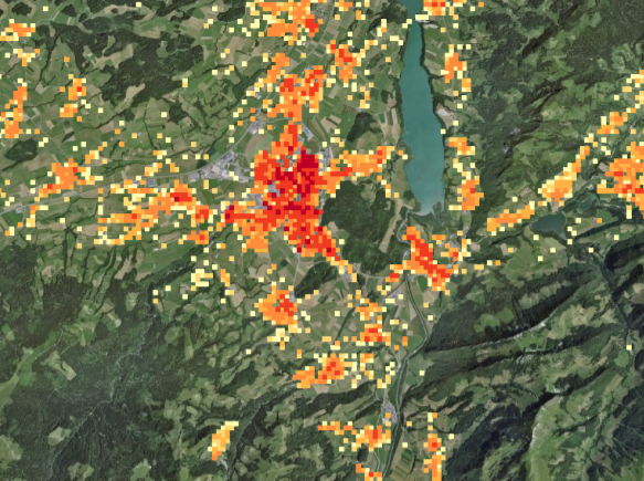
The Population and Households Statistics (STATPOP) has provided key figures since 2010 on the size, structure, development and spatial distribution of the population, as well as on the number and size of households. It is based on the registers of inhabitants of cantons and communes, complemented by sample surveys. Before 2010, the residential buildings recorded in federal national censuses were given coordinates from 1990 onwards.
Simple
- Alternate title
-
Population and Households
- Date (Creation)
- 2010-01-01
- Identifier
- ch.bfs.statistik-bevoelkerung_haushalte
- Purpose
-
The Federal Population Census has described the demographic, spatial, social and economic development of Switzerland since 1990. Its results are used for planning and decision-making in many areas, including employment policy, education, social and family policy, environmental protection, transport, spatial planning and economic promotion. The census is also essential for processing sample surveys (weighting and extrapolation) and for calculating indicators produced in other statistics.
- Status
- On going
Point of contact
Spatial resolution
- Spatial resolution
- 100 m
- Topic category
-
- M Society
Extent
Extent
- Description
-
Switzerland
))

- Maintenance and update frequency
- Annually
- Duration of Conservation
- 100
- Appraisal of Archival Value
- N
- Comment on Archival Value
-
Subset eines archivwürdigen Datensatzes
- geocat.ch
-
-
opendata.swiss
-
official geoservice
-
survey
-
- GEMET - INSPIRE themes, version 1.0
-
-
Population distribution — demography
-
- GEMET
-
-
human population
-
statistics
-
inhabitant
-
- geocat.ch
-
-
FSDI Federal Spatial Data Infrastructure
-
Resource constraints
- Access constraints
- Intellectual property rights
- Use constraints
- Other restrictions
- Other constraints
- Opendata OPEN BY: Open use. Must provide the source.
Associated resource
- Title
-
Federal Population Censuses
- Association Type
- Reference to a master resource of which this one is a part
Associated resource
- Association Type
- Part of same structured set of data held in a computer
- Metadata Reference
Associated resource
- Association Type
- Part of same structured set of data held in a computer
- Metadata Reference
- Language
- Deutsch
- Character encoding
- UTF8
- Language
- Français
- Character encoding
- UTF8
- Language
- Italiano
- Character encoding
- UTF8
- Language
- English
- Character encoding
- UTF8
- Supplemental Information
-
Hektarauswertungen der Volkszählungen werden bei GEOSTAT in relationalen Datenbanken verwaltet, in welchen jede Hektare (eines für alle Erhebungen identischen Standardrasters) einen Datenrecord darstellt. Für die Diffusion können daraus gleichermassen strukturierte Textdateien (Normalfall), bei Bedarf aber auch GIS-kompatible Vektor- (Punktdaten) oder Rasterdaten (GRID, GeoTIFF) erzeugt werden
- Basic Geodata
- true
- Basic Geodata ID
-
15.2
- Basic Geodata Legal Level
- Federal
Digital transfer options
- OnLine resource
-
Vorschau map.geo.admin.ch
Preview map.geo.admin.ch
- OnLine resource
-
Variablenliste
- OnLine resource
-
Datenbeschreibung
- OnLine resource
-
Geodata
Digital transfer options
- OnLine resource
-
GEOSTAT
GEOSTAT ist das BFS-Kompetenzzentrum für Geoinformation und digitale Bildverarbeitung.
Digital transfer options
- OnLine resource
-
Statistik der Bevölkerung und der Haushalte
- Statement
-
Durch die Geokodierung wird die Lage der Wohngebäude mit Hilfe ihrer Koordinaten (gemäss Landeskarte) erfasst, wodurch eine räumliche Zuordnung der Volkszählungsergebnisse ermöglicht wird. Bei der Geokodierung der Volkszählung 1990 wurden vier Hauptverfahren eingesetzt, wobei die Vorbereitungsarbeiten bei den Gemeinden und Kantonen lagen und die Digitalisierung und Weiterverarbeitung beim BFS. Die Volkszählung 2000 wurde auf der Basis des Eidgenössischen Gebäude- und Wohnungsregisters (GWR) in vier Phasen geokodiert: 1. Übernahme der Koordinaten aus der Geokodierung der früheren Volkszählungen 2. Übernahme zusätzlicher Gebäudekoordinaten aus amtlichen Vermessungsdaten oder kantonalen Registern 3. Identifizierung der in den zwei vorangehenden Phasen noch nicht lokalisierten Gebäude durch die Gemeinden oder Kantone und anschliessende Digitalisierung der Koordinaten beim BFS 4. Kontrolle und Validierung der Koordinaten beim BFS.
- Hierarchy level
- Dataset
- Description
-
Wo Kantone oder einzelne Städte bereits über Gebäudekoordinaten verfügten, wurden diese dem BFS direkt übermittelt. Für alle bereits in früheren Volkszählungen erfassten Gebäude wurden ebenfalls deren damals bestimmte Koordinaten übernommen. Für alle anderen Gebäude wurden die Koordinaten ab Plänen unterschiedlichster Art, welche von den Gemeinden vorbereitet wurden, durch das BFS oder Aussenstellen in einzelnen Kantonen bestimmt. Seit einigen Jahren werden die Koordinaten sukzessive durch die geometrisch genaueren Gebäudekoordinaten der Amtlichen Vermessung ersetzt und ergänzt.
- Reference system identifier
- EPSG:2056
- Maintenance and update frequency
- As needed
- Maintenance note
-
Nachführung erfolgt für jede neue Volkszählung sowie, wenn Dokumentation fehlerhaft oder verbesserungsbedürftig.
Metadata
- Metadata identifier
- 42a5fc8f-3ad8-418b-857c-6e42cda7dd2e
- Language
- Deutsch
- Character encoding
- UTF8
- Language
- Français
- Character encoding
- UTF8
- Language
- Italiano
- Character encoding
- UTF8
- Language
- English
- Character encoding
- UTF8
- Language
- Rumantsch
- Character encoding
- UTF8
Point of contact
Type of resource
- Resource scope
- Dataset
- Metadata linkage
-
https://www.geocat.ch/geonetwork/srv/api/records/42a5fc8f-3ad8-418b-857c-6e42cda7dd2e
- Date info (Creation)
- 2026-08-17T14:11:21.345289Z
- Date info (Creation)
- 2017-12-13T08:53:35Z
- Date info (Revision)
- 2026-08-20T09:23:09.348422Z
Metadata standard
- Title
-
eCH-0271