geocat.ch
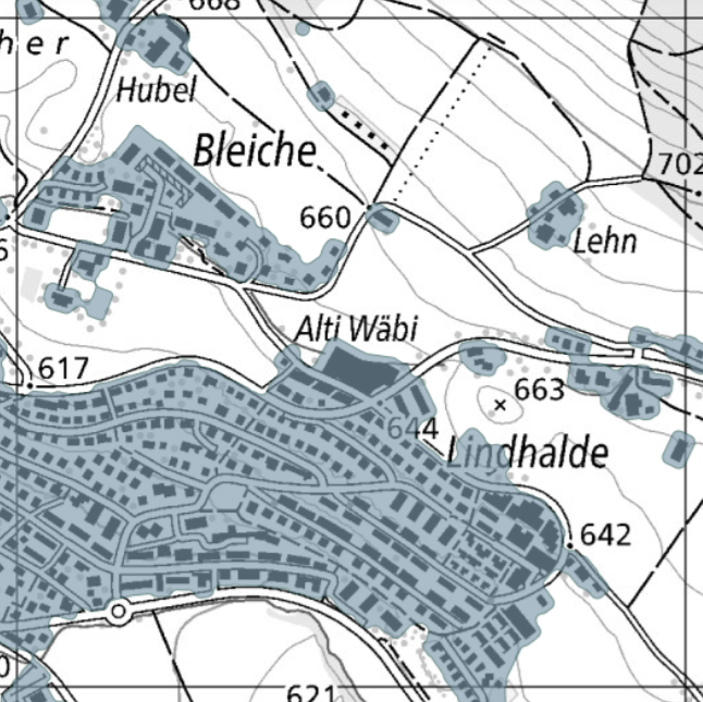
Settlement
The ‘Settlement’ is a geodata set of the settled landscape from a spatial development perspective. The data set serves as a geometric reference for various indicators in spatial observation. What is built for residential, work or leisure purposes is considered to be settled. This includes, in particular, the buildings and their surroundings, as well as the adjacent roads and transport infrastructure for their direct access. Any gaps that extend over more than 1500 m2 remain as such. The data layer is based on data from the topographic landscape model of swisstopo and the FSO's Register of Buildings and Dwellings.
The data is updated and published annually. The time series from 1919 can be viewed as a time journey at map.geo.admich.ch and downloaded as yearly updates at https://data.geo.admin.ch/browser/index.html#/collections/ch.are.siedlung.
Simple
- Alternate title
-
Settlement
- Date (Publication)
- 2024-11-13T10:00:00
- Date (Last Revision)
- 2025-10-08T10:00:00
- Identifier
- ch.are.siedlung
- Purpose
-
Raumbeobachtung, Siedlungsentwicklung, Analysen
- Credit
-
Swiss Federal Institute for Forest, Snow and Landscape Research WSL
- Status
- Completed
Owner
- Topic category
-
- E Planning cadastre
Extent
Extent
- Description
-
Switzerland
))

- Maintenance and update frequency
- Annually
- Duration of Conservation
- 44
- Appraisal of Archival Value
- A
- Reason for Archiving Value
- Developments progression
- GEMET
-
-
human settlement
-
residential area
-
building area
-
urban environment, urban stress
-
built-up area
-
- geocat.ch
-
-
Conservation and archiving planning AAP - Confederation
-
opendata.swiss
-
INSPIRE
-
register
-
- geocat.ch
-
-
FSDI Federal Spatial Data Infrastructure
-
- GEMET themes
-
-
urban environment, urban stress
-
Resource constraints
- Use constraints
- Other restrictions
- Other constraints
- Opendata BY: Open use. Must provide the source.
- Language
- Deutsch
- Character encoding
- UTF8
- Language
- Français
- Character encoding
- UTF8
- Subtopic Category
- E1 Spatial Planning, Spatial Development
- Basic Geodata
- false
- Basic Geodata Legal Level
- Federal
- Distribution format
-
-
OGC Geopackage (GPKG)
-
Digital transfer options
- OnLine resource
-
Vorschau map.geo.admin.ch
Preview map.geo.admin.ch
Digital transfer options
- OnLine resource
-
ch.are.siedlung
WMS-FSDI service, layer "Settlement"
Digital transfer options
- OnLine resource
-
ch.are.siedlung
WMTS-FSDI service, layer "Settlement"
Digital transfer options
- Geometric object type
- Surface
- Reference system identifier
- EPSG:2056
Metadata
- Metadata identifier
- 4229c353-e780-42d8-9f8c-298c83920a3a
- Language
- Deutsch
- Character encoding
- UTF8
- Language
- Français
- Character encoding
- UTF8
- Language
- Italiano
- Character encoding
- UTF8
- Language
- English
- Character encoding
- UTF8
- Language
- Rumantsch
- Character encoding
- UTF8
Point of contact
Type of resource
- Resource scope
- Dataset
- Metadata linkage
-
https://www.geocat.ch/geonetwork/srv/api/records/4229c353-e780-42d8-9f8c-298c83920a3a
- Date info (Creation)
- 2024-07-23T08:26:41.542Z
- Date info (Revision)
- 2026-04-13T09:16:04.851291Z
Metadata standard
- Title
-
eCH-0271