geocat.ch
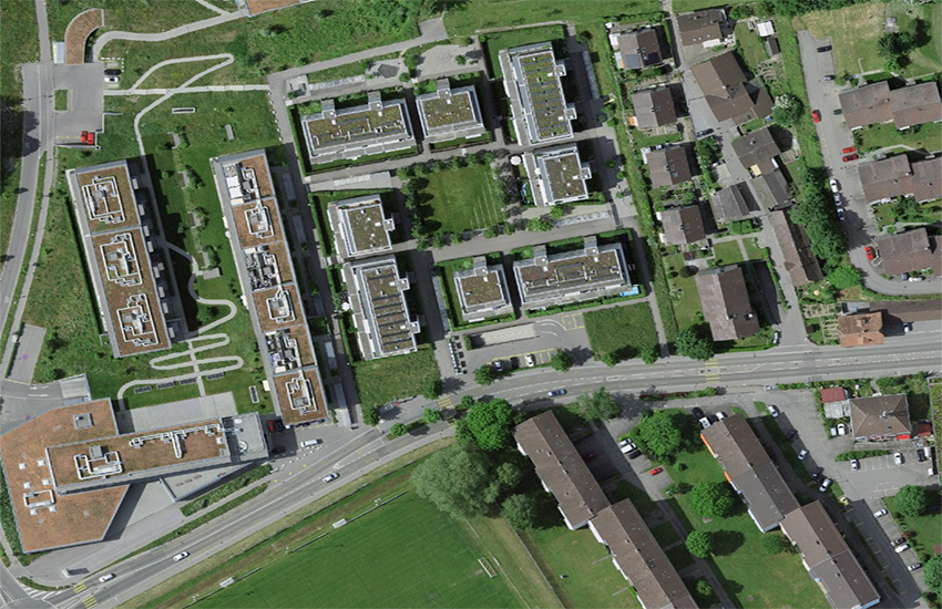
Tiling SWISSIMAGE 10 cm
SWISSIMAGE 10 cm will be available for the entire area of Switzerland and Liechtenstein from 2020. It also covers a small part of the neighbouring border regions. SWISSIMAGE is produced in 1 km2 tiles. The tiles are numbered based on the coordinates in kilometers of their southwest angle. Alongside the geometric and radiometric quality, the date on which the aerial photographs were taken is of great importance for the use of an orthophoto. Therefore, the flight year is given for each tile. At the edges of the surveying flight blocks, the tiles may not consist of pictures from the same year. As a result, these tiles contain pixels from different flight years. In these cases, the flight year that provided the majority of the pixels (more than 75% of all pixels) is given.
Simple
- Alternate title
-
Division SWISSIMAGE 10 cm Raster
- Date (Creation)
- 2001-01-01
- Identifier
- ch.swisstopo.images-swissimage-dop10.metadata
- Status
- Completed
Point of contact
- Spatial representation type
- Vector
- Topic category
-
- A Imagery base maps earth cover
Extent
Extent
- Description
-
SWISSIMAGE 10 cm
- Geographic identifier
- SWISSIMAGE 10 cm
))

- Maintenance and update frequency
- Unknown
- geocat.ch
-
-
digital color orthophoto mosaic
-
orthophoto
-
e-geo.ch
-
- GEMET
-
-
aerial photograph
-
- GEMET - INSPIRE themes, version 1.0
-
-
Orthoimagery
-
- geocat.ch
-
-
FSDI Federal Spatial Data Infrastructure
-
Associated resource
- Association Type
- Reference to a master resource of which this one is a part
- Metadata Reference
- Language
- Deutsch
- Character encoding
- UTF8
- Subtopic Category
- A1 Base Maps, Landscape Models
- Subtopic Category
- A3 Aerial and Satellite Imagery
- Distribution format
-
-
ESRI Shapefile (SHP)
-
Digital transfer options
Digital transfer options
Digital transfer options
- OnLine resource
-
ch.swisstopo.images-swissimage-dop10.metadata
WMS-FSDI service, layer "Division SWISSIMAGE 10 cm Raster"
Digital transfer options
- OnLine resource
-
Vorschau map.geo.admin.ch
Preview map.geo.admin.ch
Digital transfer options
Digital transfer options
- OnLine resource
-
RESTful API von geo.admin.ch
RESTful API from geo.admin.ch
- Topology level
- Full planar graph
- Geometric object type
- Surface
- Geometric object count
- 42683
- Reference system identifier
- EPSG:2056
Metadata
- Metadata identifier
- 3f340030-15de-4ab6-a1b1-5f33e09a997f
- Language
- Deutsch
- Character encoding
- UTF8
- Language
- Français
- Character encoding
- UTF8
- Language
- Italiano
- Character encoding
- UTF8
- Language
- English
- Character encoding
- UTF8
- Language
- Rumantsch
- Character encoding
- UTF8
Point of contact
Type of resource
- Resource scope
- Dataset
- Metadata linkage
-
https://www.geocat.ch/geonetwork/srv/api/records/3f340030-15de-4ab6-a1b1-5f33e09a997f
- Date info (Creation)
- 2017-10-25T08:44:20Z
- Date info (Revision)
- 2026-04-13T09:28:39.686668Z
Metadata standard
- Title
-
eCH-0271