geocat.ch
Kachelung SWISSIMAGE 10 cm
Découpage en tuile SWISSIMAGE 10 cm
Divisione in tiles SWISSIMAGE 10 cm
Tiling SWISSIMAGE 10 cm
Divisiun en quadrels SWISSIMAGE 10 cm
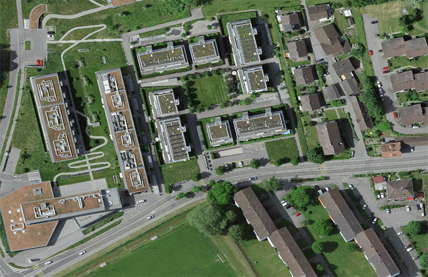
SWISSIMAGE 10 cm wird über die gesamte Fläche der Schweiz und Liechtenstein ab 2020 verfügbar sein. Es umfasst zudem einen geringen Teil der benachbarten Grenzregionen. SWISSIMAGE 10 cm wird in Kacheln von jeweils 1 km2 produziert. Die Kachelnummerierung entspricht den Kilometerkoordinaten des südwestlichen Eckpunkts einer Kachel. Neben der geometrischen und radiometrischen Qualität ist das Flugdatum der Luftbilder für die optimale Benutzung eines Orthophotos von grosser Wichtigkeit. Das Flugjahr wird daher für jede Kachel angegeben. In den Randgebieten der Befliegungsblöcke kann es vorkommen, dass die Kacheln nicht mit Bildern ein und desselben Flugjahres abgedeckt werden können. Diese Kacheln weisen daher Pixel unterschiedlicher Flugjahre auf, wobei jeweils dasjenige Flugjahr attributiert wird,das die Mehrheit der Pixel aufweist (mehr als 75% aller Pixel).
SWISSIMAGE 10 cm sera disponible sur toute la surface de la Suisse et du Liechtenstein à partir de 2020, il recouvre légèrement les zones limitrophes de ces frontières. SWISSIMAGE 10 cm est produit en tuiles de 1 km2. La numérotation des tuiles correspond aux coordonnées kilométriques de leur angle sud-ouest. Outre la qualité géométrique et radiométrique, la date de vol des photos aériennes constitue un élément essentiel pour l'utilisation optimale d'une photo. L'année de vol est définie pour chaque tuile produite. Dans les zones situées à la limite entre différents blocs annuels tous les pixels d'une tuile ne proviennent pas toujours d'une seule et même année de vol. En effet, pour créer une mosaïque uniforme, il est parfois nécessaire de mélanger des pixels issus de différents vols. Dans ce cas, l'année de vol utilisée en majorité (à plus de 75%) est attribuée à la tuile.
SWISSIMAGE 10 cm sarà disponibile per tutto il territorio della Svizzera e del Liechtenstein a partire dal 2020. Esso comprende inoltre una piccola parte delle regioni confinanti. SWISSIMAGE 10cm viene prodotto in tasselli di 1 km2. La loro numerazione corrisponde alle coordinate chilometriche del loro angolo sud-ovest. Oltre alla qualità geometrica e radiometrica, ai fini di un utilizzo ottimale di un'ortofoto riveste grande importanza anche la data del volo in cui l'ortofoto è stata scattata. L'anno del volo viene pertanto riportato su ogni tassello del mosaico di ortofoto. Nelle regioni marginali dei blocchi sorvolati può accadere che i tasselli non siano coperti da foto di uno stesso anno di volo. Questi tasselli presentano pertanto pixel di anni di volo diversi. In questi casi viene attribuito l'anno di volo che presenta la maggior parte dei pixel (oltre il 75% di tutti i pixel).
SWISSIMAGE 10 cm will be available for the entire area of Switzerland and Liechtenstein from 2020. It also covers a small part of the neighbouring border regions. SWISSIMAGE is produced in 1 km2 tiles. The tiles are numbered based on the coordinates in kilometers of their southwest angle. Alongside the geometric and radiometric quality, the date on which the aerial photographs were taken is of great importance for the use of an orthophoto. Therefore, the flight year is given for each tile. At the edges of the surveying flight blocks, the tiles may not consist of pictures from the same year. As a result, these tiles contain pixels from different flight years. In these cases, the flight year that provided the majority of the pixels (more than 75% of all pixels) is given.
A partir da l'onn 2020 vegn SWISSIMAGE 10 cm ad esser disponibel per tut la surfatscha da la Svizra e dal Liechtenstein. Ultra da quai cumpiglia SWISSIMAGE ina pitschna part da las regiuns cunfinantas vischinas. SWISSIMAGE 10 cm vegn producì en quadrels da mintgamai 1 km2. La numeraziun dals quadrels correspunda a las coordinatas kilometricas dal chantun sidvest d'in quadrel. Ultra da la qualitad geometrica e radiometrica è la data dal maletg fatg ord l'aria da gronda impurtanza per pudair duvrar optimalmain in'ortofoto. L'onn dal sgol vegn perquai inditgà per mintga quadrel. En las regiuns perifericas dals blocs da sgol poi capitar ch'ils quadrels cumpiglian maletgs da differents onns. Quests quadrels han perquai pixels da differents onns da sgol. Attribuì vegn mintgamai l'onn cun la gronda part dals pixels (passa 75 % da tut ils pixels).
Simple
-
Autre titreAltri nomi o acronimiAlternate titleAlternate titleAlternativtitel
-
Einteilung SWISSIMAGE 10 cm Raster
Découpage SWISSIMAGE 10 cm Raster
Divisione SWISSIMAGE 10 cm Raster
Division SWISSIMAGE 10 cm Raster
Divisiun SWISSIMAGE 10 cm Raster
-
Date (Création)Data (Creazione)Date (Creation)Date (Creation)Datum (Erstellung)
- 2001-01-01
-
IdentifiantIdentificatoreIdentifierIdentifierKennung
- ch.swisstopo.images-swissimage-dop10.metadata
-
ÉtatStatoStatusStatusBearbeitungsstatus
-
TerminéCompletatoCompletedCompletedAbgeschlossen
Point de contact
Punto di contatto
Point of contact
Point of contact
Ansprechpartner
-
Type de représentation spatialeTipo di rappresentazione spazialeSpatial representation typeSpatial representation typeRäumliche Darstellungsart
-
vecteurVettorialeVectorVectorVektor
-
Catégorie de thèmeCategoria ISOTopic categoryTopic categoryThematik
-
-
A Imagerie, cartes de base et occupation du solA Mappe di base con immagini della copertura terrestreA Imagery base maps earth coverA Imagery base maps earth coverA Oberflächenbeschreibung
-
Étendue
Estensione
Extent
Extent
Ausdehnung
Étendue
Estensione
Extent
Extent
Ausdehnung
-
DescriptionDescrizioneDescriptionDescriptionBeschreibung
-
SWISSIMAGE 10 cm
SWISSIMAGE 10 cm
SWISSIMAGE 10 cm
SWISSIMAGE 10 cm
SWISSIMAGE 10 cm
-
Identifiant géographiqueIdentificatore geograficoGeographic identifierGeographic identifierGeografische Kennung
- SWISSIMAGE 10 cmSWISSIMAGE 10 cmSWISSIMAGE 10 cmSWISSIMAGE 10 cmSWISSIMAGE 10 cm
))

-
Fréquence de mise à jourFrequenza di aggiornamentoMaintenance and update frequencyMaintenance and update frequencyWartungsintervall
-
InconnueSconosciutoUnknownUnknownUnbekannt
- geocat.ch
-
-
mosaïque d'orthophotos numériques en couleur
mosaico di ortofoto digitali a colori
digital color orthophoto mosaic
-
orthophoto
ortofoto
orthophoto
-
e-geo.ch
e-geo.ch
e-geo.ch
-
- GEMET
-
-
photographie aérienne
fotografia aerea (immagine)
aerial photograph
-
- GEMET - INSPIRE themes, version 1.0
-
-
Ortho-imagerie
Orto immagini
Orthoimagery
-
- geocat.ch
-
-
BGDI Bundesgeodaten-Infrastruktur
IFDG l’Infrastructure Fédérale de données géographiques
IFDG Infrastruttura federale dei dati geografici
FSDI Federal Spatial Data Infrastructure
-
Ressource associée
Risorsa associata
Associated resource
Associated resource
Verlinkte Ressource
-
Type d'associationTipo di associazioneAssociation TypeAssociation TypeAssoziationstyp
-
Citation de travail plus largeCitazione di un'opera più ampiaReference to a master resource of which this one is a partReference to a master resource of which this one is a partÜbergeordneter Datenbestand
-
Metadata ReferenceRiferimento metadatiMetadata ReferenceMetadata ReferenceMetadatenreferenz
-
LangueLinguaLanguageLanguageSprache
- Deutsch
-
Encodage de caractèresCodifica dei caratteriCharacter encodingCharacter encodingZeichenkodierung
-
Utf8UTF8UTF8UTF8Utf8
-
Catégorie de sous-thèmeCategoria di sottotemaSubtopic CategorySubtopic CategoryThematische Unterkategorien
-
A1 Cartes de base, modèles de paysageA1 Mappe di base, modelli paesaggisticiA1 Base Maps, Landscape ModelsA1 Base Maps, Landscape ModelsA1 Basiskarten, Landschaftsmodelle
-
Catégorie de sous-thèmeCategoria di sottotemaSubtopic CategorySubtopic CategoryThematische Unterkategorien
-
A3 Images aériennes, satellitesA3 Immagini aeree e satellitariA3 Aerial and Satellite ImageryA3 Aerial and Satellite ImageryA3 Luft-, Satellitenbilder
-
Format de distributionFormato (codifica)Distribution formatDistribution formatAbgabeformat
-
-
ESRI Shapefile (SHP)
-
Options de transfert numérique
Opzioni di trasferimento digitale
Digital transfer options
Digital transfer options
Optionen für die digitale Übertragung
Options de transfert numérique
Opzioni di trasferimento digitale
Digital transfer options
Digital transfer options
Optionen für die digitale Übertragung
Options de transfert numérique
Opzioni di trasferimento digitale
Digital transfer options
Digital transfer options
Optionen für die digitale Übertragung
-
Ressource en ligneRisorsa onlineOnLine resourceOnLine resourceOnline
-
ch.swisstopo.images-swissimage-dop10.metadata
WMS-BGDI Dienst, Layer "Einteilung SWISSIMAGE 10 cm Raster"Service WMS-IFDG, couche "Découpage SWISSIMAGE 10 cm Raster"Servizio WMS-IFDG, strato "Divisione SWISSIMAGE 10 cm Raster"WMS-FSDI service, layer "Division SWISSIMAGE 10 cm Raster"WMS-BGDI Dienst, Layer "Einteilung SWISSIMAGE 10 cm Raster"
Options de transfert numérique
Opzioni di trasferimento digitale
Digital transfer options
Digital transfer options
Optionen für die digitale Übertragung
-
Ressource en ligneRisorsa onlineOnLine resourceOnLine resourceOnline
-
Vorschau map.geo.admin.ch
Vorschau map.geo.admin.chAperçu map.geo.admin.chPrevisione map.geo.admin.chPreview map.geo.admin.ch
Options de transfert numérique
Opzioni di trasferimento digitale
Digital transfer options
Digital transfer options
Optionen für die digitale Übertragung
Options de transfert numérique
Opzioni di trasferimento digitale
Digital transfer options
Digital transfer options
Optionen für die digitale Übertragung
-
Ressource en ligneRisorsa onlineOnLine resourceOnLine resourceOnline
-
RESTful API von geo.admin.ch
RESTful API von geo.admin.chRESTful API de geo.admin.chRESTful API da geo.admin.chRESTful API from geo.admin.chRESTful API dad geo.admin.ch
-
Niveau de topologieLivello di topologiaTopology levelTopology levelTopologieebene
-
Topologie de réseau complèteGrafo planare completoFull planar graphFull planar graphVollständige Netzwerktopologie
-
Type d’objet géométriqueTipo di oggetto geometricoGeometric object typeGeometric object typeTyp des geometrischen Objekts
-
PolygoneSuperficieSurfaceSurfacesurface
-
Nombre d’objets géométriquesNumero di oggetti geometriciGeometric object countGeometric object countAnzahl geometrischer Objekte
- 42683
-
Nom du système de référenceNome del sistema di riferimentoReference system identifierReference system identifierName des Referenzsystems
- EPSG:2056
Metadata
-
Identifiant des métadonnéesIdentificativo della schedaMetadata identifierMetadata identifierIdentifikator des Metadatensatzes
- 3f340030-15de-4ab6-a1b1-5f33e09a997f
-
LangueLinguaLanguageLanguageSprache
- Deutsch
-
Encodage de caractèresCodifica dei caratteriCharacter encodingCharacter encodingZeichenkodierung
-
Utf8UTF8UTF8UTF8Utf8
-
LangueLinguaLanguageLanguageSprache
- Français
-
Encodage de caractèresCodifica dei caratteriCharacter encodingCharacter encodingZeichenkodierung
-
Utf8UTF8UTF8UTF8Utf8
-
LangueLinguaLanguageLanguageSprache
- Italiano
-
Encodage de caractèresCodifica dei caratteriCharacter encodingCharacter encodingZeichenkodierung
-
Utf8UTF8UTF8UTF8Utf8
-
LangueLinguaLanguageLanguageSprache
- English
-
Encodage de caractèresCodifica dei caratteriCharacter encodingCharacter encodingZeichenkodierung
-
Utf8UTF8UTF8UTF8Utf8
-
LangueLinguaLanguageLanguageSprache
- Rumantsch
-
Encodage de caractèresCodifica dei caratteriCharacter encodingCharacter encodingZeichenkodierung
-
Utf8UTF8UTF8UTF8Utf8
Point de contact
Punto di contatto
Point of contact
Point of contact
Ansprechpartner
-
Heures de serviceOrario di servizioHours of serviceHours of serviceBetriebszeiten
-
08h30 - 11h00 / 14h00 - 16h00 GMT+1
Type de ressource
Tipo di risorsa
Type of resource
Type of resource
Anwendungsbereich der Metadaten
-
Domaine d'application de la ressourceAmbito di applicazione della risorsaResource scopeResource scopeDomäne der Ressourcenanwendung
-
Jeu de donnéesSet di datiDatasetDatasetDatenbestand
-
Lien vers la métadonnéeCollegamento ai metadatiMetadata linkageMetadata linkageLink zu den Metadaten
-
Informations de date (Création)Informazioni sulla data (Creazione)Date info (Creation)Date info (Creation)Datumsangaben (Erstellung)
- 2017-10-25T08:44:20Z
-
Informations de date (Révision)Informazioni sulla data (Revisione)Date info (Revision)Date info (Revision)Datumsangaben (Aktualisierung)
- 2026-04-13T09:28:39.686668Z
Norme des métadonnées
Standard dei metadati
Metadata standard
Metadata standard
Metadatenstandard
-
TitreTitoloTitleTitleTitel
-
eCH-0271